Umatilla River facts for kids
Quick facts for kids Umatilla River |
|
|---|---|

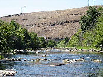
The Umatilla River, flowing through northern Pendleton, July 2005
|
|
|
Location of the mouth of the Umatilla River in Oregon
|
|
| Country | United States |
| State | Oregon |
| County | Umatilla |
| Physical characteristics | |
| Main source | Confluence of north and south forks Blue Mountains 2,332 ft (711 m) 45°43′32″N 118°11′17″W / 45.72556°N 118.18806°W |
| River mouth | Columbia River Umatilla, Oregon 269 ft (82 m) 45°55′09″N 119°21′20″W / 45.91917°N 119.35556°W |
| Length | 89 mi (143 km) |
| Basin features | |
| Basin size | 2,450 sq mi (6,300 km2) |
The Umatilla River is a river in Oregon, USA. It's about 89 miles (143 km) long. It flows into the big Columbia River. The river helps drain an area of about 2,450 square miles (6,345 square km). It joins the Columbia River near the city of Umatilla in northeastern Oregon.
Many smaller streams flow into the Umatilla River. These include the North Fork Umatilla River and the South Fork Umatilla River. Other important streams are Meacham Creek, McKay Creek, Birch Creek, and Butter Creek. The name Umatilla comes from the Native American name for the river. It was first written down as Youmalolam by the Lewis and Clark Expedition.
Contents
Where the Umatilla River Flows
The Umatilla River starts in the Blue Mountains of northeastern Oregon. This is where its north and south forks meet. The river flows mostly west through the Umatilla National Forest.
As it flows, the river picks up water from other creeks. These include Lick Creek and Bear Creek. It then passes by the community of Bingham Springs. Further downstream, Rock Creek joins the river. Then Bobsled, Augur, and Ryan creeks also add water.
Through the Umatilla Indian Reservation
The Umatilla River then enters the Umatilla Indian Reservation. Here, it passes the community of Gibbon. From Gibbon all the way to the river's end, Union Pacific Railroad tracks run next to it. Between Gibbon and Cayuse, three more creeks join: Squaw, Buckaroo, and Coonskin. After Cayuse, Moonshine, Cottonwood, and Mission creeks also flow into the river.
Passing Through Cities
The river flows by Mission. Then it leaves the Indian reservation. It reaches the city of Pendleton and goes under Oregon Route 11. Wildhorse Creek and Patawa Creek join the river here. The Umatilla River then passes under Interstate 84. McKay Creek also joins the river in this area.
About 50 miles (80 km) from where it ends, Birch Creek flows into the Umatilla River. Coombs Creek joins a bit further downstream. The river then turns north. It flows along Fort Henrietta Park in the city of Echo. It goes under Interstate 84 again.
The Umatilla River reaches Stanfield about 23 miles (37 km) from its end. It passes under Oregon Route 207. Butter Creek then joins the river. It flows into Hermiston about 9 miles (14 km) from its mouth.
Joining the Columbia River
Near its end, the river flows past a United States Geological Survey (USGS) measuring station. This station is about 2 miles (3 km) from where the river meets the Columbia River. The Umatilla River then passes under Interstate 82 and Oregon Route 730. Finally, it enters the Columbia River at Umatilla.
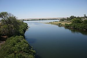
The Umatilla River joins the Columbia River at a place called Lake Umatilla. This "lake" is actually a reservoir. It was formed by the John Day Dam on the Columbia River. The meeting point is about 289 miles (465 km) from where the Columbia River flows into the Pacific Ocean at Astoria. Another dam on the Columbia, called McNary Dam, is a little bit upstream.
Fish and Fishing
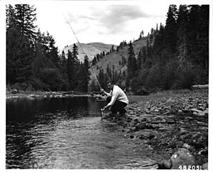
The Umatilla River is home to different types of fish. You can find spring Chinook, fall Chinook, and Coho salmon here. There are also small trout in the upper parts of the river.
It's fairly easy for the public to go fishing for salmon and steelhead downstream of the Oregon Route 11 bridge. However, upstream of this bridge, the river flows through the Umatilla Indian Reservation. Fishing in this area is only allowed if you have a special permit from the tribe.
 | Bessie Coleman |
 | Spann Watson |
 | Jill E. Brown |
 | Sherman W. White |


