Sacagawea Heritage Trail facts for kids

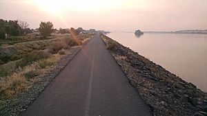
The Sacagawea Heritage Trail, looking eastbound, in Pasco, Washington.
|
|
| Length | 23 mi (37 km) |
|---|---|
| Location | Tri-Cities, Washington |
| From | Sacajawea State Park, Pasco |
| To | Cable Bridge connecting Kennewick to Pasco |
The Sacagawea Heritage Trail is a fun path in the Tri-Cities, Washington. It's about 23 miles (37 km) long. This trail is great for walking, running, and biking.
It follows the Columbia River for its whole length. The trail forms a big loop. This loop connects the cities of Pasco, Richland, and Kennewick. The entire path is paved, making it smooth for everyone.
The trail starts at Sacajawea State Park. This park is where the Columbia and Snake Rivers meet. You will see mile markers along the trail. These markers help you know how far you have gone.
The trail is named after Sacagawea. She was a brave Lemhi Shoshone woman. Sacagawea helped the famous Lewis and Clark Expedition.
Contents
Discover the Sacagawea Heritage Trail
What is the Sacagawea Heritage Trail?
The Sacagawea Heritage Trail is a special path. It is designed for many different activities. You can ride your bike, go for a run, or simply walk. It's a great place to enjoy the outdoors.
The trail has different types of sections. Some parts are fully paved paths. Other parts have a center stripe for bikes. There are also sections with signs to guide you. Mile markers are placed along the entire trail.
Exploring the Trail: A City-by-City Guide
The Sacagawea Heritage Trail takes you through three different cities. Each part of the trail offers unique sights. Let's explore the journey city by city.
Pasco's Path
The trail begins in Pasco at Sacajawea State Park. From there, it heads west. You will pass through an industrial area. You'll also go by the Port of Pasco.
The trail goes under two big bridges. These are the Cable Bridge and the Blue Bridge. After the Blue Bridge, you enter Wade Park. Here, the path has special lanes. There are lanes for bikes going both ways. There is also a lane for walkers.
These special lanes end when you leave the park. Then, you climb onto the Pasco Levee. At the end of the levee, you go through Chiawana Park. After that, the trail joins Court Street. This street has bike lanes just for you. You will ride for about 1.1 miles (1.8 km). Finally, you cross the Interstate 182 Bridge into Richland.
Richland's River Journey
When you get off the bridge, the trail connects with the Riverfront Trail. It continues west for a bit. Then, it turns south near SR 240. The trail runs next to the highway. Along this part, you will cross the Yakima River Delta.
As you get close to Columbia Park Trail, the path turns east. It goes onto a levee. You will reach a parking area. After this, the trail passes by Bateman Island. Then, it enters Columbia Park. This is where the city of Kennewick begins.
The Riverfront Trail also goes north from Columbia Point. It leads to Howard Amon Park and WSU Tri-Cities.
Kennewick's Columbia Park Stretch
The trail goes all the way through Columbia Park. It has special bike lanes on Columbia Park Trail. At the east end of the park, you will pass under the Blue Bridge again.
Then, the trail goes onto another levee. You will pass Clover Island. After that, you cross the Cable Bridge. This completes the big loop! There is also another way to go. You can cross the Blue Bridge instead. Both bridges have bike lanes separate from car traffic.
Sometimes, a part of the trail in Columbia Park closes. This happens during the HAPO Gold Cup event.
 | James Van Der Zee |
 | Alma Thomas |
 | Ellis Wilson |
 | Margaret Taylor-Burroughs |


