West Richland, Washington facts for kids
Quick facts for kids
West Richland, Washington
|
|
|---|---|
| City of West Richland | |

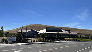
West Richland's current City Hall complex on Belmont Blvd.
|
|

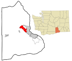
Location of West Richland, Washington
|
|
| Country | United States |
| State | Washington |
| County | Benton |
| Incorporated | June 13, 1955 |
| Government | |
| • Type | Mayor–council |
| Area | |
| • Total | 22.28 sq mi (57.71 km2) |
| • Land | 22.11 sq mi (57.28 km2) |
| • Water | 0.17 sq mi (0.43 km2) |
| Elevation | 413 ft (126 m) |
| Population
(2020)
|
|
| • Total | 16,295 |
| • Estimate
(2021)
|
16,951 |
| • Density | 731.37/sq mi (282.36/km2) |
| Time zone | UTC-8 (Pacific (PST)) |
| • Summer (DST) | UTC-7 (PDT) |
| ZIP codes |
99352-99353
|
| Area code | 509 |
| Official flower | Phlox longifolia |
| GNIS feature ID | 1512794 |
West Richland is a city in Benton County, Washington. In 2020, about 16,295 people lived there. The city is part of the Tri-Cities metropolitan area. The main cities in this area are Richland, Kennewick, and Pasco.
Contents
History of West Richland
Early Days and First Settlers
The first people in this area were the Chemnapum Indians. They were closely related to the Wanapum tribe and lived near the mouth of the Yakima River. Explorers Lewis and Clark traveled through here in 1805. Later, in 1841, the Army Corps of Topographical Engineers mapped the Yakima Valley.
In 1853, a road was approved by Congress to go through the Yakima Valley. This road passed through what is now West Richland. However, people didn't start settling here properly until the late 1870s. The very first schoolhouse was built in 1896. It was located on the Van Horn property, just south of Van Giesen Street today.
Growth and New Names
Benton County was created in 1905. Richland became an official town in 1906. At that time, the West Richland area was known as 'Lower Yakima'. To help farming, an irrigation canal was built in 1908. It brought water into Richland from the north side of Horn Rapids Dam.
Between 1917 and 1918, the Yellowstone Trail highway passed through the Yakima Valley. This national road stretched all the way from New York to Seattle. It crossed the Fallon Bridge between Richland and West Richland.
Becoming West Richland
During the 1940s, the nearby city of Richland was built and managed by the government. This was for the Manhattan Project, a secret project during World War II. Some people didn't like the government's rules in Richland. So, many moved across the Yakima River. Here, they could buy land and own their homes instead of renting.
In 1948, a man named Carl Heminger bought about 80 acres (32 hectares) of land. He planned to build a new city. He wanted to name it Heminger City. But in 1949, the people living there chose the name Enterprise instead. Heminger was unhappy and moved a mile away. He started a small community there, which he called Heminger City.
In 1955, when it was time to make the town official, they decided on a new name: West Richland. This name was chosen because Richland was already well-known. West Richland officially became a city on June 17, 1955. It combined the two small towns of Heminger City and Enterprise.
Modern Achievements
In 2008, West Richland was the site of a special speed test. The Aero SSC TT, which was the fastest production car in the world at the time, reached over 250 miles per hour (402 km/h) here.
Geography and Climate
Where is West Richland?
West Richland is located at 46°17′32″N 119°21′16″W / 46.29222°N 119.35444°W. The city covers a total area of about 22.12 square miles (57.29 square kilometers). Most of this area is land, with a small part being water.
What is the Climate Like?
West Richland has a semi-arid climate. This means it's quite dry, but not quite a full desert climate. It gets warm summers and cool winters.
| Climate data for West Richland, Washington | |||||||||||||
|---|---|---|---|---|---|---|---|---|---|---|---|---|---|
| Month | Jan | Feb | Mar | Apr | May | Jun | Jul | Aug | Sep | Oct | Nov | Dec | Year |
| Mean daily maximum °C (°F) | 4 (39) |
8 (47) |
14 (57) |
18 (65) |
22 (72) |
26 (79) |
30 (86) |
29 (85) |
25 (77) |
18 (64) |
9 (48) |
3 (38) |
17 (63) |
| Mean daily minimum °C (°F) | −3 (26) |
−2 (29) |
1 (33) |
3 (38) |
7 (44) |
11 (51) |
13 (55) |
13 (55) |
9 (48) |
4 (39) |
0 (32) |
−3 (26) |
4 (40) |
| Average precipitation mm (inches) | 28 (1.1) |
23 (0.9) |
20 (0.8) |
20 (0.8) |
18 (0.7) |
15 (0.6) |
7.6 (0.3) |
7.6 (0.3) |
10 (0.4) |
15 (0.6) |
28 (1.1) |
33 (1.3) |
230 (8.9) |
| Source: Weatherbase | |||||||||||||
People of West Richland
| Historical population | |||
|---|---|---|---|
| Census | Pop. | %± | |
| 1960 | 1,347 | — | |
| 1970 | 1,107 | −17.8% | |
| 1980 | 2,938 | 165.4% | |
| 1990 | 3,962 | 34.9% | |
| 2000 | 8,385 | 111.6% | |
| 2010 | 11,811 | 40.9% | |
| 2020 | 16,295 | 38.0% | |
| 2021 (est.) | 16,951 | 43.5% | |
| U.S. Decennial Census 2020 | |||
Population in 2020
In 2020, the city had 16,295 people living in 4,640 households. The population density was about 731 people per square mile (282 per km2). Most residents, about 86.9%, were White. About 13.4% of the population was of Hispanic or Latino background.
The average household had 3.2 people. The typical income for a household in the city was $102,974 per year. The average income per person was $36,735. About 7% of the people lived below the poverty line. There were 933 veterans in the city. Also, 6.2% of the population was born outside the United States.
Population in 2010
In 2010, there were 11,811 people living in West Richland. There were 4,145 households and 3,253 families. The population density was about 538 people per square mile (207 per km2). About 90.3% of the people were White. About 7.1% were of Hispanic or Latino background.
In 43.1% of households, there were children under 18. Most households, 65.7%, were married couples living together. The average household size was 2.85 people. The average family size was 3.22 people.
The average age in the city was 35.4 years. About 29.6% of residents were under 18. About 8.3% were 65 years old or older. The population was almost evenly split between males (50.5%) and females (49.5%).
Culture and Events
Annual Events
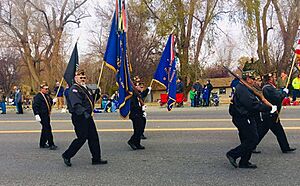
- The City of West Richland has held a Veteran's Day Parade every year since 1999. It is one of only three cities in Washington state to have a special designation from the United States Department of Veterans Affairs. This means it's a recognized place for Veteran's Day celebrations. The parade has grown a lot over the years. In 2023, more than 3,000 people attended, and over 1,000 people participated in the parade.
Local Businesses
- SSC North America is a car company located in West Richland. This company built the SSC Aero, which was once known as the fastest production car in the world.
Notable People from West Richland
- Ryan Kennelly – A world record holder in geared bench-press. He lifted 1075 pounds (489 kg)!
- Rachel Willis-Sørensen – A talented opera singer.
See also
 In Spanish: West Richland (Washington) para niños
 | Kyle Baker |
 | Joseph Yoakum |
 | Laura Wheeler Waring |
 | Henry Ossawa Tanner |


