Tieton River facts for kids
Quick facts for kids Tieton River |
|
|---|---|
 |
|
|
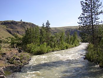
Mouth of the Tieton River in Washington
|
|
| Other name(s) | North Fork Tieton River |
| Country | United States |
| State | Washington |
| Region | Yakima County |
| Physical characteristics | |
| Main source | North Fork Tieton River Cascade Range, McCall Glacier, Goat Rocks Wilderness 6,246 ft (1,904 m) 46°30′27″N 121°26′11″W / 46.50750°N 121.43639°W |
| River mouth | Naches River 1,601 ft (488 m) 46°44′46″N 120°47′12″W / 46.74611°N 120.78667°W |
| Length | 33 mi (53 km) |
| Basin features | |
| Tributaries |
|
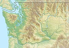
The Tieton River is a river in Yakima County, Washington, in the United States. It flows into the Naches River.
Contents
Where Does the Tieton River Start?
The Tieton River actually begins as two separate streams. These are called the North Fork Tieton River and the South Fork Tieton River.
The North Fork's Journey
The North Fork Tieton River starts at McCall Glacier. This glacier is found on the eastern slopes of mountains like Old Snowy Mountain and Ives Peak. These mountains are part of the Goat Rocks Wilderness. The North Fork collects water from other high mountains, including Tieton Peak. It then flows northeast into Clear Lake. From there, it continues into the western part of Rimrock Lake.
The South Fork's Journey
The South Fork Tieton River begins at Meade Glacier. This glacier is on the eastern side of Gilbert Peak, which is also in the Goat Rocks area. The South Fork gathers many smaller streams as it flows north. It joins Rimrock Lake near its eastern end.
Rimrock Lake and the Tieton Dam
Rimrock Lake is not a natural lake. It is an artificial reservoir (a human-made lake). It was created by the Tieton Dam. The U.S. Bureau of Reclamation manages this lake.
Why Was Rimrock Lake Created?
The main purpose of Rimrock Lake is to store water. This water is used for irrigation, which means watering crops. It is part of a bigger project called the Yakima Project.
The River's Flow After the Dam
The main Tieton River flows out of Rimrock Lake right at the Tieton Dam. It generally flows east. Finally, it joins the Naches River close to the town of Tieton.
 | Precious Adams |
 | Lauren Anderson |
 | Janet Collins |


