
Gilbert Peak (Washington) facts for kids
Quick facts for kids Gilbert Peak |
|
|---|---|

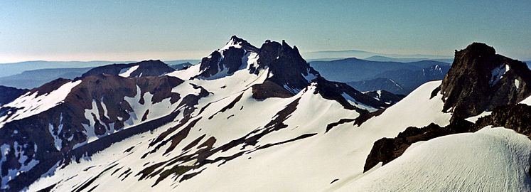
Gilbert Peak in background at far left
|
|
| Highest point | |
| Elevation | 8,184 ft (2,494 m) |
| Prominence | 3,664 ft (1,117 m) |
| Geography | |

Gilbert Peak
Location in Washington (state)

Gilbert Peak
Location in the United States
|
|
| Location | Goat Rocks, Washington, U.S. |
| Parent range | Cascade Range |
| Topo map | USGS Walupt Lake |
| Climbing | |
| Easiest route | Scramble |
Gilbert Peak is a tall mountain in the Goat Rocks area of Washington, a state in the U.S.. It stands partly within the Goat Rocks Wilderness. This mountain is the highest point in the Goat Rocks. It is also found on the border of the Yakama Indian Reservation and Yakima County.
What is Gilbert Peak?
Gilbert Peak reaches a height of 8,184 feet (2,494 m). It is the highest mountain in the Goat Rocks range. The Goat Rocks are actually the remains of an ancient, inactive stratovolcano. This means it was once a very active volcano that erupted many times. Over a long time, wind and water have worn away much of the volcano, leaving behind the peaks we see today.
Glaciers on Gilbert Peak
Even though it's an old volcano, Gilbert Peak is still home to ice. Two important glaciers are found on its slopes. The Meade Glacier is located on the southeastern side of the mountain. The Conrad Glacier can be found on the northern slope. Glaciers are large, slow-moving rivers of ice. They form when snow builds up over many years and turns into ice.
Gallery
-
Gilbert Peak seen from Old Snowy

