Wapato, Washington facts for kids
Quick facts for kids
Wapato, Washington
|
|
|---|---|

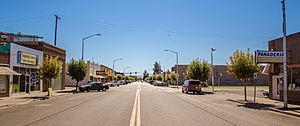
Wapato Avenue
|
|

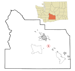
Location of Wapato, Washington
|
|
| Country | United States |
| State | Washington |
| County | Yakima |
| Founded | 1885 |
| Incorporated | September 16, 1908 |
| Area | |
| • Total | 1.16 sq mi (2.99 km2) |
| • Land | 1.16 sq mi (2.99 km2) |
| • Water | 0 sq mi (0.00 km2) |
| Elevation | 856 ft (261 m) |
| Population
(2020)
|
|
| • Total | 4,607 |
| • Estimate
(2022)
|
4,513 |
| • Density | 4,333.91/sq mi (1,673.42/km2) |
| Time zone | UTC-8 (Pacific (PST)) |
| • Summer (DST) | UTC-7 (PDT) |
| ZIP code |
98951
|
| Area code | 509 |
| FIPS code | 53-76125 |
| GNIS feature ID | 1512774 |
Wapato is a town located in Yakima County, Washington, in the United States. In 2020, about 4,607 people lived there. Most of the people living in Wapato are of Hispanic background.
Contents
The Story of Wapato
How Wapato Started
Wapato began in 1885 as a railroad stop called Simcoe. It was founded by Alexander McCredy, who was a postmaster. A law in 1887 allowed the government to divide up land on the Yakama Indian Reservation. This meant that Native American families could own their own plots of land. Selling some of this land brought new settlers to the area.
When the Irwin Canal was built in 1896, farming became very important in Wapato. In the early 1900s, McCredy and George Rankin helped plan the town. They opened the first bank and started selling land plots. The town changed its name to Wapato in 1903. This was because people often confused it with nearby Fort Simcoe. Another law in 1906 encouraged more non-Native people to buy land from the Yakamas. Wapato officially became a town on September 16, 1908. At that time, about 300 people lived there.
The name wapato comes from a word in the Chinook Jargon language. It means an edible root, which is a plant part that grows underground.
Japanese and African American Residents
Around 1905, many Japanese people started moving to Wapato. Most of them came from Hawaii. From 1916 to 1918, a "Japanese Town" grew on what is now West 2nd Street. Over 1,000 Japanese people lived in the Yakima Valley at that time. This community became a major center for Japanese people in Washington, second only to Seattle. The Yakima Buddhist Bussei Kaikan, a special building for the Buddhist community, was built there in 1936.
In 1938, a group of people, including police, attacked African Americans at a railroad camp in Wapato. African American residents in town were also forced to leave. After World War II began, the Japanese language school in Wapato was burned down. Several Japanese homes were also set on fire. In 1942, President Roosevelt's order forced Japanese residents to leave Wapato. Many were sent to internment camps.
Wapato During World War II
During World War II, many workers for the farms and orchards around Wapato came from two groups. Some were German prisoners of war held in a camp nearby. Others were Japanese people still living in internment camps. After the war, there weren't enough workers. This led to Hispanic migrant workers coming to Wapato. The Bracero Program also brought guest workers from Mexico. These events greatly changed the culture of Wapato.
Wapato Today
From the 1970s to the 1990s, Wapato was known for growing large amounts of potatoes and apples. Today, Wapato has one of the largest Hispanic populations in Washington State. In 2000, about 76% of the people were Hispanic. Many people now describe Wapato as a "Mexican Town."
For many years, Wapato has attracted people from different backgrounds. These include Filipino Americans, Hispanic Americans, Japanese Americans, and Native Americans. Older white residents moved away or to nursing homes. Younger white people often left for school and did not return. Hispanic immigrants came for farm jobs and the small-town life.
In 1952, the Filipino community built the Yakima Valley Filipino Community Hall in Wapato. This was the first building of its kind in the Western United States. In 2024, it was added to the National Register of Historic Places.
Wapato's Location and Weather
Where is Wapato?
Wapato is located within the Yakama Indian Reservation. The city covers about 1.17 square miles (2.99 square kilometers) of land.
Wapato's Climate
Wapato has a cold semi-arid climate. This means it is generally dry and has hot summers and cold winters.
| Climate data for Wapato (1991–2020 normals, extremes 1915–2013) | |||||||||||||
|---|---|---|---|---|---|---|---|---|---|---|---|---|---|
| Month | Jan | Feb | Mar | Apr | May | Jun | Jul | Aug | Sep | Oct | Nov | Dec | Year |
| Record high °F (°C) | 68 (20) |
72 (22) |
86 (30) |
94 (34) |
102 (39) |
104 (40) |
110 (43) |
106 (41) |
101 (38) |
89 (32) |
75 (24) |
68 (20) |
110 (43) |
| Mean maximum °F (°C) | 57.1 (13.9) |
60.1 (15.6) |
70.9 (21.6) |
80.4 (26.9) |
90.2 (32.3) |
95.6 (35.3) |
101.7 (38.7) |
100.2 (37.9) |
93.2 (34.0) |
80.5 (26.9) |
64.7 (18.2) |
55.4 (13.0) |
102.4 (39.1) |
| Mean daily maximum °F (°C) | 39.3 (4.1) |
47.5 (8.6) |
56.9 (13.8) |
65.2 (18.4) |
74.5 (23.6) |
81.2 (27.3) |
90.2 (32.3) |
88.8 (31.6) |
80.3 (26.8) |
65.9 (18.8) |
49.5 (9.7) |
38.5 (3.6) |
64.8 (18.2) |
| Daily mean °F (°C) | 31.8 (−0.1) |
36.9 (2.7) |
44.8 (7.1) |
52.0 (11.1) |
60.5 (15.8) |
67.2 (19.6) |
74.7 (23.7) |
73.2 (22.9) |
64.5 (18.1) |
51.6 (10.9) |
39.1 (3.9) |
30.9 (−0.6) |
52.3 (11.3) |
| Mean daily minimum °F (°C) | 24.4 (−4.2) |
26.3 (−3.2) |
32.6 (0.3) |
38.7 (3.7) |
46.6 (8.1) |
53.3 (11.8) |
59.2 (15.1) |
57.7 (14.3) |
48.8 (9.3) |
37.3 (2.9) |
28.7 (−1.8) |
23.3 (−4.8) |
39.7 (4.3) |
| Mean minimum °F (°C) | 9.1 (−12.7) |
14.4 (−9.8) |
22.0 (−5.6) |
28.6 (−1.9) |
33.0 (0.6) |
41.4 (5.2) |
46.6 (8.1) |
46.3 (7.9) |
39.2 (4.0) |
24.0 (−4.4) |
15.6 (−9.1) |
10.1 (−12.2) |
2.1 (−16.6) |
| Record low °F (°C) | −22 (−30) |
−21 (−29) |
6 (−14) |
18 (−8) |
26 (−3) |
33 (1) |
36 (2) |
35 (2) |
23 (−5) |
12 (−11) |
−9 (−23) |
−27 (−33) |
−27 (−33) |
| Average precipitation inches (mm) | 1.10 (28) |
0.61 (15) |
0.56 (14) |
0.56 (14) |
0.83 (21) |
0.54 (14) |
0.24 (6.1) |
0.23 (5.8) |
0.23 (5.8) |
0.64 (16) |
0.92 (23) |
1.36 (35) |
7.82 (199) |
| Average snowfall inches (cm) | 5.2 (13) |
1.1 (2.8) |
0.3 (0.76) |
0.0 (0.0) |
0.0 (0.0) |
0.0 (0.0) |
0.0 (0.0) |
0.0 (0.0) |
0.0 (0.0) |
0.2 (0.51) |
1.6 (4.1) |
12.0 (30) |
20.4 (52) |
| Average precipitation days (≥ 0.01 in) | 8.5 | 5.9 | 5.6 | 5.2 | 6.4 | 4.5 | 2.6 | 2.2 | 3.1 | 5.9 | 8.2 | 9.5 | 67.6 |
| Average snowy days (≥ 0.1 in) | 3.5 | 0.9 | 0.2 | 0.0 | 0.0 | 0.0 | 0.0 | 0.0 | 0.0 | 0.1 | 0.7 | 3.7 | 9.1 |
| Source 1: NOAA | |||||||||||||
| Source 2: WRCC | |||||||||||||
People Living in Wapato
| Historical population | |||
|---|---|---|---|
| Census | Pop. | %± | |
| 1910 | 400 | — | |
| 1920 | 1,128 | 182.0% | |
| 1930 | 1,222 | 8.3% | |
| 1940 | 1,483 | 21.4% | |
| 1950 | 3,185 | 114.8% | |
| 1960 | 3,137 | −1.5% | |
| 1970 | 2,841 | −9.4% | |
| 1980 | 3,307 | 16.4% | |
| 1990 | 3,795 | 14.8% | |
| 2000 | 4,582 | 20.7% | |
| 2010 | 4,997 | 9.1% | |
| 2020 | 4,607 | −7.8% | |
| 2022 (est.) | 4,513 | −9.7% | |
| U.S. Decennial Census 2020 Census |
|||
2010 Census Information
In 2010, there were 4,997 people living in Wapato. There were 1,240 households, which are groups of people living together. About 64.7% of these households had children under 18. Most households (51.1%) were married couples.
The average household had about 3.88 people. The average family had about 4.12 people. The population density was about 4,271 people per square mile.
When looking at different groups of people:
- 17.2% were White
- 0.3% were African American
- 6.6% were Native American
- 1.3% were Asian
- 0.1% were Pacific Islander
- 70.6% were from other races
- 3.9% were from two or more races
About 84.2% of the population was Hispanic or Latino. The average age in the city was 24.9 years old. About 37% of residents were under 18. The population was almost evenly split between males (50.5%) and females (49.5%).
Schools in Wapato
The Wapato School District provides public education in the area. It is also known as Wapato Public Schools. The district operates six different schools:
- Wapato High School
- Wapato Middle School
- Pace High School
- Adams Elementary
- Satus Elementary
- Camas Elementary
- Simcoe Elementary
Famous People from Wapato
- Deb Manjarrez, a politician
See also
 In Spanish: Wapato (Washington) para niños
 | John T. Biggers |
 | Thomas Blackshear |
 | Mark Bradford |
 | Beverly Buchanan |

