Horse Heaven Hills facts for kids
Quick facts for kids Horse Heaven Hills |
|
|---|---|
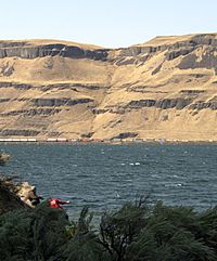
The Horse Heaven Hills along the Columbia River at Wallula Gap; note the dark areas of extensive flood basalts exposed by erosion.
|
|
| Highest point | |
| Peak | Bickleton Ridge |
| Elevation | 4,327 ft (1,319 m) |
| Geography | |
| Country | United States |
| State | Washington |
| Range coordinates | 46°08′N 119°52.05′W / 46.133°N 119.86750°W |
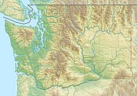
The Horse Heaven Hills are a long chain of rolling hills in Washington. You can find them in Klickitat, Yakima, and Benton counties. These hills formed when ancient lava flows were squeezed together. This squeezing created a ridge, much like pushing a rug together makes a bump.
For hundreds of years, Native Americans lived around these hills. They used the area for hunting and as a natural border between different tribes. Later, the Lewis and Clark Expedition were the first known Europeans to explore this region. Over time, settlers arrived and began farming. Today, wineries are a big part of the local economy. The Horse Heaven Hills AVA (a special wine region) was created in 2005.
The hills were shaped by huge flood basalts that erupted millions of years ago. Then, giant floods from the last ice age further changed the landscape. These floods carried huge icebergs, which dropped unique rocks called glacial erratics. These rocks stand out from the dark lava rock common in the area.
Most of the Horse Heaven Hills are covered in native grasses and shrubs. There are very few trees. You can also find beautiful native flowers, some of which are now rare. Long ago, many large animals roamed here, but hunting caused some to disappear. Wild horses used to be common, but they were mostly moved to make way for farms. Now, you can only see wild horses near Satus Pass. People are working to bring back some animals that used to live here.
Contents
Geography of the Hills
The Horse Heaven Hills stretch east from the Simcoe Mountains to a place called Wallula Gap. To the west, they are bordered by Satus Creek. The Columbia River forms their eastern and southern edges. To the north, the hills follow the Yakima River. The Simcoe Mountains connect the Horse Heaven Hills to the Cascade Range in the west.
The northern side of the hills is very steep. But the southern side slopes down more gently. These hills form the southern edge of the Yakima River Valley. The highest point is Bickleton Ridge. It reaches 4,327 feet (1,319 m) high near the town of Bickleton.
Not many people live directly in the hills. There are only a few small towns like Bickleton and Horse Heaven. However, larger towns like the Tri-Cities and Prosser are located just north of the hills.
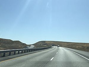
Many county roads cross the Horse Heaven Hills. Interstate 82 (which is also US 395) goes through the hills. It connects Kennewick to Plymouth. State Route 221 links Prosser to Paterson. State Route 397 also runs through the lower parts of the hills.
Several small streams start in the Horse Heaven Hills, like Amon Creek. Water from the northern slopes flows into the Yakima River. The rest of the hills drain directly into the Columbia River.
Climate and Weather
The Horse Heaven Hills are one of the hottest places in Washington. They have a dry, semi-arid climate, similar to nearby cities like the Tri-Cities. The climate here is mostly dry with warm summers. Some areas have hot summers, while others are cold and semi-arid.
Not much rain falls here, usually from 9 inches (230 mm) to 20 inches (510 mm) each year. This is because the hills are in the "rain shadow" of the Cascade Mountains. The Cascades block most of the rain from reaching eastern Washington. Most of the rain that does fall happens in winter. Summers are usually very dry.
Even though it's dry, summer thunderstorms can cause sudden floods. Before a dam was built in 1992, Kennewick often had severe flooding.
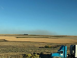
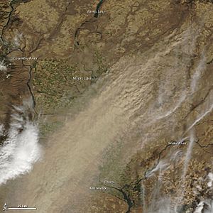
This area is one of the driest places in the world to grow wheat. Strong winds can blow away a lot of soil from farms. These dust storms can make it hard to see and sometimes close highways. In winter, the hills get more snow than the valleys around them. When this snow melts quickly, it can also cause soil erosion.
The Horse Heaven Hills might also affect air quality in the Tri-Cities. On hot, calm summer days, air can get trapped at the base of the hills. This can cause ozone levels to rise, sometimes reaching levels similar to big cities like Seattle.
History of the Hills
People have lived in and around the Horse Heaven Hills for a very long time. However, not many people lived directly in the hills themselves. The hills were an important border between different Native American groups.
The first time these people met Europeans was during the Lewis and Clark Expedition. After this, the way people used the Horse Heaven Hills changed. It went from mostly hunting and grazing to the modern farming we see today. Larger cities also grew up around the edges of the hills.
Early Times and Explorers
Before Europeans settled here, Native Americans lived in the Horse Heaven Hills for centuries. The hills were part of the land of the Umatilla tribe. They also marked the southern border for the Yakama tribe. The Walla Walla tribe lived in the far northeastern part of the hills. All these tribes spoke the Sahaptin language and found their food by hunting and gathering.
In 1855, these tribes were moved from their traditional lands. The Walla Walla and Umatilla people now live on the Umatilla Indian Reservation in Oregon. The Yakama people live on the Yakima Indian Reservation in Washington.
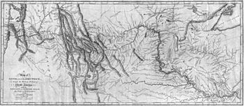
The Lewis and Clark Expedition traveled down the Snake River in 1805. On October 16, they wrote about the Horse Heaven Hills in their journal. They described them as "a range of high Countrey" about two miles from the Columbia River. In the next few days, the expedition continued down the Columbia River, passing through Wallula Gap.
Settlement and Naming
The first wagon trains arrived in the nearby Yakima Valley in 1853. At first, the local Native Americans were friendly to the settlers. But soon, all of eastern Washington, including the Horse Heaven Hills, was closed to white settlement. This ban was lifted after some conflicts. Early settlers could claim 160 acres of land. By 1910, all the land had been claimed.
James Gordon Kinney, an early pioneer, is said to have named the Horse Heaven Hills in 1881. He first came to the area in 1857. He was amazed by the tall grass that fed many wild horses roaming freely. He said, "This is surely a horse heaven!"
Farmers started growing wheat in the hills above Prosser after a flour mill was built there in 1887. A few small towns, like Bickleton and Horse Heaven, were started in the late 1800s and early 1900s. Bickleton began as a trading post. Horse Heaven had a post office for about 30 years, but Bickleton's still operates today.
How the Hills Were Formed (Geology)
Millions of years ago, lava burst out from cracks in the ground in Oregon and Idaho. This created a huge layer of rock called the Columbia River Basalt Group. There were over 300 separate lava flows. Each flow was massive, like a giant river of rock. These eruptions were different from the volcanoes in the nearby Cascade Range.
The lava flows became very thick, about 1.8 kilometres (5,900 ft) deep. The weight of all this new rock caused the ground underneath to sink. Then, about 15 million years ago, the land started to slowly push upwards. This pushing, from north to south, created the Horse Heaven Hills. The land is still pushing up about 1 millimetre (0.039 in) each year.
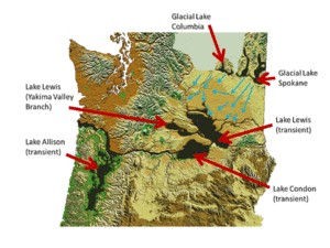
Near the end of the last glacial maximum (the last Ice Age), a huge sheet of ice blocked the Clark Fork River in Montana. This created a giant lake called Glacial Lake Missoula. Between 15,000 and 13,000 years ago, this ice dam broke about every 55 years. This sent massive floods of water rushing towards the Pacific Ocean. The water flowed incredibly fast, much more than the Amazon River.
The Horse Heaven Hills acted like a dam for this floodwater. This created a huge temporary lake called Lake Lewis. The surface of Lake Lewis reached about 1,200 feet (370 m) above today's sea level. Most of the water then squeezed through Wallula Gap. The lake stretched as far as Yakima and Moses Lake.
These floods left behind glacial erratics on the lower slopes of the hills. These are rocks like granite that were carried by the ice sheet from far away. They were then dropped by the flood when the icebergs they were stuck in melted on the hillsides. After passing Wallula Gap, the water was blocked again, forming another lake called Lake Condon.
The soil in the Horse Heaven Hills is a mix of things. It includes material from the Missoula floods, wind-blown dust, and ash from volcanoes in the Cascade volcanoes to the west. These soils are not very rich in nutrients and drain water quickly. You can see small, deep canyons in the hills where the lava rock is exposed. The northern slope has many places where land has slid down. The wind-blown dust contains ash from volcanoes like Mount Mazama, Glacier Peak, and Mount St. Helens.
The 1936 State Line earthquake happened near Milton-Freewater, Oregon, on the same fault line as the Horse Heaven Hills. However, the name Horse Heaven Hills is only used for the hills west of Wallula Gap.
Human Use of the Hills
Even though not many people live in the Horse Heaven Hills, they are important for farming and making electricity in Washington. With Irrigation (bringing water to dry land), parts of the hills can now grow many different crops. Most of the irrigated land is on the southern side of the hills.
Government agencies own thousands of acres in the Horse Heaven Hills. The Washington State Department of Natural Resources controls most of this public land. The Bureau of Land Management also owns land south of Benton City.
Farming and Wineries
Irrigation water from the Yakima and Columbia Rivers has made parts of the Horse Heaven Hills a key farming area. In places without irrigation, farmers grow dryland wheat. The system for bringing water to farms is still growing. For example, in 2016, a project allowed 4,000 more acres of land to be irrigated.
Where irrigation water is available, many different crops can be grown. These include potatoes, onions, and carrots. The area is also great for fruit orchards and wineries.
Many wineries are located in the hills. Some of them produce Washington's most famous wines. The Horse Heaven Hills AVA was created in 2005 to help these wineries. Chateau Ste. Michelle has the largest wine-making facility in Washington in the town of Paterson.
Generating Energy
The Horse Heaven Hills have strong, steady winds, which are perfect for making electricity. Because of this, several wind farms are located here. They generate power for the region.
The Nine Mile Canyon Project is south of Kennewick. It covers 75 acres (30 ha) and can produce 95.9 megawatts of power. This project was built in three stages between 2002 and 2007. It connects to the main power grid run by the Bonneville Power Administration.
The Juniper Canyon Wind Project near Bickleton started being built in 2010. Its first phase can produce 150 megawatts, and a second part added another 100 megawatts. It also connects to the Bonneville Power Administration system through a new 20.4 miles (32.8 km) power line.
Plants and Animals (Ecology)
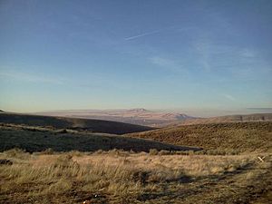
The Horse Heaven Hills are mostly covered by grasses, shrubs, and small flowering plants. Sagebrush is a common plant native to this area. Some of the flowers found here are rare or endangered, like the cushion daisy. Invasive plants (plants that are not native and can take over) have also grown in the hills. This happened because many large grazing animals that used to eat them are no longer here.
When horses first arrived, Native Americans likely used them for hunting. This led to a decrease in animals like bison, pronghorn sheep, and elk. Even though the area is called "Horse Heaven," wild horses are now only seen in certain parts of the hills. You might spot them near Satus Pass. Horses were once the main grazing animal, but they were largely moved away for farming.
Small numbers of deer can still be found in the Horse Heaven Hills. The Yakama Nation has recently brought back pronghorn sheep near Satus Pass.
A study in Benton County found many fossils of ancient animals. These included prehistoric mammoths, bisons, and early horses. These fossils show that these animals once lived in the hills. Most of the fossils were found in canyons under layers of silt and sand. They are between 7,000 and 12,000 years old, and some are even older. The fact that these fossils were found at higher elevations means these animals survived the huge Missoula Floods. A special group was created to help fund research at a dig site where a mammoth is being uncovered south of Kennewick.
 | Selma Burke |
 | Pauline Powell Burns |
 | Frederick J. Brown |
 | Robert Blackburn |


