Mount Aix facts for kids
Quick facts for kids Mount Aix |
|
|---|---|

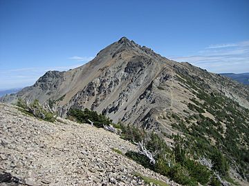
Mount Aix, northwest aspect
|
|
| Highest point | |
| Elevation | 7,766 ft (2,367 m) |
| Prominence | 3,296 ft (1,005 m) |
| Geography | |
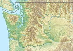
| Location | Yakima County, Washington, U.S. |
| Parent range | Cascades |
| Topo map | USGS Bumping Lake |
| Climbing | |
| Easiest route | Trail class 1 |
Mount Aix is a very tall mountain in Washington state. It stands about 7,766 feet (or 2,367 meters) high! You can find it right in the middle of the William O. Douglas Wilderness. This special area is managed by the Wenatchee National Forest. Mount Aix is actually the highest point in this entire wilderness area.
The mountain is located in Yakima County. It's about 24 miles east-southeast of the famous Mount Rainier. Mount Aix is situated east of the main Cascade Range mountains. It's also found southeast of Bumping Lake and northwest of Rimrock Lake.
Mount Aix is considered very "prominent." This means it stands out a lot from the land around it. It's the tallest peak in a large area. This area is east of Mount Rainier National Park, north of the Goat Rocks Wilderness, and west of Yakima. Before 1897, when the USGS officially recognized the name, it was sometimes spelled Mount Aiks on older maps.
Weather Around Mount Aix
Mount Aix is located on the east side of the Cascade Range. This means the weather here is a bit different from the west side of the mountains. Most weather systems start over the Pacific Ocean. They then travel northeast toward the Cascade Mountains.
As these weather systems approach the mountains, the peaks force the air to rise. This process is called Orographic lift. When the air rises, it cools down and drops its moisture. This moisture falls as rain or snow onto the Cascades. Because of this, the east side of the Cascades gets less rain and snow than the west side.
During the winter months, the weather is usually cloudy. However, in the summer, high-pressure systems often form over the Pacific Ocean. These systems bring clear skies, so there is usually little or no cloud cover. Any rain or snow that falls on Mount Aix eventually flows into the Yakima River. From there, it makes its way to the larger Columbia River.
 | Jessica Watkins |
 | Robert Henry Lawrence Jr. |
 | Mae Jemison |
 | Sian Proctor |
 | Guion Bluford |


