Mount Rainier National Park facts for kids
Quick facts for kids Mount Rainier National Park |
|
|---|---|
|
IUCN Category II (National Park)
|
|
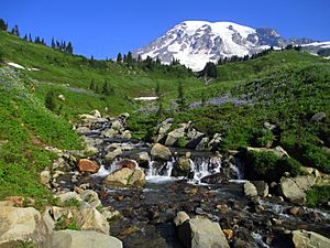
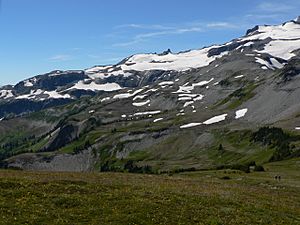
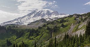
Mount Rainier from above Myrtle Falls
|
|
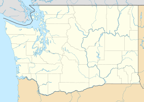
| Location | Pierce County and Lewis County, Washington, United States |
| Nearest city | Tacoma |
| Area | 236,381 acres (956.60 km2) |
| Established | March 2, 1899 |
| Visitors | 1,518,491 (in 2018) |
| Governing body | National Park Service |
| Website | Mount Rainier National Park |
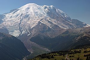
Mount Rainier National Park is a special place in Washington state, USA. It became the fifth national park in the United States on March 2, 1899. The park covers about 236,381 acres (956.6 km2). It includes all of Mount Rainier, which is a huge volcano.
Mount Rainier is a stratovolcano that stands 14,411 feet (4,392 m) tall. It rises sharply from the land around it. The park's elevation goes from 1,600 feet to over 14,000 feet (490–4,300 m). Mount Rainier is the highest point in the Cascade Range mountains.
The park is full of beautiful valleys, tall waterfalls, and green meadows. It also has 91,000 acres (368 km2) of very old forests. More than 25 glaciers flow down the sides of the volcano. Clouds often cover the mountain, bringing lots of rain and snow.
A famous hiking path called the Wonderland Trail goes all the way around Mount Rainier. The mountain is covered by glaciers and snowfields that total about 35 square miles (91 km2). The Carbon Glacier is the largest glacier by how much ice it holds in the lower 48 states. The Emmons Glacier is the largest by its size. Mount Rainier is a very popular place for mountaineering. About 10,000 people try to climb it each year, and about half of them reach the top!
Contents
Park History
Most of Mount Rainier National Park, about 97%, is protected as a wilderness area. This means it's kept as natural as possible. It became the Mount Rainier Wilderness in 1988. The park is also a National Historic Landmark. This means it's important for its history and special buildings. Many buildings in the park, like the Paradise Inn, show a special style of architecture from the 1920s and 1930s.
Native American History
People have lived in the Mount Rainier area for a very long time. The oldest sign of humans is a tool found near Bench Lake, dating back about 4,000 to 5,800 years ago.
Another important discovery was a rock shelter near Fryingpan Creek. Hunters used this shelter. It was not a place where people lived all year. Tools found there suggest that Columbia Plateau Tribes used the site between 1,000 and 300 years ago.
Native American tribes like the Nisqually, Puyallup, Muckleshoot, Yakama, and Taidnapam used the park area. They did not live there permanently. Instead, they used it for hunting and gathering food. They also used it for special spirit quests.
Park Plants and Animals
Mount Rainier National Park has many different plants and animals. The park's high areas are like an Alpine tundra, with meadows and bare land.
Park Animals
Many mammals live in the park. These include the cougar, black bear, raccoon, coyote, and bobcat. You might also see snowshoe hares, weasels, moles, beavers, and red foxes. Other animals are porcupines, skunks, marmots, deer, martens, shrews, pikas, elk, and mountain goats.
Many birds also call the park home. Some common birds are the thrush, chickadee, kinglet, and steller's jay. You might also spot a Clark's nutcracker, bald eagle, ptarmigan, or harlequin duck. Raptors like the northern goshawk, spotted owl, peregrine falcon, and golden eagle fly overhead.
How the Park Was Created
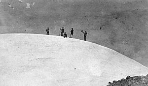
On March 2, 1899, President William McKinley signed a bill to create Mount Rainier National Park. It was the fifth national park in the country. This park was special because it was the first one made from a national forest.
A famous naturalist named John Muir visited Mount Rainier in 1888. He and nine others climbed to the top. This trip helped Muir decide to spend his life protecting nature. He wanted places like Mount Rainier to be national parks, which offer more protection than national forests.
Many groups supported making Mount Rainier a national park. These included the Sierra Club, the National Geographic Society, and scientists. Businesses in Tacoma and Seattle also wanted the park. Even the Northern Pacific Railway supported it. It took over five years and six tries to get the bill passed in Congress. Finally, Congress agreed, but only after being sure the land was not good for farming or mining. They also wanted to make sure no federal money would be needed to manage the park.
2006 Flooding Event
Mount Rainier National Park had to close in November 2006 because of really bad flooding. A huge storm, called a Pineapple Express, brought 18 inches (460 mm) of rain in just 36 hours.
Many campsites and roads in the park were washed away. Power went out in areas like Paradise and Longmire. Sunshine Point Campground was completely destroyed and never reopened. Parts of the Carbon River Road also washed out. This road used to be open to cars but is now closed to vehicles. The park slowly reopened to cars in May 2007.
Park Climate
Mount Rainier National Park has a unique climate. It's often described as a "Mediterranean-influenced Subarctic climate." This means it has cold winters with lots of snow and short, cool summers.
The National Park Service says that "Paradise is the snowiest place on Earth where snowfall is measured regularly." In the winter of 1971-1972, 93.5 feet (28.5 m) of snow fell there. That was a world record for that year! Paradise also holds the record for the most snow on the ground in the Cascade Range, with 30.583 feet (9.322 m) on March 10, 1956.
| Climate data for Paradise Ranger Station (1981–2010) | |||||||||||||
|---|---|---|---|---|---|---|---|---|---|---|---|---|---|
| Month | Jan | Feb | Mar | Apr | May | Jun | Jul | Aug | Sep | Oct | Nov | Dec | Year |
| Record high °F (°C) | 65 (18) |
62 (17) |
70 (21) |
78 (26) |
88 (31) |
86 (30) |
87 (31) |
94 (34) |
89 (32) |
88 (31) |
78 (26) |
66 (19) |
94 (34) |
| Mean daily maximum °F (°C) | 34.9 (1.6) |
35.7 (2.1) |
37.9 (3.3) |
42.1 (5.6) |
49.3 (9.6) |
54.7 (12.6) |
63.3 (17.4) |
64.5 (18.1) |
58.1 (14.5) |
47.9 (8.8) |
37.3 (2.9) |
33.8 (1.0) |
46.6 (8.1) |
| Daily mean °F (°C) | 28.7 (−1.8) |
28.9 (−1.7) |
30.8 (−0.7) |
34.0 (1.1) |
40.5 (4.7) |
45.5 (7.5) |
53.0 (11.7) |
54.2 (12.3) |
48.9 (9.4) |
40.1 (4.5) |
31.0 (−0.6) |
27.4 (−2.6) |
38.6 (3.7) |
| Mean daily minimum °F (°C) | 22.5 (−5.3) |
22.1 (−5.5) |
23.7 (−4.6) |
25.9 (−3.4) |
31.8 (−0.1) |
36.2 (2.3) |
42.7 (5.9) |
43.9 (6.6) |
39.7 (4.3) |
32.3 (0.2) |
24.7 (−4.1) |
21.1 (−6.1) |
30.6 (−0.8) |
| Record low °F (°C) | −13 (−25) |
−18 (−28) |
−2 (−19) |
2 (−17) |
13 (−11) |
13 (−11) |
20 (−7) |
26 (−3) |
18 (−8) |
2 (−17) |
−11 (−24) |
−20 (−29) |
−20 (−29) |
| Average precipitation inches (mm) | 18.24 (463) |
12.69 (322) |
12.56 (319) |
8.30 (211) |
5.89 (150) |
4.11 (104) |
1.95 (50) |
1.97 (50) |
4.71 (120) |
10.43 (265) |
20.28 (515) |
17.17 (436) |
118.3 (3,005) |
| Average snowfall inches (cm) | 118.7 (301) |
91.6 (233) |
90.6 (230) |
67.5 (171) |
26.1 (66) |
5.6 (14) |
0.3 (0.76) |
0.1 (0.25) |
1.4 (3.6) |
24.1 (61) |
120.9 (307) |
124.0 (315) |
670.9 (1,702.61) |
| Average precipitation days (≥ 0.01 in) | 21.1 | 17.8 | 21.5 | 18.8 | 15.4 | 12.8 | 7.3 | 6.6 | 9.6 | 15.0 | 21.7 | 21.1 | 188.7 |
| Average snowy days (≥ 0.1 in) | 18.5 | 15.9 | 19.5 | 14.4 | 7.9 | 2.5 | 0.2 | 0.1 | 0.7 | 6.2 | 16.6 | 19.0 | 121.5 |
| Source 1: NOAA (normals, 1981–2010) | |||||||||||||
| Source 2: Western Regional Climate Center (extremes 1916–present) | |||||||||||||
| Climate data for Sunrise Visitor Center, Mount Rainier National Park. (Elev: 6309 ft / 1923 m) 1981–2010 | |||||||||||||
|---|---|---|---|---|---|---|---|---|---|---|---|---|---|
| Month | Jan | Feb | Mar | Apr | May | Jun | Jul | Aug | Sep | Oct | Nov | Dec | Year |
| Mean daily maximum °F (°C) | 30.5 (−0.8) |
32.1 (0.1) |
35.2 (1.8) |
39.8 (4.3) |
46.4 (8.0) |
51.9 (11.1) |
60.8 (16.0) |
61.8 (16.6) |
56.1 (13.4) |
44.7 (7.1) |
33.8 (1.0) |
29.6 (−1.3) |
43.6 (6.4) |
| Daily mean °F (°C) | 24.9 (−3.9) |
25.3 (−3.7) |
27.5 (−2.5) |
31.4 (−0.3) |
37.6 (3.1) |
43.0 (6.1) |
50.7 (10.4) |
51.6 (10.9) |
46.9 (8.3) |
37.3 (2.9) |
28.2 (−2.1) |
24.1 (−4.4) |
35.8 (2.1) |
| Mean daily minimum °F (°C) | 19.4 (−7.0) |
18.5 (−7.5) |
19.9 (−6.7) |
23.0 (−5.0) |
28.8 (−1.8) |
34.1 (1.2) |
40.6 (4.8) |
41.3 (5.2) |
37.7 (3.2) |
29.8 (−1.2) |
22.6 (−5.2) |
18.6 (−7.4) |
27.9 (−2.3) |
| Average precipitation inches (mm) | 11.84 (301) |
8.73 (222) |
8.12 (206) |
5.52 (140) |
3.80 (97) |
4.08 (104) |
1.83 (46) |
1.22 (31) |
2.93 (74) |
5.29 (134) |
12.38 (314) |
13.19 (335) |
78.93 (2,005) |
| Average relative humidity (%) | 80.0 | 74.7 | 69.4 | 72.6 | 68.6 | 68.1 | 69.0 | 66.7 | 65.7 | 68.0 | 79.6 | 80.3 | 71.9 |
| Average dew point °F (°C) | 19.6 (−6.9) |
18.4 (−7.6) |
18.8 (−7.3) |
23.6 (−4.7) |
28.2 (−2.1) |
33.2 (0.7) |
40.9 (4.9) |
40.9 (4.9) |
36.0 (2.2) |
27.7 (−2.4) |
22.7 (−5.2) |
18.9 (−7.3) |
27.5 (−2.5) |
| Source: PRISM Climate Group | |||||||||||||
Major Attractions in the Park
The entire park is considered a National Historic Landmark District. This is because of the beautiful design and care put into its buildings. There are 42 places in the park listed on the National Register of Historic Places. Four of these are also National Historic Landmarks.
Paradise Area
Paradise is a very popular spot in the park. It's located on the south side of Mount Rainier, about 5,400 feet (1,600 m) high. Most visitors to Mount Rainier National Park come to Paradise.
Here you'll find the historic Paradise Inn, built in 1916. There's also the Paradise Guide House from 1920. The Henry M. Jackson Visitor Center, rebuilt in 2008, is also in Paradise.
Longmire Area
Longmire is another important visitor area in the park. It's about 6.5 miles (10.5 km) east of the Nisqually Entrance. The area is named after James Longmire, an early settler.
Longmire is in the Nisqually River valley, about 2,761 feet (842 m) high. It's surrounded by tall, old trees like Douglas fir, western red cedar, and western hemlock.
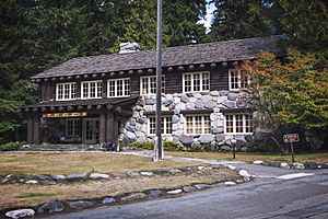
At Longmire, you can find Mount Rainier's National Park Inn, which is open all year. There's also the Longmire Museum and a Wilderness Information Center. Longmire is the second most popular spot in the park after Paradise. The Cougar Rock Campground is nearby, with many campsites. Longmire is also one of the starting points for the Wonderland Trail.
Sunrise Area
Sunrise is a lodge and visitor center in the northeast part of the park. At about 6,400 feet (1,951 m) high, it's the highest point in the park you can reach by car.
There are many miles of hiking trails around Sunrise. Popular trails go to Mount Fremont, Burroughs Mountain, and Sourdough Ridge. You can get to Sunrise by taking a 10-mile (16 km) turnoff from SR 410 near the White River entrance.
Other Developed Areas
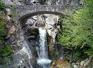
Ohanapecosh is a campground and ranger station in the southeast part of the park. It's about 3 miles (4.8 km) from the park boundary off Highway 123. This area is in a deep valley with old-growth forests, below 2,000 feet (610 m). It's the only main area of the park where you can't see Mount Rainier. The Ohanapecosh Hot Springs, Grove of the Patriarchs, and Silver Falls are all in this area.
The Carbon River Entrance Station is in the northwest corner of the park. It's off Highway 165. This area has the only rainforest at Mount Rainier. There's a campground and a short trail through the rainforest. You can also hike to the Carbon Glacier, which is one of the lowest glaciers in the United States.
Mowich Lake is the biggest and deepest lake in the park. It's located south of Carbon, at the end of Highway 165. You can find a campground, picnic area, and hiking trails near the lake.
Some roads in the northwest part of the park were badly damaged by floods in 2006. The Carbon River entrance ranger station is open in the summer. However, cars are not allowed past that point.
See also
 In Spanish: Parque nacional del Monte Rainier para niños
 | William L. Dawson |
 | W. E. B. Du Bois |
 | Harry Belafonte |


