
Burroughs Mountain facts for kids
Quick facts for kids Burroughs Mountain |
|
|---|---|

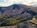
Burroughs Mountain from east
|
|
| Highest point | |
| Elevation | 7,828 ft (2,386 m) |
| Prominence | 388 ft (118 m) |
| Naming | |
| Etymology | John Burroughs |
| Geography | |

Burroughs Mountain
Location in Washington (state)
|
|
| Location | Mount Rainier National Park Pierce County, Washington, U.S. |
| Parent range | Cascades |
| Topo map | USGS Sunrise |
| Type of rock | Andesitic lava |
| Climbing | |
| Easiest route | Trail |
Burroughs Mountain is a cool mountain located on the northeast side of Mount Rainier. It sits above a place called Glacier Basin. This mountain was named after John Burroughs, a famous naturalist. A naturalist is someone who studies nature. John Burroughs visited Mount Rainier many times.
John Burroughs was born in New York in 1837 and lived until 1931. He wrote a lot about his travels and loved nature. He was also involved in the conservation movement, which works to protect nature.
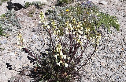
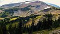
Burroughs Mountain is a high ridge. It was formed from an old lava flow. It has three main flat areas, called plateaus, that get higher as you go along. The mountain is inside Mount Rainier National Park. It is special because it has alpine tundra plants. These are plants that usually grow in very cold places or high up mountains.
The ground here is rocky and the plants are low to the ground. They have a short time to grow because snow covers the ridge for most of the year. This is due to the harsh alpine climate. The plants here are very delicate. Walking off the marked trail can easily damage them.
Contents
Exploring Burroughs Mountain
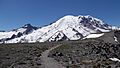
Burroughs Mountain is a very popular place for hiking. Hikers love it because it offers amazing close-up views. You can see huge glaciers like the Emmons Glacier and Winthrop Glacier. You can also see Little Tahoma Peak. The trail gives you views in every direction. This is because most of the path is above the tree line. This means there are no trees blocking your view.
Hiking Trails and Peaks
The main hiking trail starts at the Sunrise Historic District. It forms a loop that goes up to two main peaks:
- First Burroughs Mountain: This peak is about 7,160 feet high.
- Second Burroughs Mountain: This peak is a bit higher at 7,402 feet.
There is also a Third Burroughs Mountain. It is the highest at 7,828 feet. This peak is about a mile past Second Burroughs. But, it is not on the main trail. The whole loop trail is about 6.2 miles long. A small part of this loop is also part of the famous Wonderland Trail.
Best Time to Visit
You can only visit Burroughs Mountain when the Sunrise Road is open. Snow closes this road for much of the year. Sometimes, ice can also block the trail above Frozen Lake. The best months to visit are usually July, August, and September. This is when the road is open for cars.
Mountain Geology
Burroughs Mountain is at the northeast base of Mount Rainier. It shows off a huge andesite lava flow. This flow is about 3.4 cubic kilometers in size. It is up to 350 meters thick. It stretches for about 11 kilometers.
Scientists have studied the rocks here. They found that the lava flow has two main parts. The bottom part is about 100 meters thick. It has more felsic rocks. Felsic rocks are lighter in color and have more silica. Above this is a sharper, more mafic upper part. Mafic rocks are darker and have less silica. The upper part changes slightly as it goes up. The lower part is more mixed. It also has small pieces of basaltic andesite magma.
Amazing Alpine Plants
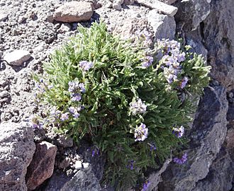
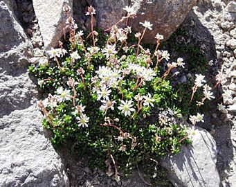
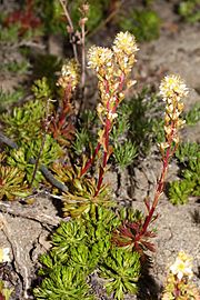
Burroughs Mountain is famous for its wide variety of alpine tundra plants. You can easily see them here. These plants are special because they can live in harsh, cold conditions. Some of the plants you might spot include:
- Sedges (Cyperaceae)
- Saxifraga
- Dwarf lupine (Lupinus lepidus)
- Luetkea
- Antennaria
- Koenigia davisiae
- Alpine yellow fleabane (Erigeron aureus)
- Tundra Aster (Oreostemma alpigenum)
- Empetrum nigrum
- Arenaria lateriflora
-
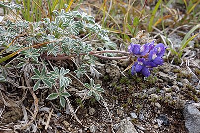
Dwarf Lupine (Lupinus lepidus)
-
Curved-beak lousewort (Pedicularis contorta)
-
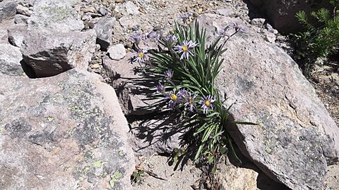
Tundra Aster (Oreostemma alpigenum)
-
Polemonium elegans
-
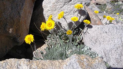
Golden fleabane (Erigeron aureus)
-
Tolmie's saxifrage (Micranthes tolmiei)
-
Luetkea pectinata
.jpg)
_-_Flickr_-_brewbooks_(1).jpg)
_-_Flickr_-_brewbooks.jpg)
.jpg)
_-_Flickr_-_brewbooks.jpg)
_-_Flickr_-_brewbooks.jpg)

Wildlife on the Mountain
Burroughs Mountain is home to many cool animals. You might see:
Lower down the mountain, in Berkeley Park, you might also spot Deer. The American black bear (Ursus americanus) also lives in this area.
Mountain Climate
Burroughs Mountain is in a marine west coast climate zone. This means it gets a lot of moisture from the Pacific Ocean. Most weather fronts come from the Pacific Ocean. They travel northeast towards the Cascade Mountains.
When these weather fronts hit the tall Cascade Mountains, they are forced to rise. This causes them to drop their moisture. So, the west side of the Cascades gets a lot of rain or snow. This happens especially during the winter.
Because it's close to the Pacific Ocean, the area rarely gets extremely cold or hot. Temperatures rarely drop below 0°F (-18°C) or go above 80°F (27°C). Winters are usually cloudy. But in summer, high pressure systems over the Pacific Ocean often bring clear skies. The snow here tends to be wet and heavy. This can sometimes lead to a high avalanche danger.
Images for kids
-
First Burroughs Mountain
-
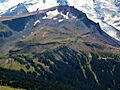
Second Burroughs Mountain (seen from Skyscraper Mountain)
-
Third Burroughs Mountain
-
Burroughs Mountain from above
-
Top of First Burroughs Mountain view of Rainier
-
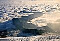
Burroughs Mountain above sea of clouds
-
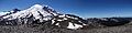
Panoramic of Mount Rainier from Second Burroughs


_with_snow_looking_west._11976._slide_(a1887698d8f1453db7085e0b081cd804).jpg)


