Emmons Glacier facts for kids
Quick facts for kids Emmons Glacier |
|
|---|---|
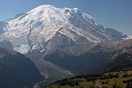
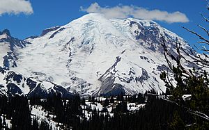
From just below the summit of Mount Rainier, Emmons Glacier descends to the left of Steamboat Prow (center) which divides it from Winthrop Glacier (right).
|
|
| Type | Mountain glacier |
| Coordinates | 46°51′44″N 121°43′01″W / 46.86222°N 121.71694°W |
| Area | 4.3 sq mi (11 km2) |
| Length | 3.9 mi (6.3 km) estimated |
| Terminus | Moraine |
| Status | Retreating |
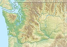
The Emmons Glacier is a huge river of ice found on the northeast side of Mount Rainier. Mount Rainier is a large volcano in Washington, USA. This glacier is special because it covers about 4.3 sq mi (11 km2). This makes it the largest glacier by surface area in the main part of the United States (not including Alaska or Hawaii).
The glacier was named after Samuel Franklin Emmons. He was a geologist who helped explore Mount Rainier in 1870.
Contents
About Emmons Glacier
The Emmons Glacier starts very high up on Mount Rainier. It begins at an elevation of over 13,800 ft (4,200 m). From there, it slowly flows downhill towards the east.
How the Glacier Flows
As it moves, the Emmons Glacier meets another glacier called the Ingraham Glacier. This happens near a place called Disappointment Cleaver, at about 12,200 ft (3,700 m). The two glaciers join together and flow as one.
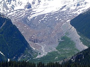
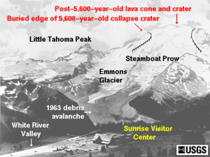
They stay connected until they reach a rocky point called Little Tahoma Peak. Here, they split apart again. The Emmons Glacier then turns and flows northeast. It continues to move downhill until it reaches its end, called the terminus. This rocky end is at about 5,100 ft (1,600 m) in elevation.
How the Glacier Changes Over Time
In the 1930s, scientists noticed that the Emmons Glacier was shrinking quickly. But something interesting happened in 1963. A large amount of rocks fell from Little Tahoma Peak. These rocks covered the lower part of the glacier.
This rock cover acted like a blanket. It protected the ice underneath from melting too fast. Because of this, the glacier actually grew quickly in the early 1980s. This growth continued into the 1990s, but it slowed down. By 2003, the glacier started shrinking again. Many glaciers in the western United States have been shrinking in recent decades.
Climbing Mount Rainier
The Emmons Glacier is a popular path for climbers. Many people use it as a route to reach the very top of Mount Rainier. This path is often called the Columbia Crest route.
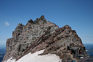
There is a special Ranger Station at Camp Schurman. This station is located right on the edge of a ridge called Steamboat Prow. Rangers are there to help climbers and keep them safe.
 | Stephanie Wilson |
 | Charles Bolden |
 | Ronald McNair |
 | Frederick D. Gregory |


