Pomeroy, Washington facts for kids
Quick facts for kids
Pomeroy
|
|
|---|---|
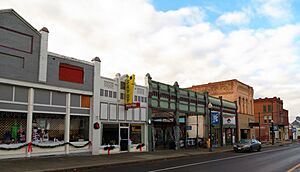
Downtown Pomeroy in 2018
|
|
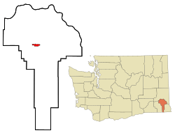
Location of Pomeroy, Washington
|
|
| Country | United States |
| State | Washington |
| County | Garfield |
| Area | |
| • Total | 1.78 sq mi (4.60 km2) |
| • Land | 1.78 sq mi (4.60 km2) |
| • Water | 0.00 sq mi (0.00 km2) |
| Elevation | 1,857 ft (566 m) |
| Population
(2020)
|
|
| • Total | 1,389 |
| • Density | 780.3/sq mi (302.0/km2) |
| Time zone | UTC−8 (Pacific (PST)) |
| • Summer (DST) | UTC−7 (PDT) |
| ZIP code |
99347
|
| Area code | 509 |
| FIPS code | 53-55120 |
| GNIS feature ID | 1512575 |
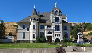
Pomeroy is a small city in Washington State, USA. It's the main town, or county seat, of Garfield County. It's also the only official city in the whole county! In 2020, about 1,389 people lived there.
Contents
Where is Pomeroy Located?
Pomeroy covers about 1.78 square miles (4.60 square kilometers) of land. There's no water area within the city limits.
U.S. Route 12 in Washington is the main highway that goes through Pomeroy. This road connects the city to the Lewiston–Clarkston metropolitan area in the east. It also links Pomeroy to the Tri-Cities and Walla Walla areas in the west.
The city is located 1,857 feet (566 meters) above sea level. It sits in a very hilly area. To the south are the Blue Mountains. To the north is the Palouse region, known for its rolling hills. Just a few miles east of Pomeroy, the highway goes over Alpowa Summit, which is 2,785 feet high.
What is Pomeroy's History?
The land where Pomeroy now stands has a long history. The Nez Perce Native American trail existed here for many years. The first written records of non-Native people passing through were from the Lewis and Clark explorers in 1805. Later, Captain Benjamin Bonneville surveyed the area in 1834.
In 1860, an Irish settler named Parson Quinn made his home just east of where Pomeroy is today. He lived there for about 40 years. Then, in 1864, a rancher named Joseph M. Pomeroy bought the land. He planned out the town's design in May 1878.
Pomeroy officially became a city on February 3, 1886. It has been the main city for Garfield County since 1882. This was a big deal because other nearby towns, like Pataha and Asotin, also wanted to be the county seat.
In 1883, Garfield County was split. Asotin became the county seat for the new Asotin County, Washington. But the debate over Pomeroy's role as the county seat for Garfield County continued. This discussion even went all the way to the United States Congress in 1884!
Pomeroy faced some challenges, including fires. After fires in 1890 and 1898, the city made a rule that downtown buildings had to be made of fire-proof materials. However, on July 18, 1900, a large fire still destroyed half of the downtown business area. It took two years to rebuild, but this led to a building boom. New buildings were made of brick.
In 1912, the city voted to stop the making or selling of alcohol. This was part of a larger movement called Prohibition. This law stayed in place until 1933, when the 21st Amendment ended Prohibition across the country.
On August 21, 2003, a special part of downtown Pomeroy was recognized. A 10-block area, known as the Downtown Pomeroy Historic District, was added to the National Historic Register. This means it's an important historical place.
How Many People Live in Pomeroy?
| Historical population | |||
|---|---|---|---|
| Census | Pop. | %± | |
| 1890 | 661 | — | |
| 1900 | 953 | 44.2% | |
| 1910 | 1,605 | 68.4% | |
| 1920 | 1,804 | 12.4% | |
| 1930 | 1,600 | −11.3% | |
| 1940 | 1,723 | 7.7% | |
| 1950 | 1,775 | 3.0% | |
| 1960 | 1,677 | −5.5% | |
| 1970 | 1,823 | 8.7% | |
| 1980 | 1,716 | −5.9% | |
| 1990 | 1,393 | −18.8% | |
| 2000 | 1,517 | 8.9% | |
| 2010 | 1,425 | −6.1% | |
| 2020 | 1,389 | −2.5% | |
| U.S. Decennial Census 2020 Census |
|||
The most recent count in 2020 showed that 1,389 people live in Pomeroy.
What Was the Population in 2010?
In 2010, there were 1,425 people living in Pomeroy. These people lived in 642 households, and 401 of those were families.
Most of the people in Pomeroy were White (94.9%). There were also small numbers of Native American (0.3%), Asian (1.3%), and other races (1.3%). About 3.2% of the population was Hispanic or Latino.
The average age of people in Pomeroy was 50 years old. About 19.6% of residents were under 18. About 24.4% were 65 years old or older. The city had slightly more females (52.5%) than males (47.5%).
What is Pomeroy's Climate Like?
Pomeroy has a climate that is a mix between a Mediterranean and a continental Mediterranean climate. This means it has dry summers. Summer afternoons are warm to hot, while mornings are cool or warm.
Winters are chilly or cold, and can be snowy. The weather box below shows more details about the temperatures and rainfall throughout the year.
| Climate data for Pomeroy, Washington (1991–2020 normals, extremes 1891–2020) | |||||||||||||
|---|---|---|---|---|---|---|---|---|---|---|---|---|---|
| Month | Jan | Feb | Mar | Apr | May | Jun | Jul | Aug | Sep | Oct | Nov | Dec | Year |
| Record high °F (°C) | 67 (19) |
71 (22) |
80 (27) |
98 (37) |
101 (38) |
102 (39) |
112 (44) |
109 (43) |
102 (39) |
93 (34) |
78 (26) |
72 (22) |
112 (44) |
| Mean maximum °F (°C) | 58.2 (14.6) |
59.3 (15.2) |
67.6 (19.8) |
75.8 (24.3) |
83.2 (28.4) |
91.4 (33.0) |
98.4 (36.9) |
99.1 (37.3) |
91.3 (32.9) |
79.9 (26.6) |
64.7 (18.2) |
57.7 (14.3) |
100.2 (37.9) |
| Mean daily maximum °F (°C) | 40.4 (4.7) |
44.5 (6.9) |
52.0 (11.1) |
58.6 (14.8) |
67.3 (19.6) |
74.4 (23.6) |
85.1 (29.5) |
85.1 (29.5) |
75.4 (24.1) |
60.9 (16.1) |
47.7 (8.7) |
39.5 (4.2) |
60.9 (16.1) |
| Daily mean °F (°C) | 33.8 (1.0) |
36.4 (2.4) |
42.3 (5.7) |
47.9 (8.8) |
55.6 (13.1) |
61.5 (16.4) |
69.0 (20.6) |
69.0 (20.6) |
60.3 (15.7) |
48.9 (9.4) |
39.6 (4.2) |
32.9 (0.5) |
49.8 (9.9) |
| Mean daily minimum °F (°C) | 27.1 (−2.7) |
28.3 (−2.1) |
32.6 (0.3) |
37.3 (2.9) |
43.9 (6.6) |
48.5 (9.2) |
52.9 (11.6) |
52.8 (11.6) |
45.2 (7.3) |
37.0 (2.8) |
31.5 (−0.3) |
26.3 (−3.2) |
38.6 (3.7) |
| Mean minimum °F (°C) | 9.2 (−12.7) |
13.7 (−10.2) |
19.4 (−7.0) |
25.6 (−3.6) |
29.9 (−1.2) |
37.6 (3.1) |
42.5 (5.8) |
40.9 (4.9) |
32.6 (0.3) |
21.5 (−5.8) |
15.3 (−9.3) |
18.0 (−7.8) |
0.9 (−17.3) |
| Record low °F (°C) | −22 (−30) |
−17 (−27) |
6 (−14) |
11 (−12) |
20 (−7) |
30 (−1) |
35 (2) |
33 (1) |
24 (−4) |
5 (−15) |
−13 (−25) |
−27 (−33) |
−27 (−33) |
| Average precipitation inches (mm) | 2.04 (52) |
1.62 (41) |
2.08 (53) |
1.67 (42) |
1.60 (41) |
1.15 (29) |
0.46 (12) |
0.53 (13) |
0.58 (15) |
1.31 (33) |
2.32 (59) |
2.27 (58) |
17.63 (448) |
| Average snowfall inches (cm) | 2.2 (5.6) |
1.2 (3.0) |
0.8 (2.0) |
0.1 (0.25) |
0.0 (0.0) |
0.0 (0.0) |
0.0 (0.0) |
0.0 (0.0) |
0.0 (0.0) |
0.0 (0.0) |
0.5 (1.3) |
3.6 (9.1) |
8.4 (21.25) |
| Average precipitation days (≥ 0.01 in) | 12.2 | 10.4 | 11.5 | 9.7 | 9.2 | 6.7 | 3.0 | 3.2 | 3.7 | 7.3 | 12.6 | 12.0 | 101.5 |
| Average snowy days (≥ 0.1 in) | 1.2 | 0.7 | 0.5 | 0.0 | 0.0 | 0.0 | 0.0 | 0.0 | 0.0 | 0.0 | 0.7 | 1.6 | 4.7 |
| Source 1: NOAA | |||||||||||||
| Source 2: National Weather Service | |||||||||||||
What Fun Events Happen in Pomeroy?
The Pomeroy Chamber of Commerce hosts several yearly events:
- Pioneer Day and Tumbleweed Festival: This event takes place on the second weekend in June.
- Garfield County Fair: Held every September.
- Starlight Parade and Festival of Trees: These festive events begin after Thanksgiving.
What About Education in Pomeroy?
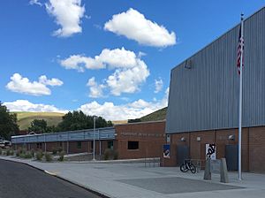
Students in Pomeroy attend schools that are part of the Pomeroy School District 110. Older students complete their public school education at Pomeroy Junior/Senior High School.
Who Are Some Famous People from Pomeroy?
Several notable people have connections to Pomeroy:
- Samuel G. Cosgrove (1847–1909): He was the 6th governor of Washington State.
- Mary Dye: A politician who is a member of the Washington House of Representatives.
- Elgin V. Kuykendall (1870–1958): An attorney and judge who also served in the Washington State Senate.
- Michael P. Malone (1940–1999): A historian who was also the president of Montana State University.
See also
 In Spanish: Pomeroy (Washington) para niños
 | Isaac Myers |
 | D. Hamilton Jackson |
 | A. Philip Randolph |


