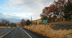
Pataha, Washington facts for kids
Quick facts for kids
Pataha
|
|
|---|---|
 |
|
| Country | United States |
| State | Washington |
| County | Garfield |
| Elevation | 2,064 ft (629 m) |
| Time zone | UTC-8 (Pacific (PST)) |
| • Summer (DST) | UTC-7 (PDT) |
| ZIP code |
99347
|
| Area code | 509 |
| GNIS feature ID | 1512551 |
Pataha is a small, unincorporated community in Garfield County, Washington, United States. An unincorporated community is a place that isn't officially a city or town. Pataha is located about 4 miles (6.4 km) east of Pomeroy. Pomeroy is the main town, or county seat, of Garfield County. Pataha is home to the historic Houser Mill. This is an old flour mill that still works using water power. It was originally built in 1879.
Contents
Where is Pataha Located?
Pataha is found along Pataha Creek. It is about four miles east of Pomeroy, the county seat of Garfield County. U.S. Route 12, a main road, passes through Pataha. It follows the valley made by Pataha Creek.
The valley here is quite steep. It is only about a mile wide in Pataha. The land rises quickly from the valley floor. It goes up over 300 feet (91 m) on the north side. To the south, it rises more than 500 feet (152 m) right next to the community.
The History of Pataha
Pataha is located on Pataha Creek. This creek was part of the old Nez Perce trail. This trail was used by the Nez Perce Native American tribe. They traveled along it to cross the Rocky Mountains. The name 'Pataha' comes from a Nez Perce word meaning 'brush.' This is because there was a lot of thick brush along the creek.
Early Explorers and Settlers
In May 1806, the famous explorers Lewis and Clark camped here. They were on their way back from the Pacific coast. Later, in 1834, Captain B. L. E. Bonneville visited the area. He was doing survey work for the U.S. Government.
The first settler, James Bowers, arrived in 1861. The next year, a stagecoach line was started. It ran between Walla Walla and Lewiston. This new line passed through Pataha. It helped bring many more settlers to the area.
Farming and Town Growth
These early settlers mostly grew vegetables and raised cattle. But by the 1870s, wheat farming became more popular. The area began to grow as a town in 1878. It was officially planned out in 1882. This was done by Angevine Titus and Company Favor. For a short time, the town was called 'Favorsburg' and 'Watertown.' But the original Native American name, Pataha, stuck.
Pataha's Decline
Pataha grew into a successful town. For a while, it was even a rival to nearby Pomeroy. When Garfield County was created in 1881, Pataha was briefly the county seat. This means it was the main government town. The 'Pataha Spirit' newspaper also started that same year.
However, things changed in 1885. The Oregon Railroad and Navigation Company built a rail line to Pomeroy. But the train tracks were not extended to Pataha. Soon, Pataha started to lose its advantage over Pomeroy. The town began to decline. The flour mill, however, kept running until 1940.
See also

- In Spanish: Pataha (Washington) para niños
 | Selma Burke |
 | Pauline Powell Burns |
 | Frederick J. Brown |
 | Robert Blackburn |


