Kenmore, Washington facts for kids
Quick facts for kids
City of Kenmore
|
||
|---|---|---|
 |
||
|
||
|
||
| Country | United States | |
| State | Washington | |
| County | King | |
| Incorporated | August 31, 1998 | |
| Government | ||
| • Type | Council–manager | |
| Area | ||
| • Total | 7.22 sq mi (18.69 km2) | |
| • Land | 6.15 sq mi (15.92 km2) | |
| • Water | 1.07 sq mi (2.77 km2) | |
| Elevation | 30 ft (9 m) | |
| Population
(2020)
|
||
| • Total | 23,914 | |
| • Density | 3,756.22/sq mi (1,450.40/km2) | |
| Time zone | UTC-8 (PST) | |
| • Summer (DST) | UTC-7 (PDT) | |
| ZIP code |
98028
|
|
| Area code(s) | 425 | |
| FIPS code | 53-35170 | |
| GNIS feature ID | 1512345 | |
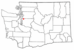
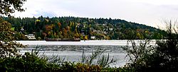
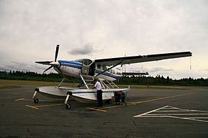
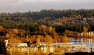
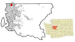
Kenmore is a city in King County, Washington. It sits on the northern shore of Lake Washington. It's a suburban town near the Sammamish River. Kenmore is about 12 miles (19 km) northeast of Seattle and 2 miles (3.2 km) west of Bothell. In 2020, about 23,914 people lived there. Kenmore Air Harbor is the biggest airport in the U.S. just for seaplanes.
You can reach Kenmore by State Route 522. The Burke-Gilman Trail also runs through the city. These paths go east and west along the lake. Kenmore's city limits reach north to the Snohomish County line. To the south, it borders Kirkland. Kenmore's official flower is the dahlia. Its bird is the great blue heron, and its evergreen plant is the rhododendron.
Contents
History of Kenmore
Kenmore was founded in 1901. Its name comes from a Scottish village called Kenmore. The city's founder, McMasters, and his wife Annie came from Canada around 1889. They planned to start a business making shingles. They opened a shingle mill on Lake Washington's north shore.
By 1903, Kenmore had a school and a post office. But it didn't officially become a city until August 31, 1998.
Early Days: Lumber and Gardens
A cargo railway passed through the area as early as 1887. However, most people traveled to Kenmore by boat. Regular ferry service to Seattle, Bothell, and Woodinville began in 1906. Later, the city got a passenger train stop.
The first good road to Seattle and Bothell opened between 1913 and 1914. It was called the Red Brick Road. Bus service started after the road was built. Because of this, Kenmore became a country getaway. People from Seattle with cars and a love for gardening bought small "garden plots" here.
Kenmore was also known for its many restaurants and entertainment spots. There were over 30 different places to eat, dance, and have fun in a small area. This was a big part of Kenmore's identity until the 1940s.
Changes Over Time: From Voucherville to Modern Kenmore
During the Great Depression, Kenmore became home to a small group of workers. This was part of President Franklin D. Roosevelt's "Back to the Land" program. These workers were paid with vouchers, not cash, by the Works Progress Administration. Their settlement in northwest Kenmore was called "Voucherville."
After World War II, Kenmore hosted US Army Nike Hercules missile batteries. These missiles were part of Cold War defense plans. They were meant to protect Seattle from Soviet bombers. The missiles were removed in 1974.
The downtown area changed a lot after the war. Kenmore Air Harbor opened, becoming one of the world's largest seaplane-only airports. Kenmore Air now flies seaplanes to many places in the Pacific Northwest. Kenmore's closeness to Seattle also made it a target for new housing. The first homes in the Uplake neighborhood were sold in 1954.
Housing and businesses grew quickly over the next few decades. Most of the old dining and entertainment spots were replaced by shopping centers and homes. One interesting building, the Jewel Box Building, was moved to Kenmore from the Seattle World's Fair in 1962.
In 1996, Kenmore got its first college, Bastyr University. It moved to the former St. Edward Seminary grounds.
Becoming a City and Rebuilding Downtown
People in Kenmore had thought about becoming an official city many times. One vote failed in 1954. But the idea gained support in the 1990s. This was partly due to the Washington State Growth Management Act of 1990. A committee was formed in 1995, leading to a successful public vote. Kenmore officially became a city on August 31, 1998. This was 97 years after it was first founded.
After becoming a city, the new government made plans to improve downtown. They wanted to bring back and rebuild the city's main areas. A big part of this plan involved using land owned by the city. This area is called the Northwest Quadrant. In 2005, architects and developers were invited to submit plans for this area. The City Council chose to work with Kenmore Partners LLC in 2006. Design plans were shared with the public that summer.
Kenmore's oldest roads used to have different names. For example, 61st Avenue NE was Cat's Whiskers Road. These old names were brought back in 2007 as secondary names in the downtown area.
Geography of Kenmore
Kenmore is located at 47°45′10″N 122°14′50″W / 47.75278°N 122.24722°W. It includes all of the north shore and much of the northeastern shore of Lake Washington. The land here has rolling hills made from glacial till. Flat areas are usually found near large bodies of water.
The biggest river is the Sammamish River. It connects Lake Sammamish to Lake Washington. This river divides the city into northern and southern parts. The northeastern part of the city also has narrow swamps and marshlands. These run north to south along Swamp Creek.
The United States Census Bureau says Kenmore has a total area of 6.26 square miles (16.21 km2). Of this, 6.15 square miles (15.93 km2) is land and 0.11 square miles (0.28 km2) is water.
Nearby Cities and Lake
 |
Brier | Brier/Bothell | Bothell |  |
| Lake Forest Park | Bothell | |||
| Lake Washington | Kirkland | Kirkland |
Climate in Kenmore
Kenmore's climate is much like Seattle's. It has a Marine west coast climate. This means it has damp, cool winters and mild, dry summers. This is true even though it is further north than cities like Toronto.
Kenmore Neighborhoods
Kenmore has several unique neighborhoods:
- Arrowhead: This neighborhood is in southern Kenmore, by the lake. The first house was built here in 1888. The oldest house still standing is from 1929.
- Inglewood: Also in southern Kenmore, this area was first planned in 1953. Large suburban developments appeared by 1962.
- Lower Moorlands: In eastern Kenmore, the first house here was built in 1904. Many homes were built after World War I. The Charles and Elvera Thomsen House, built in 1927, is a landmark here.
- Upper Moorlands: Also in eastern Kenmore, building started here in 1938-1939. It stayed rural due to a lack of a good water system. Suburban development arrived in the mid-1950s.
- Central Kenmore: This is the downtown area, along Bothell Way. It was the city's original core. Today, it's Kenmore's main business and industrial area.
- Northlake Terrace: This was an early residential neighborhood north of town. Now it has both businesses and homes. Much of its eastern part will be redeveloped as part of the new Downtown Plan.
- Linwood Heights: In northwest Kenmore, this area started as part of the "Back to the Land" movement during the Great Depression. It was once called Voucherville. Now it's mostly suburban housing.
- Kenlake Vista: In northern Kenmore, this area has post-war suburban housing.
- Kenmore Terrace
- Northshore Summit
Since 2000, many developers have built high-end homes in northern Kenmore. This has changed the area from rural to a wealthy suburb. This growth has also affected nearby Bothell, leading to new commercial areas.
Population and People
| Historical population | |||
|---|---|---|---|
| Census | Pop. | %± | |
| 1980 | 7,281 | — | |
| 1990 | 8,917 | 22.5% | |
| 2000 | 18,678 | 109.5% | |
| 2010 | 20,460 | 9.5% | |
| 2020 | 23,914 | 16.9% | |
| 2021 (est.) | 23,502 | 14.9% | |
| U.S. Decennial Census 2018 Estimate |
|||
In 2010, there were 20,460 people living in Kenmore. There were 7,984 households and 5,487 families. The average household had 2.55 people. About 33.5% of households had children under 18.
The median age in Kenmore was 39.5 years. About 22.8% of residents were under 18. And 11.9% were 65 or older. The population was 49.6% male and 50.4% female.
Economy of Kenmore
Kenmore is largely a "bedroom community." This means many people live here and travel to work in Seattle, Bothell, and Redmond. However, Kenmore also has its own economy. It focuses on construction materials like concrete and asphalt. It also has many special construction companies.
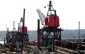
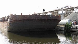
Kenmore has one of the last industrial ports on Lake Washington. It's located at the mouth of the Sammamish River. Big businesses near the port include Rinker Materials and Kenmore Ready-Mix. These companies deal with cements and asphalts. Other businesses include Pacific Topsoils, Michael Homchick Stoneworks, and Plywood Supply.
The city is also home to the James G. Murphy Company. This is one of the ten largest commercial auction houses in the U.S. Kenmore Air, a large seaplane airline, has its headquarters here. Alaska General Seafoods also has its main office and processing plant in Kenmore. Bastyr University, a school for naturopathic medicine, is also a major part of the economy.
Education in Kenmore
Kenmore is part of the Northshore School District. The local high school is Inglemoor High School. Inglemoor High School is known for its IB program. Kenmore used to have its own school district, Kenmore School District No. 141, started in 1903. It joined with the Bothell district in 1916. Then, in 1959, it combined with the Woodinville district to form Northshore.
The Saint Edward Environmental Learning Center offers environmental classes. These are for the public and work with Washington State Parks. The Kenmore Library Association is a volunteer group. They plan and support library programs.
A small part of Kenmore is in the Lake Washington School District. This area includes parts of Saint Edward State Park.
Kenmore is home to Bastyr University. It's a private school for naturopathic medicine, founded in 1978. The city is also close to the University of Washington in Seattle. UW Bothell and Cascadia College are in nearby Bothell. Paved bike trails and bus services connect Kenmore to all three schools. There's also a bus connection to Shoreline Community College.
Culture and Fun
Events and Festivals
Kenmore hosts several annual events:
- Kenmore Summer Concert Series: These concerts are held at Saint Edward State Park.
- Kenmore Art Show: This is an art exhibition sponsored by the Arts of Kenmore.
- Fourth of July Fireworks: A fireworks display at Log Boom Park, which started in 2006.
- Farmers Market: Held at Town Square every Wednesday from June to August. It began in 2022.
Media and Recognition
Kenmore gets news from Seattle-area media. Local events are covered by the Bothell/Kenmore Reporter. This is a weekly newspaper and online news source. The city also sends out a newsletter to residents every three months. It shares news about government activities and community events.
Family Circle Magazine named Kenmore one of the "10 Best Towns for families" in 2009. Seattle Magazine also ranked Kenmore as a top Seattle-area neighborhood in 2008–2009.
Parks in Kenmore
Not all parks in Kenmore are run by the city. The Burke-Gilman Trail is a King County park. Saint Edward State Park is managed by Washington State Parks. Here are some parks within Kenmore:
- Burke-Gilman Trail: This King County park connects to the Sammamish River Trail. It links Marymoor Park to Seattle and other areas.
- ƛ̕ax̌ʷadis Park: This park is along the Sammamish River. It's named after an old village near downtown Kenmore.
- Linwood Park: A small 3-acre (12,000 m2) park in northwest Kenmore. It has grass, a playground, and picnic tables.
- Moorlands Park: A 5-acre (20,000 m2) park in southeastern Kenmore. It has baseball and basketball facilities.
- Rhododendron Park: This 13-acre (53,000 m2) park has hundreds of Rhododendron plants. It also has a public boathouse.
- Saint Edward State Park: The largest park in Kenmore at 365 acres (1.48 km2). It has over half a mile of Lake Washington shoreline. It also features the historic Saint Edward Seminary, now a hotel, and the state's largest playground.
- Swamp Creek Park: This park is along the Sammamish River. It's city-owned farmland that is currently undeveloped.
- Log Boom Park (Tracy Owen Station): This park includes 16 acres (65,000 m2) of shoreline. It has a large walking dock that extends into the lake.
- Wallace Swamp Creek Park: A 17 acres (69,000 m2) park that surrounds Swamp Creek in northeast Kenmore. It features walking trails.
Notable People from Kenmore
- Anthony Arena (born 1990) – soccer player
- Burke Fahling (born 1997) – soccer player
- Steve Fossen (born 1949) – bassist and co-founder of the band Heart
- Kirby Larson (born 1954) – author
- Pete Schoening (1927–2004) – mountain climber
- Charissa Thompson (born 1982) – television host and sportscaster
See also
 In Spanish: Kenmore (Washington) para niños
 | Audre Lorde |
 | John Berry Meachum |
 | Ferdinand Lee Barnett |


