Cedar River (Washington) facts for kids
Quick facts for kids Cedar River |
|
|---|---|
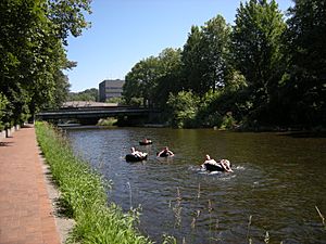
Cedar River in Downtown Renton in 2009
|
|
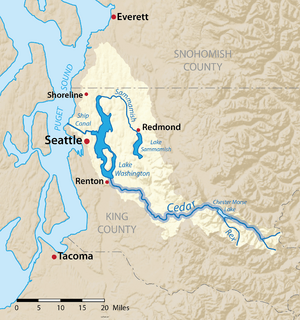
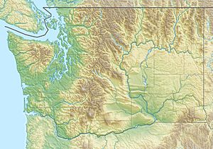
Map of the Lake Washington drainage basin with the Cedar River highlighted
|
|
|
Location of the mouth of the Cedar River in Washington
|
|
| Country | United States |
| State | Washington |
| County | King |
| Cities | Maple Valley, Renton |
| Physical characteristics | |
| Main source | Cascade Range 2,220 ft (680 m) 47°18′47″N 121°31′17″W / 47.31306°N 121.52139°W |
| River mouth | Lake Washington 17 ft (5.2 m) 47°30′2″N 122°12′58″W / 47.50056°N 122.21611°W |
| Length | 45 mi (72 km) |
| Basin features | |
| Basin size | 184 sq mi (480 km2) |
| Tributaries |
|
The Cedar River is a river in the state of Washington, USA. It is about 45 miles (72 km) long. The river starts in the Cascade Range mountains. It flows generally west and northwest. Finally, it empties into the southern part of Lake Washington.
The upper part of the river, called the Cedar River Watershed, is a special protected area. It provides clean drinking water for many people in the Seattle area. The Cedar River's water eventually flows into Puget Sound. This happens through Lake Washington and the Lake Washington Ship Canal.
Contents
Where Does the Cedar River Flow?
The Cedar River begins high up in the Cascade Range. It starts near peaks like Abiel Peak and Meadow Mountain. Many small streams join together in the mountains. These streams are fed by melting glaciers.
The river then flows west. It forms a large lake called Chester Morse Lake. This was a natural lake that was dammed in 1900. The dam helps store water for the city. The Rex River and other parts of the Cedar River flow into Chester Morse Lake.
Below Chester Morse Lake, the Cedar River flows through a smaller lake called Masonry Pool. After this, the river leaves the protected Cedar River Watershed. This happens at a place called Landsburg. From here, pipelines carry water to the Seattle area.
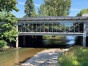
Outside the watershed, the river flows west and then north. It passes by the cities of Maple Valley and Renton. At Renton, the Cedar River flows into the southern end of Lake Washington. Its water then travels through the Lake Washington Ship Canal to reach Puget Sound.
How is the Cedar River Managed?
The upper part of the Cedar River is a protected area. It is called the Cedar River Municipal Watershed. This area is about 90,000 acres (364 km²) in size. The City of Seattle owns this land.
Why is the Watershed Protected?
The Cedar River Watershed provides drinking water for 1.4 million people. This is a large part of the Seattle area. About two-thirds of King County gets its water from here. They use over 100 million US gallons (380,000 m3) of water every day.
Seattle Public Utilities owns and runs the reservoirs and pipelines. People are not allowed to enter most of the watershed. This helps keep the water clean. It also protects the natural environment.
Chester Morse Lake is the main storage lake for the water system. Pipelines carry water from Landsburg to Seattle.
Changes to the River's Path
Before 1912, the Cedar River did not flow into Lake Washington. Instead, it flowed into the Black River. The Black River then joined the Green River. Together, they formed the Duwamish River, which flowed into Elliott Bay.
In 1911, there was a big flood on the lower Cedar River. To prevent future floods, the city of Renton built a new canal. This canal changed the Cedar River's path. By 1912, the Cedar River emptied directly into Lake Washington.
In 1916, the Lake Washington Ship Canal was finished. This canal connected Lake Washington to Lake Union. The water level of Lake Washington dropped by 8.8 feet (2.7 m). Because of this, the Black River dried up completely. Now, the Cedar River's water goes into Lake Washington. Then it flows through the Ship Canal to Puget Sound.
Natural Water Cleaning System
The upper Cedar River flows over ground that lets water soak in easily. This creates an aquifer, which is like an underground water storage area. Much of this underground water later comes back to the surface as springs. These springs flow into the Cedar River and other nearby rivers.
This process is like a natural water filter. It helps clean the water. Because of this, the Cedar River is one of the few rivers in the U.S. that provides drinking water without needing special filters.
Near the Cedar River Watershed is another protected area. This is the Green River Watershed. It provides drinking water for the Tacoma area.
The watershed also has an education center. Visitors can learn about drinking water, forests, and wildlife there.
Environmental Concerns
The Cedar River faces some environmental challenges. These include invasive species, which are plants or animals that don't belong there. There are also problems with erosion and pollution from nearby areas.
In 1996, a group called "Friends of the Cedar River Watershed" was formed. They worked to protect the river and its smaller streams. They focused on teaching people and restoring the natural environment. Their programs included the Cedar River Salmon Journey and volunteer habitat restoration. In 2015, the group stopped operating, but other organizations took over their important work.
History of the Cedar River's Use
People started trying to use the Cedar River for water in the 1890s. A dam was built at Landsburg. Water was then sent through a 29-mile (47 km) pipeline. This pipeline carried water to Seattle's reservoirs on Capitol Hill. The first water deliveries happened in 1901. More pipelines were built in 1909 and 1923.
In the early 1900s, the City of Seattle built another reservoir. This was on an old glacial lake bed. A large concrete dam was built. The reservoir was called the Cedar Reservoir. It was fed by the Cedar River.
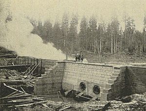
On December 23, 1918, a large part of the Cedar Reservoir failed. A huge amount of water, between 800,000 and 2,000,000 cubic yards, spilled out. This water flowed down Boxley Creek Valley. It destroyed the town of Edgewick and sawmills. Parts of the Milwaukee Railroad were also damaged. The failure happened on the side of the reservoir, not at the dam itself.
By 1899, the City of Seattle owned most of the Cedar River Watershed. Some land was still owned by logging companies. Before 1924, large parts of the forest were cut down for timber. Wildfires also burned many forests after logging.
In 1924, Seattle began managing the watershed carefully. The goal was to protect water quality for the future. Logging continued, but it was more controlled. Fire safety rules were also made stronger. In 1962, an agreement helped transfer the remaining private land to Seattle. By 1996, the United States Forest Service also gave its land in the watershed to Seattle. Now, the city is the only owner of the Cedar River Watershed.
Wildlife and Nature
Because of past logging, only about 17% of the Cedar River Watershed is old growth forest. This is about 14,000 acres (57 km²). Most of the forest there today is second growth forest, meaning it has grown back after being cut down.
The Cedar River Watershed is home to many different animals. The river itself provides a home for migrating fish. These include Chinook salmon, Coho salmon, Sockeye salmon, and Steelhead trout.
In the early 1900s, cutting down trees and erosion harmed the wildlife habitat. But starting in the late 20th century, people began working to protect and restore the river and its watershed. A big focus has been on helping salmon. Efforts are underway to create better places for salmon to lay eggs. They are also building fish ladders to help fish move past dams.
 | Kyle Baker |
 | Joseph Yoakum |
 | Laura Wheeler Waring |
 | Henry Ossawa Tanner |


