Somerset Island, Bermuda facts for kids
| Geography | |
|---|---|
| Coordinates | 32°17′47″N 64°52′10″W / 32.29639°N 64.86944°W |
| Area | 2.84 km2 (1.10 sq mi) |
| Administration | |
|
Bermuda
|
|
| Parish | Sandys |
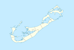
Somerset Island is one of the main islands that make up the country of Bermuda. It is located in the far west of Bermuda. This island covers about 2.84 square kilometers (1.1 square miles).
Contents
What is Somerset Island?
Somerset Island is a big part of the Sandys area. It is the largest island in a group that stretches along the northwest coast of the Great Sound. The small village of Somerset is found in the northern part of the island.
How is Somerset Island Connected?
Somerset Island is connected to other places by bridges. To the northeast, it connects to Boaz Island. To the south, it connects to the main part of Bermuda. This southern connection is made by the famous Somerset Bridge. This bridge is very old and well-known!
Exploring Somerset Island's Geography
The coast of Somerset Island has many interesting bays. One of these is Mangrove Bay in the northeast. Another is Ely's Harbour, a natural harbor in the southwest.
Key Places to See
You can also find Daniel's Head on the island. This is the westernmost point of Somerset Island. Another important spot is the historic Fort Scaur. This old fort is a great place to learn about the island's history.
See also
 In Spanish: Isla Somerset (Bermudas) para niños
 | Misty Copeland |
 | Raven Wilkinson |
 | Debra Austin |
 | Aesha Ash |


