
Southern Red Sea Region facts for kids
Quick facts for kids
Southern Red Sea Zone
Zoba Debubawi Keyih Bahri
ዞባ ደቡባዊ ቀይሕ ባሕሪ منطقة البحر الأحمر الجنوب Regione del Mar Rosso Meridionale
|
|
|---|---|
|
Region
|
|
 |
|

Southern Red Sea Region in Eritrea
|
|
| Country | |
| Capital | Assab |
| Area | |
| • Total | 27,600 km2 (10,700 sq mi) |
| Population | |
| • Total | 398,073 |
| • Density | 14.423/km2 (37.36/sq mi) |
| ISO 3166 code | ER-DK |
The Southern Red Sea Region is one of the six main areas, called regions, in the country of Eritrea. Its capital city is Assab. This region is known for its long coastline along the Red Sea.
Geography of the Region
The Southern Red Sea Region stretches for about 500 kilometers (310 miles) along the Red Sea coast. However, it is quite narrow, only around 50 kilometers (31 miles) wide. A large part of this region is covered by the Danakil Desert. This desert is famous for being one of the hottest places on Earth.
Subregions and Administration
The Southern Red Sea Region is divided into smaller areas called subregions. These help manage the different parts of the region. The three subregions are:
- Are'eta Subregion
- Central Denkalya Subregion
- Southern Denkalya Subregion
Images for kids
-
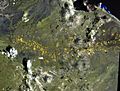
A volcanic field
-
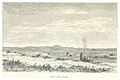
Desert in the region

_p029_JEBEL_ABOU_ASSAB.jpg)
See also
 In Spanish: Región del Mar Rojo Meridional para niños

All content from Kiddle encyclopedia articles (including the article images and facts) can be freely used under Attribution-ShareAlike license, unless stated otherwise. Cite this article:
Southern Red Sea Region Facts for Kids. Kiddle Encyclopedia.