Staines Moor facts for kids
| Site of Special Scientific Interest | |

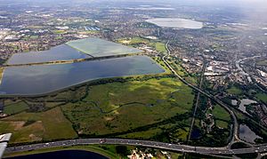
Staines Moor in foreground with King George VI and Staines reservoirs behind.
|
|
| Area of Search | Surrey |
|---|---|
| Interest | Biological |
| Area | 510.8 hectares (1,262 acres) |
| Notification | 1984 |
| Location map | Magic Map |
Staines Moor is a very special natural area located north of Staines-upon-Thames in Surrey. It covers about 510.8-hectare (1,262-acre) of land. This area is so important for nature that it's called a Site of Special Scientific Interest (SSSI). It's also part of a bigger protected area known as the South West London Waterbodies, which is recognized internationally as a Ramsar site and a Special Protection Area.
Exploring Staines Moor
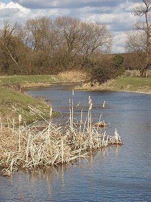
Staines Moor is made up of flood meadows. These are grassy fields that sometimes get covered by water from a river. It also includes the King George VI Reservoir and the Staines Reservoirs. A part of the River Colne flows through it.
The moor has very rich soil called alluvial soil. This soil is thick and naturally fertile. It's much better for growing grass than other areas nearby. Because of this, the land is mostly used for grazing animals. Even though it's called a "moor," it's more like a "mead" or a meadow. A moor usually means stony, infertile land.
The King George VI Reservoir is part of the Staines Moor SSSI. Many important birds spend their winters here. These include tufted ducks, pochard, goosander, and common goldeneye. The moor is next to the Wraysbury Reservoir on one side. The M25 highway runs between them. There's also an old viaduct that used to be a railway line.
A Look Back: History of Staines Moor
Staines Moor has been common land since the year 1065. This means that local people have shared rights to use it. If you own grazing animals and register them, you can let them feed on the moor. In the past, people could usually graze one horse and two cattle.
The land of the moor has changed over time. More than half of its 500 acres (2.0 km2) has become water. This happened when the King George VI Reservoir was built. The reservoir, including its large banks, covers about 350 acres (1.4 km2). Some smaller parts of the moor were also lost. This was due to the building of the M25 and the A30 highway.
Nearby fields were once part of an "open field system." This was a way of farming where fields were not fenced off. These fields were later privatized, meaning they became owned by individuals. However, Staines Moor itself has always remained common land. It is the only large green space like this left in the local area.
In the 1800s, a rifle range was set up on the moor. It was later moved in 1891 and stopped being used by 1933.
 | Sharif Bey |
 | Hale Woodruff |
 | Richmond Barthé |
 | Purvis Young |


