Staines-upon-Thames facts for kids
Quick facts for kids Staines-upon-Thames |
|
|---|---|
| Market town | |
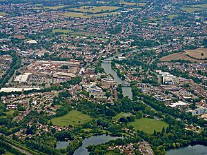 Staines-upon-Thames (left) and Egham Hythe (right) viewed from the north west |
|
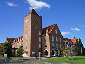
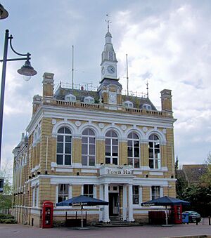 Town Hall, Market Square |
|
| Area | 7.86 km2 (3.03 sq mi) |
| Population | 18,484 (2011 Census, traditional boundaries) or 25,736 (Built-up Area, which includes Laleham) |
| • Density | 2,352/km2 (6,090/sq mi) |
| OS grid reference | TQ036716 |
| • London | 28 km (17 mi) ENE |
| District |
|
| Shire county | |
| Region | |
| Country | England |
| Sovereign state | United Kingdom |
| Post town | Staines-Upon-Thames |
| Postcode district | TW18-19 |
| Dialling code | 01784 |
| Police | Surrey |
| Fire | Surrey |
| Ambulance | South East Coast |
| EU Parliament | South East England |
| UK Parliament |
|
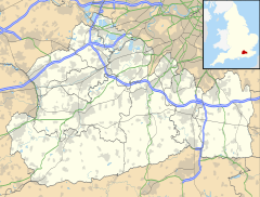
Staines-upon-Thames, often called Staines, is a historic market town in northwest Surrey, England. It is about 28 kilometers (17.25 miles) west of central London. The town is located where the River Thames and River Colne meet. Staines used to be part of Middlesex but became part of Surrey in 1965. It is also close to Heathrow Airport and has good connections to major roads like the M25 and M3.
People have lived in the Staines area since the Paleolithic (Stone Age). During the Neolithic period, there was a special circular area called a causewayed enclosure on Staines Moor. The first bridge over the Thames here was likely built by the Romans. A settlement grew near the modern High Street by the end of the 1st century CE. For many years in the Middle Ages, Staines was mainly a farming town owned by Westminster Abbey. The first official record of a market is from 1218, but markets might have happened even earlier, during the Anglo-Saxon period.
Staines started to become an industrial town in the mid-1600s when Thomas Ashby opened a brewery. Better transport, like new roads and the railway, helped the town grow in the mid-1800s. The current Staines Bridge, designed by George Rennie, was opened in 1832 by William IV. The first railway line arrived in Staines in 1848. The town also became famous for making linoleum starting in 1864, when Frederick Walton built a factory there.
Towards the end of the 1900s, Staines became known as the home of the funny TV character Ali G. Some local people felt this hurt the town's image. However, Sacha Baron Cohen, who created Ali G, actually said Staines was a "lovely, leafy, middle-class suburb... where swans swim under the beautiful bridge." Partly because of this, the local council decided in 2011 to add "upon-Thames" to the town's name.
Contents
- Understanding the Name of Staines
- Exploring Staines-upon-Thames
- History of Staines
- People and Homes
- Public Services
- Getting Around Staines
- Learning in Staines
- Places of Worship
- Culture in Staines
- Sports and Recreation
- Famous Buildings and Landmarks
- Parks and Green Spaces
- Notable People from Staines
- See also
Understanding the Name of Staines
The oldest document mentioning Staines is from the early 200s AD. It calls the place Pontibus, which means "at the bridges." Later, in 1066, it was called Stana and Stane. In the Domesday Book of 1086, it was Stanes. The name comes from an old English word, stān, meaning "stone." This might refer to a Roman milestone (a stone marker for distances) that was on the old London to Silchester road.
To make the town sound more connected to its river and to move away from the Ali G image, the Spelthorne Borough Council voted in 2011 to change the name to "Staines-upon-Thames." The official ceremony happened on May 20, 2012. The Royal Mail started using the new name in mid-2013.
Exploring Staines-upon-Thames
Where is Staines-upon-Thames?
Staines-upon-Thames is in northwest Surrey, about 28 kilometers (17.25 miles) from central London. It is close to the borders of Berkshire and Greater London. Major roads like the M25 and M3 connect to the town. Egham Hythe, also in Surrey, is on the south side of the Thames and is linked to Staines by Staines Bridge.
The center of Staines is near where the River Colne flows into the Thames. A old millstream called Sweeps Ditch used to run east of the High Street. Most of it is now underground. Staines has experienced big floods in the past, including in 1894, 1947, and 2014.
Land and Geology
Much of Staines is built on "gravel islands" that are slightly higher than the low-lying floodplains of the Thames and Colne rivers. These gravel areas are usually about 14 meters (46 feet) above sea level. The High Street in Staines runs across one of these islands. This area was the heart of the Roman town. St Mary's Church, on "Binbury island," was likely important in the late-Saxon period. Some areas were prone to flooding until the early 1800s.
History of Staines
Early Times
The oldest signs of human activity in Staines are from the Paleolithic period. Tools made of flint and bones of reindeer and horses have been found. During the Mesolithic period, the area was probably covered in thick pine and birch forests. A Neolithic causewayed enclosure was found west of St Mary's Church. This site had two circular ditches and was about 16 meters (52 feet) above sea level. Pottery pieces and tools were found there, along with human bone fragments.
Pottery from the Bronze Age shows that people lived in the Staines area then. A roundhouse from this time was found in Laleham. Two circular ditches, one with a burial, were found at Knowle Green in 2021. A Bronze Age field system was also used during the Iron Age. Because Staines is on a low floodplain, many older archaeological finds might have been washed away by floods.
Roman and Saxon Periods
A Roman road from London to Silchester crossed the Thames near Staines. The Thames and Colne rivers likely had many small channels back then, meaning more than one bridge might have been needed. A Roman settlement grew near the modern High Street. The earliest evidence of this settlement is from 54–96 AD.
By the mid-100s AD, Staines was growing. Early Roman-British roundhouses were replaced by stone buildings. Pieces of painted walls and mosaic floors have been found, showing that some buildings were quite fancy. A special stamp found suggests a healer lived in the town. Staines became less important by the late 100s AD, possibly due to more winter floods. However, Roman-British people still lived there until the early 300s AD.
After the end of Roman rule in Britain, the main settlement in Staines seems to have moved from the High Street to the area around St Mary's Church. Finds like pottery suggest a permanent settlement here by the mid-Saxon period. There might have been a marketplace near Church Street. Staines might have been a fortified town called a burh with an important church. A Saxon burial site with many skeletons suggests the town was also a center for justice.
For much of the early Saxon period, the Thames at Staines was the border between Middlesex (north) and Surrey (south). In the 800s, Danish Vikings used the river to travel into England. In 993, the Norwegian King, Olaf Tryggvason, sailed up the Thames to Staines with 93 ships. In 1009, a large Viking army attacked Oxford and retreated, crossing the river at Staines.
Town Management and Growth
Between 1042 and 1052, Edward the Confessor gave Staines to Westminster Abbey. It stayed with the Abbey until the Reformation. In 1086, the Domesday Book recorded Staines as having land for 24 ploughs, six mills, and woodland. It brought in a good income for the Abbey. Staines was like a "home farm" for the abbot. Records from the 1200s show a market was active by 1218, and 46 burgesses (town citizens) lived there, showing Staines was an important local center.
After the Abbey was dissolved in 1540, Staines became property of the King, Henry VIII. This helped him expand his Windsor hunting grounds. Later, in 1613, King James I gave the manor to Thomas Knyvet, who had arrested Guy Fawkes.
Local government changed over time. In the 1800s, new systems emerged. The Poor Law Amendment Act 1834 changed how help for the poor was managed. In 1885, a local school board was set up. In 1895, the Staines Urban District Council (UDC) was created to manage the town.
More changes happened in the 1900s. In 1965, Staines moved from Middlesex into Surrey. Then, in 1974, the Staines UDC merged with the Sunbury-on-Thames UDC to form the Borough of Spelthorne.
Staines Bridge History

The first mention of a bridge in the medieval period is from 1222, when repairs were allowed using wood from Windsor Forest. In the 1200s, a raised road was built at Egham Hythe to improve access to the bridge. Money from tolls (fees) on boats also helped pay for bridge upkeep.
The bridge was destroyed during the English Civil War and rebuilt in the 1680s. In 1734, an Act of Parliament said the bridge was "ruinous and dangerous." In the late 1700s and early 1800s, four attempts were made to build a new bridge. The first, in 1796, closed after two years due to cracks. A cast-iron one in 1803 also cracked quickly. A third, made of timber and iron, was costly to maintain.
A new Act of Parliament in 1828 allowed for a fourth bridge. This granite bridge was designed by George Rennie, similar to Waterloo Bridge. Rennie moved the bridge upstream to build stronger foundations. This meant new approach roads had to be built. The bridge was opened by William IV in April 1832. Tolls for crossing the bridge ended in 1871.
Transport and Travel
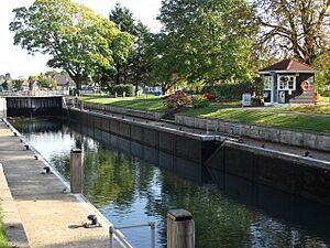
The first locks on the upper Thames were built in the 1600s. However, improvements near Staines didn't start until the 1800s. The pound lock at Penton Hook, downstream of Staines, was built in 1815. Bell Weir Lock, upstream, opened in 1818. These locks helped control the river's flow, making it deeper for boats and providing water power for mills.
For a thousand years after the Roman period, there were few improvements to local roads. In 1727, a turnpike road (a toll road) from Hounslow to Bagshot opened, crossing Staines Bridge. Another turnpike from Staines to Kingston opened in 1773. When the bridge was moved in the 1830s, the road network changed, and Clarence Street was built to direct traffic to the new bridge.
The railway line through Staines opened on August 22, 1848. In 1856, Staines became a junction when a line to Ascot opened. A second station, Staines High Street station, was open from 1884 to 1916. The railway line to Windsor was electrified in 1930.
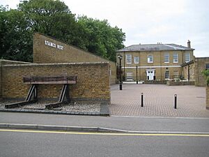
A third station, Staines West, opened on November 2, 1885. This was the end point of a single-track line from the Great Western Main Line. The freight yard closed in the 1950s, and passenger services stopped in March 1965.
In the second half of the 1900s, major road improvements happened around Staines. The A30 bypass was built in the early 1960s, including Runnymede Bridge over the Thames. A second bridge was needed for the M25. The M25 section north of Staines opened in November 1981.
On June 18, 1972, a plane crashed shortly after takeoff from Heathrow Airport near Staines. All 118 people on board died. Two memorials were dedicated on June 18, 2004. One is a stained-glass window in St Mary's Church, where a yearly service is held. The second is a garden near the accident site.
Shops and Businesses
The first record of a market in Staines is from 1218. It stopped for a while but was restarted in 1872 when the Town Hall was built. Today, the market is held in the High Street on Wednesdays, Fridays, and Saturdays. An annual fair was granted to Westminster Abbey in 1228. By 1792, there were two one-day fairs each year. These fairs were stopped in 1896.
The Domesday Book mentions six mills in Staines in 1086. One mill, Pound Mill, was used for grinding mustard in the early 1800s, which is why there's a "Mustard Mill Road." Hale Mill, on the River Colne, was rebuilt in 1388. Many mills were bought by Thomas Ashby in the 1700s, who started a brewery. This brewery became a big employer in the town. Brewing stopped in the 1950s.
Staines became a center for linoleum making in 1864 when Frederick Walton opened the first factory on the Hale Mill site. In the 1920s, the factory covered 20 hectares (50 acres). After World War II, linoleum sales dropped as vinyl flooring became popular. The Staines lino factory closed in 1973.
The Elmsleigh Shopping Centre opened in 1980, offering a large retail space. Much of the High Street became a pedestrian area in 2002. The Two Rivers Shopping Centre, built on the old linoleum factory site, also opened in 2002.
Today, Staines' closeness to London, Heathrow Airport, and the M25 motorway has attracted big company offices. These include Bupa (healthcare), Wood plc (oil & gas), Siemens Building Automation, and British Gas. Samsung's UK research and development division is also based here.
Homes and Development
Modern Staines seems to have started in the late 1100s, with the area around the High Street being a planned town. The town's layout didn't change much until the bridge was moved in the 1830s.
The population of Staines grew a lot in the 1800s, from 1,750 in 1801 to 4,638 in 1881. The arrival of the railway in 1848 helped this growth. New homes for workers were built along London and Kingston Roads. More homes were built in the 1930s and after World War II, especially for workers at the growing Heathrow Airport.
Staines in World War II
Even though it was near London and had important targets like the bridge and factories, Staines didn't suffer much bomb damage during World War II. There was a big bombing raid on August 24–25, 1940. A V-1 flying bomb landed on June 19, 1944, killing four people. In total, 71 civilians in the Staines area died from enemy attacks. Factories like Lagonda and the linoleum factory were used to make military supplies.
Much effort was put into defending Staines Bridge. Tank traps were put at each end. A temporary Bailey bridge was built across the Thames in case the main bridge was damaged. This temporary bridge was used by pedestrians until 1959.
People and Homes
| Output area | Population | Households | % Owned outright | % Owned with a loan | hectares |
|---|---|---|---|---|---|
| Staines (ward) | 7,861 | 3,528 | 24.0% | 33.8% | 550 |
| Staines South (ward) | 7,123 | 2,899 | 29.9% | 37.7% | 131 |
| Spelthorne 009B (riverside north) | 1,818 | 862 | 37.6% | 37.5% | 35 |
| Spelthorne 009C (riverside south) | 1,662 | 723 | 51.5% | 39.1% | 70 |
| Regional average | 35.1% | 32.5% |
| Output area | Detached | Semi-detached | Terraced | Flats and apartments | Caravans/temporary/mobile homes | shared between households |
|---|---|---|---|---|---|---|
| Staines (ward) | 387 | 844 | 843 | 1,439 | 2 | 13 |
| Staines South (ward) | 197 | 1,505 | 702 | 492 | 1 | 2 |
| Spelthorne 009B (riverside north) | 174 | 225 | 93 | 365 | 0 | 5 |
| Spelthorne 009C (riverside south) | 369 | 96 | 109 | 148 | 1 | 0 |
In the South East Region, 28% of homes were detached houses and 22.6% were apartments.
Public Services
Utilities for the Town
The first drinking water for Staines came from the West Surrey Water Company, which built its works in Egham in 1889. Today, Affinity Water supplies drinking water to the town.
Until the early 1900s, wastewater from Staines went straight into the River Thames. A sewerage system started being built in 1899. The local works closed in 1936, and Staines' sewers were connected to a larger system in Isleworth.
The Staines and Egham Gas Light and Coke Company started in 1834. It began supplying gas to streetlamps on Staines Bridge in February 1834. A large gas holder was built in Staines in 1927 but was taken down in 1986.
The first electricity generating station for Staines opened in Egham in 1905. It closed in 1912 and was replaced by a new one in Egham Hythe, which operated until 1924.
Emergency Services and Justice
The earliest record of a fire-fighting team in Staines is from 1738, when a hand-operated fire pump was bought. In 1800, a new manual fire engine was purchased. The Staines UDC bought the first diesel engine for the brigade in 1926. In 1948, Middlesex County Council took over fire services. Today, Surrey Police is the local police force.
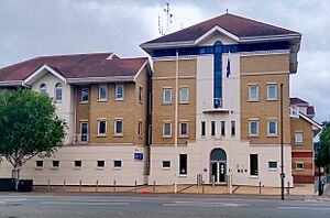
The first record of a town gaol (jail) in Staines is from 1274. There were also stocks in the Market Square until at least 1790. The town Constable was appointed by the local church until 1840, when the Metropolitan Police took over law enforcement. The police station moved several times, with the current one on Kingston Road opening in 1998.
The magistrates' courts at Knowle Green opened in 1976.
Healthcare in Staines
Staines Cottage Hospital opened on May 19, 1914. It was renamed Staines Hospital in 1933 but became less important after Ashford Hospital opened in 1939. It closed in the early 1980s. The Kingscroft respite service for adults with learning difficulties opened on the site in 1987.
The closest hospital with an A&E (Accident and Emergency) is St Peter's Hospital, about 6.3 kilometers (3.9 miles) from Staines-upon-Thames. In 2022, Staines has GP (General Practitioner) practices at Burgess Way, Knowle Green, and Rochester Road.
Getting Around Staines
Bus Travel
Staines has many bus routes connecting it to nearby towns and villages in north Surrey, southwest London (including Heathrow Airport), and east Berkshire. The bus station is south of the Elmsleigh Centre.
Train Travel
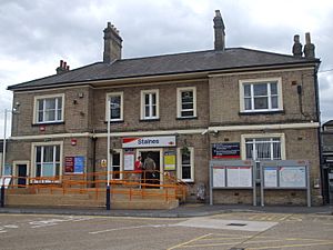
Staines railway station is east of the town center. South Western Railway manages the station and runs all services. Trains go to London Waterloo, to Reading via Ascot, and to Windsor and Eton Riverside.
The non-tidal part of the River Thames can be navigated by boats between Lechlade and Teddington Lock. The Environment Agency is in charge of managing river navigation.
Cycling and Walking Routes
National Cycle Route 4, which connects London to Fishguard, goes through Staines. The Thames Path, a long-distance walking route, crosses Staines Bridge.
Learning in Staines
Early Schools
The first record of a schoolmaster in Staines is from 1353. By the 1700s, there wasn't a dedicated teacher. In 1795, the parish clerk taught four children. The British Boys' School in Staines was founded in 1808, and a girls' school existed by 1832. An infants' school started in 1833. Many schools moved to new buildings over the years. The 1867 schoolhouse on Thames Street still exists behind shops.
Local Schools Today
Riverbridge Primary School was formed in September 2011 by merging three older schools. The oldest, Shortwood Infant School, opened in 1905. Knowle Park School opened in 1974, and Kingscroft Junior School opened in 1992. Riverbridge Primary School used to operate on three sites but now uses two.
Our Lady of the Rosary Catholic Primary School was founded in 1893.
Construction of the Matthew Arnold School began in 1939 but stopped during World War II. Parts of the building were used by students whose classrooms were bombed. The school officially opened in 1954.
Independent School
Staines Preparatory School was founded in 1935. It moved to new premises and expanded over the years. Today, Staines Prep School teaches boys and girls aged 3 to 11.
Places of Worship
St Mary's Church
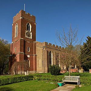
St Mary's Church is first mentioned in 1179, but it might be even older. It was mainly built of brick in the Gothic style, and the tower was added in 1631.
The church fell into disrepair in the late 1600s and 1700s. The north side collapsed in 1827, and a new church was built in 1828–29, keeping the 1600s tower. Among the stained glass windows is one given by the Crown Prince and Crown Princess of Prussia. In 2005, a window was dedicated to those who died in the 1972 Staines air disaster.
St Peter's Church
St Peter's Church started as a smaller church linked to St Mary's in 1874. A brick building was used until 1885, then a temporary "iron church."
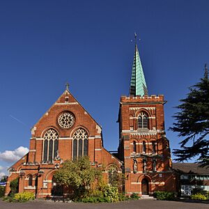
The foundation stone for the current St Peter's Church was laid on July 22, 1893. It was designed by George Fellowes Prynne in the free Perpendicular style. The church has a crenellated tower with a spire and eight bells.
Christ Church
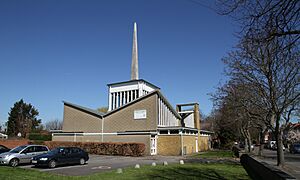
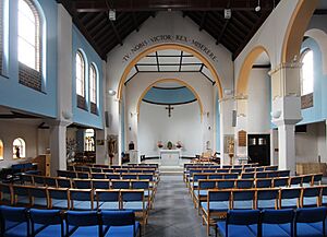
The first Christ Church was built in 1935 to serve new homes. The brick building could hold 280 people. A new Christ Church was built on the same site and opened in October 1962. It has a central altar under a square lantern that lets in natural light. The font dates from 1750 and was previously in St Mary's Church.
Staines Methodist Church
John Wesley first visited Staines in 1771. By the early 1800s, there was a small group of Methodists. Their first chapel opened around 1845. A larger building replaced it in 1865. The congregation moved to the current church on Thames Street in 1987.
Our Lady of the Rosary
The first Roman Catholic Mass in Staines since the Reformation was held in 1862. A chapel opened in 1890. The current church was extended in 1931. Renovation work in 1990 added more aisles and a new church hall.
Staines Congregational Church
There have been many Dissenters (Protestants who separated from the Church of England) in Staines since the mid-1600s. By 1690, they had a permanent meeting house. A chapel was built in Thames Street in 1802. The current Congregational Church, on Kingston Road, opened in May 1956.
Culture in Staines
Art and Creativity
Many artists have painted Staines Bridge, including William Bernard Cooke and Arthur Melville. An engraving of the bridge is held by the Victoria and Albert Museum.
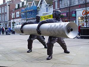
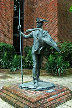
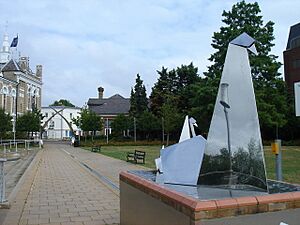
Public art in Staines includes mosaics by Gary Drostle and sculptures by Terence Clarke that show the town's Roman history. The Two Rivers shopping center has two bronze sculptures by David Backhouse: Time Continuum celebrates Staines' history, and Water Sprites refers to the nearby rivers. The Swanmaster, a sculpture by Diana Thomson, was moved to the Memorial Gardens in 2014.
Film and Television
Staines is the hometown of the fictional character Ali G, created by Sacha Baron Cohen. Ali G first appeared on TV in 1998. Baron Cohen said Ali G "believes that he is a black hip-hop artist from Staines. He believes his neighbourhood is a rough ghetto, when in fact it's this lovely, leafy, middle-class suburb." Ali G also appeared in the 2002 film Ali G Indahouse, where his hometown is threatened by Heathrow Airport's expansion. The film ends with Staines being saved.
Literature and Books
William Shakespeare mentions Staines in his play Henry V. Chapters 9–11 of Three Men in a Boat (1889) by Jerome K. Jerome are set in the Staines area. In H. G. Wells' novel The War of the Worlds (1897), an army unit fights a Martian near Staines. In John Wyndham's novel The Kraken Wakes (1953), characters are stopped in the "Staines-Weybridge area" while trying to escape a flooded England.
Music Scene
The indie rock band Hard-Fi formed in Staines in 2003. Many songs from their first album, Stars of CCTV, talk about their small-town suburban beginnings.
Sports and Recreation
Leisure Centre
Spelthorne Leisure Centre, at Knowle Green, opened in 1990. A new leisure center is expected to open in 2024, with a 25-meter pool, a fitness area, and three artificial football pitches on its roof.
Football (Soccer)
Staines Town F.C. (STFC) started from a football team in 1878. STFC itself was founded in 1892. The club played its home games at Wheatsheaf Park. In March 2022, the club announced it was stopping football operations due to a dispute.
Staines Lammas F.C. was founded in 1926. The club moved to Laleham Recreation Ground in the 1980s and opened a new pavilion in 2001.
Cricket
Cricket has been played on Staines Moor since at least 1759. Laleham Cricket Club was founded over 200 years ago. It changed its name to Staines and Laleham Cricket Club in the 1970s and moved to its current ground, "The Faulkners," on Worple Road.
Hockey
Staines Hockey Club was formed in 1890 and is one of the oldest hockey clubs in the world. The club has been based at Worple Road since 1972 and has four full-size hockey pitches. The first ladies' team was formed in 1979.
Rugby
Staines Rugby Football Club was founded in 1926. In 1947, the club started renting pitches at the Laleham Cricket Club ground. It bought land for its current premises, "The Reeves," in 1962, which opened in September 1964.
Rowing
Staines Boat Club was formed in 1851. The current boathouse, at Egham Hythe, is a temporary building from 1950, built after the previous one burned down.
Staines Stadium
Staines Stadium, on Wraysbury Road, opened in 1928 and was mainly used for greyhound racing. In 1936, Cheetahs were even trained to race there! Stock car racing also took place in the late 1950s. The stadium closed in 1960 and was taken down in 1965 because the A30 Staines bypass was built through part of the site.
Famous Buildings and Landmarks
Blue Anchor Inn
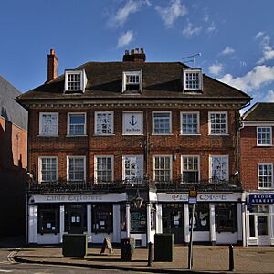
There has probably been an inn on the site of the Blue Anchor since the 1500s. The current building is from the early to mid-1700s and is made of brick. Much of the inside is thought to be original. During renovations in 1957, an oak beam was found to be 650 years old.
Coal Tax Posts
There are three coal-tax posts left in the Staines area. These posts marked the limits where a tax on coal was collected by the Corporation of the City of London. Two posts on Wraysbury Road were moved to their current spots in the late 1900s. The third is a 3-meter (10-foot) tall cast-iron monument on Thames Street.
London Stone
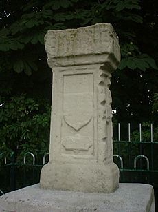
The London Stone is a carved stone pillar next to the River Thames. The first stone was put up by the Corporation of the City of London in 1280 or 1285. It marked the western edge of their control over the river and showed the tidal limit of the Thames in medieval times. It was moved to its current spot in the 1600s or 1700s and replaced by a copy in 1986. The original stone is now at the Spelthorne Museum.
Reservoirs

The two Staines Reservoirs, northeast of the town, were finished in 1902. They hold a lot of water. During World War II, the No. 617 Squadron RAF used them to practice aiming bouncing bombs for Operation Chastise.
The King George VI Reservoir was finished in 1939 but was left empty during World War II. It was used by the Royal Air Force for fog dispersal experiments in 1942. It was finally opened by King George VI in November 1947.
Town Hall
The Town Hall, in the Market Square, was designed by John Johnson and finished in 1880. It replaced an older medieval market hall. The building is made of white brick with stone details.
The Town Hall was used as the council's main office until 1976. In the early 1990s, it was an arts center. In 2004, it became a wine bar. In January 2018, the building was turned into thirteen apartments.
War Memorial
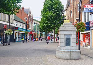
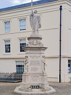
The Staines War Memorial was designed by E. J. Barrett and put in the Memorial Gardens in 1920. It is a statue of the winged figure of Victory made of Portland stone. The names of 196 men who died in World War I are on the base, and those who died in World War II are listed below. The memorial was moved to the Market Square in 2002.
Parks and Green Spaces
Church Lammas
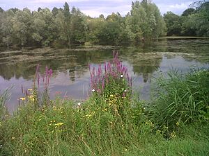
Church Lammas is an 8.8 hectare (22 acre) area of common land northeast of the town center. Between 1988 and 1996, it was a quarry. After gravel and sand were removed, the area was turned into a park with three lakes.
Lammas Recreation Ground
The 15 acre (6 hectare) Lammas lands were given to the town in 1922 and opened as a recreation ground that same year.
Market Square and Memorial Gardens
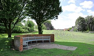
The Memorial Gardens, next to the River Thames, first opened in 1897 as the "Town Gardens." They got their current name after World War I when the war memorial was placed there. In 2002, the Market Square was updated, and new "Swan Arches" were installed at the entrances to the Memorial Gardens.
Staines Moor
Staines Moor, north of the town, is a very large area of common land, about 511 hectares (1,263 acres). Until 1965, any homeowner whose chimney smoke could be seen from St Mary's Church could graze their animals on the moor.
Staines Moor is the largest area of alluvial meadow in Surrey. It was named a Site of Special Scientific Interest in 1984 because of its rare plants like brown sedge and upright chickweed. It is also home to many invertebrates like bees and butterflies, and over 190 species of bird have been seen there.
Staines Park
Staines Park at Knowle Green is a 4.7 hectare (12 acre) recreation ground. It has tennis courts, a bowling green, and a children's playground. Since 2019, the park has been legally protected by the charity Fields in Trust.
Notable People from Staines
- All Alone (pigeon) – an important war pigeon.
- Charles Wellington Furse (1868–1904) – a portrait painter, born in Staines.
- Geoffrey Molyneux Palmer (1882–1957) – a composer, born in Staines.
- Norman Hunter (1899–1995) – a children's author, lived on a houseboat in Staines after retiring.
- Danny Blanchflower (1926–1993) – captain of Tottenham Hotspur F.C., died in Staines.
- B. H. Barry (born 1940) – a fight director, born in Staines.
- Steve Holley (born 1954) – a musician, lived in Staines.
- Bobby Davro (born 1958) – a comedian, lived in Staines.
- Nina Wadia (born 1968) – an actress, lived in Staines.
- Jon Tickle (born 1974) – a television personality, lived and worked in Staines.
- Dan Jones (born 1981) – a historian, author, and TV presenter, lives in Staines.
See also
 In Spanish: Staines-upon-Thames para niños
 | Janet Taylor Pickett |
 | Synthia Saint James |
 | Howardena Pindell |
 | Faith Ringgold |


