Penton Hook Lock facts for kids

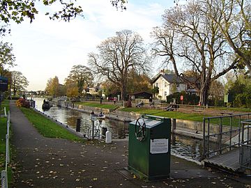
Penton Hook Lock with the lock-keeper's house
|
|
| Waterway | River Thames |
|---|---|
| County | Surrey (historically Middlesex, locally) |
| Maintained by | Environment Agency |
| Operation | Hydraulic |
| First built | 1815 |
| Latest built | 1909 |
| Length | 81.28 m (266 ft 8 in) |
| Width | 7.56 m (24 ft 10 in) |
| Fall | 1.22 m (4 ft 0 in) |
| Above sea level | 41 feet (12 m) |
| Distance to Teddington Lock |
14 miles (23 km) |
| Power is available out of hours | |
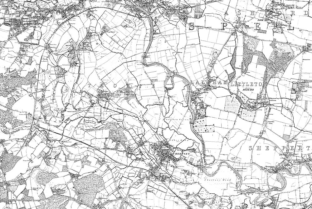
Penton Hook Lock is a special gate system on the River Thames in England. It's the sixth lock you'd find if you were traveling upstream from the sea. This lock is built next to an island called Penton Hook Island. Long ago, this area was a big bend in the river that sometimes got cut off by floods.
The lock helps boats pass safely and controls the river's flow. It's also right on the old border between the towns of Laleham and Staines-upon-Thames in Surrey. For many years, this area was part of Middlesex county. At 266 ft (81 m), it is the third longest lock on the entire river.
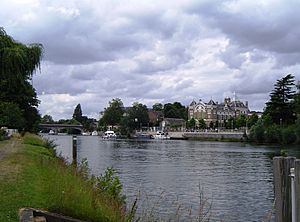
About 900 meters upstream from the lock, there's a bend called Silvery Sands. This is where the Staines Regatta takes place every year. It's a fun rowing competition! On the other side of the river in Thorpe, Surrey, you'll find Penton Hook Marina. This marina is built on lakes that were once pits where gravel was dug out of the ground.
Contents
History of Penton Hook Lock
For a long time, floods caused problems here. The river would sometimes cut across the narrow neck of the big bend, causing erosion and making it hard for boats to pass. To fix this, the City of London Corporation decided to fund a new lock and special dams called weirs.
Parliament passed a law in 1814 to allow this project. The lock was finished in 1815. It was the farthest upstream lock on the Thames that the City of London Corporation controlled. You can even see their special crest on the Lock Cottage, which was built in 1814. Penton Hook Lock quickly became the sixth lock as you travel upstream, and it still is today.
The main weir was built in 1846. It was placed below where the Abbey River splits off. The Abbey River is an old channel that used to power watermills. These mills were important for grinding grain.
Over time, the mills became less important. Farmers in the area also wanted less water flowing into the Abbey River to prevent flooding their fields. So, the start of the Abbey River was moved to below the main weir of Penton Hook. This helped reduce flooding along the Abbey River.
Today, the Environment Agency is looking at building new channels below this lock and the next one. These channels would help move floodwaters away, much like the Jubilee River does upstream. This helps protect towns from flooding. The lock itself was rebuilt in 1909 to make it stronger and more modern.
Getting to Penton Hook Lock
You can reach Penton Hook Lock by walking or cycling. There's a special path called a towpath that leads to it. You can get onto the towpath from Blacksmiths Lane, Riverside, or Penton Hook Road.
The lock is on the left bank of the river. This side has been the border between the church parishes of Laleham and Staines-upon-Thames in Surrey for many centuries. This border has been in place since at least the Norman Conquest. If you're coming by boat, you can access the lock from Thorpe, Surrey on the right bank.
The River Above the Lock

After the lock, the river flows through areas with many buildings on both sides as it passes through Staines-upon-Thames. On the near bank, there was a "bungalow town" called Penton Hook or South Staines by 1919.
Between the Staines Railway Bridge and Staines Bridge, there's an open area by the river with pubs. Here, two branches of the River Colne join the Thames. One branch is in the town center, and the other is called Sweeps Ditch.
Further upstream on the left bank, you'll see a copy of the London Stone. This stone was placed here in 1285 to mark the highest point where the tide reached on the Thames. It also showed the area that the City of London controlled. Near it are Church Island and a recreation area.
Even further upstream are Hollyhock Island and its small wooded island, Holm Island. The right bank used to be an industrial area with gas works and water works. Now, it has been redeveloped into business and shopping areas. A wide bridge designed by Edwin Lutyens carries the M25 motorway and the A30 road across the river.
Below the town's rowing club, on the Egham side, the Staines Regatta takes place. This happens at Silvery Sands, about 900 meters above the lock, usually in July.
The Thames Path
The Thames Path is a long-distance walking trail that follows the River Thames. From Bell Weir Lock, the path is on the right bank (which is the side on your right if you're looking downstream). When it reaches Staines Bridge, the path crosses over to the left bank.
 | Madam C. J. Walker |
 | Janet Emerson Bashen |
 | Annie Turnbo Malone |
 | Maggie L. Walker |


