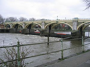
Locks and weirs on the River Thames facts for kids
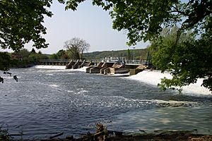
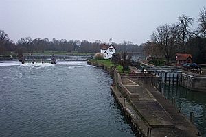
The River Thames in England is a famous waterway. You can travel on it by boat from places like Cricklade or Lechlade all the way to the sea! Along its journey, the river drops about 71 meters (234 feet). To help boats move along and to control the water flow, especially during floods, there are 45 special structures called locks and weirs. Each lock usually has one or more weirs next to it.
Contents
River Thames Locks: A Look Back in Time
For a very long time, the Thames had many things blocking it. These were often for catching fish or for powering watermills. Even a document from 1215, called Magna Carta, said that these blockages should be removed. But it seems that didn't really happen!
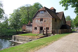
In the Middle Ages, the river's drop was used to power watermills. These mills made things like flour and paper. To make the mills work, people built weirs to send water into them. However, these weirs made it hard for boats to pass. So, to solve this, locks were built next to the weirs. This allowed boats to move between different water levels.
From Flash Locks to Pound Locks
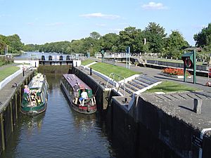
The first locks were called "flash locks." Imagine a part of the weir that could be opened. When a boat wanted to go downstream, the lock would open, and a "flash" of water would carry the boat through. Going upstream, boats had to be pulled or winched through the open lock. This was tricky and wasted a lot of water, which was bad for the mill owners. Because of these problems, flash locks were eventually replaced with "pound locks." These are more like the locks you see today, even though many have been made bigger and use machines now.
Controlling the Tidal River
The lower part of the Thames used to be affected by the tide much further upstream, all the way to Staines. The City of London was in charge of this section. After 1810, more locks were built on the tidal part of the river, up to Teddington. These locks and weirs helped keep the water deep enough for boats and also reduced the risk of flooding.
Who Looked After the River?
Over the years, different groups have been in charge of managing the Thames and building locks. The first was the Oxford-Burcot Commission in 1633. Later, the Thames Navigation Commissioners built many locks between 1770 and 1773. When the Thames and Severn Canal opened in 1789, even more locks were built upstream.
The City of London Corporation built six locks on the tidal section between 1811 and 1815. Then, in 1857, the Thames Conservancy took over managing all the river. They added even more locks, with the last ones built in 1928. In 1908, the Port of London Authority became responsible for the lower part of the Thames, including Richmond Lock. Today, the Environment Agency manages most of the river, while Richmond Lock is still looked after by the Port of London Authority.
How Locks and Weirs Work Today
Who Manages the River?
From Cricklade down to Teddington Lock, the Environment Agency is in charge. They have two main jobs: controlling the water flow to prevent floods and making sure the river is deep enough for boats. They also help people navigate the river safely. This means the Environment Agency owns and runs almost all the locks and weirs, except for Richmond Lock, which is managed by the Port of London Authority.
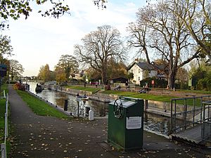
Each lock and weir run by the Environment Agency has a lock keeper. This person usually lives in a house right next to the lock. Their job is to operate the lock for boats and to control the water levels above the lock by adjusting the weir gates.
Using the Locks
Most locks are open and operated by their keepers from 9 a.m. to 7 p.m. during the summer (June to August). The hours get shorter as the days get shorter. Lock keepers also take a lunch break from 1 p.m. to 2 p.m., so the locks are closed then. During busy summer times, extra staff called Assistant Lock Keepers help out to keep things moving.
However, Teddington Lock, which is the last lock before the tidal part of the river, is open 24 hours a day. In winter, some locks might close for maintenance, so it's always good to check with the Environment Agency.
The locks at the very top of the river, from St John's Lock to King's Lock, are operated by hand. All the other locks on the Thames use hydraulic power (machines that use liquid pressure). If a lock keeper isn't on duty, boat crews can still operate most locks using a "public power" system, which lets them use the hydraulic machines at a slower speed. This isn't allowed when it's dark.
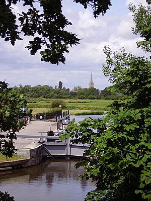
Locks are popular places to visit, and many even sell refreshments. Because locks were often built next to islands, many are in quiet spots and can only be reached by walking.
Understanding Weirs and Water Flow
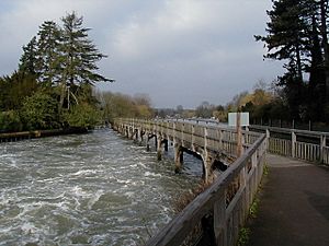
The Environment Agency is also responsible for managing how much water flows along the river. This helps prevent flooding in certain areas and keeps the water deep enough for boats. They control the water's speed and volume by adjusting the gates at each weir.
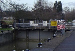
Sometimes, the river can flow very fast, making it dangerous for boats. When this happens, yellow or red warning boards are put up on the lock gates. The Environment Agency also publishes the status of all locks online. While they can't legally stop boats from traveling when red boards are out, it's very risky to continue, and your boat insurance might not cover you.
Sometimes, flooding can't be avoided. The Agency then issues "Flood Warnings" with different levels of seriousness: Flood Alert, Flood Warning, and Severe Flood Warning.
In recent years, groups like the Salmon Conservancy have been adding fish ladders to weirs. These ladders help salmon swim upstream to lay their eggs.
Today, some weirs are also used for fun activities like kayaking and canoeing. You might see people doing whitewater slalom or "playboating" at places like Hambleden Weir and Boulter's Weir, where special changes have been made for these sports.
River Sections (Reaches)
The locks and weirs divide the river into 44 sections, or "lock reaches." Each lock controls the water level in the reach above it. Every reach has its own unique features and interesting places to see.
Many reaches host boat races (regattas) and other events. These are planned by local River User's Groups. The Environment Agency might close part of a reach for an event, but most regattas only need one side of the river, which can then be closed off.
Long ago, boats were pulled by horses along a path on the riverbank. This path is now the basis for the Thames Path, a walking trail that follows the river from its start to its end. The path often runs between locks, making it a main way to access them by land. Where the towpath switched sides of the river, there used to be ferries. Most of these are gone now, so the Thames Path sometimes has to go a long way to the nearest bridge.
List of Locks and Weirs on the Thames
Here is a list of the locks, weirs, and a few remaining ferries, going from the start of the river down to the sea. Many old "flash locks" are gone, and only three ferries are still running (at Weybridge, Hampton, and Hammerton's). Most of the older weirs used to have mills next to them, and some even had special traps called "eel bucks" for catching eels.
| Lock | Date Built | Flash Lock Recorded | Water Drop | Distance to Next Lock Up | Older Weirs in This Section | Ferries |
|---|---|---|---|---|---|---|
| St John's Lock | 1790 | 1775 | 0.85 m (2.8 ft) | |||
| Buscot Lock | 1790 | 1.69 m (5.5 ft) | 1.85 km (1.15 mi) | |||
| Grafton Lock | 1896 | 1762 (Day's/Lower Hart) | 1.11 m (3.6 ft) | 5.37 km (3.34 mi) | Farmer's, Harts | |
| Radcot Lock | 1892 | 1746 (Beck's, Clare's or Buck's) | 1.48 m (4.9 ft) | 2.98 km (1.85 mi) | Old Eye | |
| Rushey Lock | 1790 | 1.82 m (6.0 ft) | 4.23 km (2.63 mi) | Old Nan's | Rushey | |
| Shifford Lock | 1898 | 1762 | 2.23 m (7.3 ft) | 6.92 km (4.30 mi) | Tadpole (Kent), Thames, Ten foot, Shifford Upper, Duxford | Duxford |
| Northmoor Lock | 1896 | (Hart's Weir) | 1.24 m (4.1 ft) | 7.63 km (4.74 mi) | Limbre's | Ridge's (Hart's) |
| Pinkhill Lock | 1791 | Pre-1791 | 1.05 m (3.4 ft) | 6.21 km (3.86 mi) | Ridge's (Langley), Ark, Skinner's | Bablock Hythe |
| Eynsham Lock | 1791 | 0.84 m (2.8 ft) | 2.38 km (1.48 mi) | |||
| King's Lock | 1890? | 1541 | 0.77 m (2.5 ft) | 4.37 km (2.72 mi) | Clay | |
| Godstow Lock | 1790 | 1.57 m (5.2 ft) | 1.81 km (1.12 mi) | |||
| Osney Lock | 1790 | 1227 | 1.89 m (6.2 ft) | 3.87 km (2.40 mi) | Medley (Binsey) | |
| Iffley Lock | by 1632 | 1585 | 0.81 m (2.7 ft) | 3.73 km (2.32 mi) | Folly | Iffley |
| Sandford Lock | 1632 (enlarged 1793) | 2.69 m (8.8 ft) | 2.7 km (1.7 mi) | |||
| Abingdon Lock | 1790 | 1316 | 1.89 m (6.2 ft) | 7.38 km (4.59 mi) | Nuneham | Thrupp |
| Culham Lock | 1638 (moved 1809) | 1580 | 2.41 m (7.9 ft) | 4.15 km (2.58 mi) | Culham old (1638 on Swift ditch), Swift | |
| Clifton Lock | 1812 | 1.03 m (3.4 ft) | 4.52 km (2.81 mi) | Culham | ||
| Day's Lock | 1789 | 1580 | 1.58 m (5.2 ft) | 4.8 km (3.0 mi) | Dorchester, Clifton | |
| Benson Lock | 1788 | 1746 | 1.87 m (6.1 ft) | 6.37 km (3.96 mi) | Shillingford, Keen Edge | |
| Cleeve Lock | 1787 | 1580 | 0.89 m (2.9 ft) | 10.46 km (6.50 mi) | Pollington's, Chalmore Lock, Moulsford (lock) | Leather Bottle, South Stoke, Littlestoke, Chalmore, Benson |
| Goring Lock | 1787 | 1538 | 1.77 m (5.8 ft) | 1 km (0.62 mi) | Streatley | |
| Whitchurch Lock | 1787 | 1580 | 1.01 m (3.3 ft) | 6.55 km (4.07 mi) | Hart's lock | Gatehampton |
| Mapledurham Lock | 1777 | 1300 | 2.05 m (6.7 ft) | 3.67 km (2.28 mi) | ||
| Caversham Lock | 1778 | 1493 | 1.44 m (4.7 ft) | 7.08 km (4.40 mi) | Chawsey | Purley (2) |
| Sonning Lock | 1773 | 1580 | 1.63 m (5.3 ft) | 4.23 km (2.63 mi) | Breach's | |
| Shiplake Lock | 1773 | 1746 | 1.55 m (5.1 ft) | 4.68 km (2.91 mi) | Wargrave, Bolney | |
| Marsh Lock | 1773 | 1580 | 1.33 m (4.4 ft) | 4.8 km (3.0 mi) | Beggar's Hole (Bolney), Lashbrook, Wargrave | |
| Hambleden Lock | 1773 | 1338 | 1.44 m (4.7 ft) | 4.59 km (2.85 mi) | Aston | |
| Hurley Lock | 1773 | 1580 | 1.05 m (3.4 ft) | 5.89 km (3.66 mi) | Mednam | Medmenham |
| Temple Lock | 1773 | 1580 | 1.23 m (4.0 ft) | 1.03 km (0.64 mi) | Temple | |
| Marlow Lock | 1773 | 1585 | 2.16 m (7.1 ft) | 3.13 km (1.94 mi) | ||
| Cookham Lock | 1830 | 1.3 m (4.3 ft) | 6.44 km (4.00 mi) | Cookham Upper, Spade Oak | ||
| Boulter's Lock | 1772 (moved 1828) | 1580 | 2.39 m (7.8 ft) | 3.35 km (2.08 mi) | My Lady, Hedsor | |
| Bray Lock | 1845 | 1328 | 1.46 m (4.8 ft) | 3.43 km (2.13 mi) | ||
| Boveney Lock | 1838 | 1375 | 1.47 m (4.8 ft) | 5.1 km (3.2 mi) | Boveney | |
| Romney Lock | 1797 | 2.01 m (6.6 ft) | 3.75 km (2.33 mi) | Gill's bucks | Windsor | |
| Old Windsor Lock | 1822 | 1300 | 1.74 m (5.7 ft) | 4.83 km (3.00 mi) | Datchet | |
| Bell Weir Lock | 1817 | 1300 | 1.82 m (6.0 ft) | 4.94 km (3.07 mi) | Magna Carta Island | |
| Penton Hook Lock | 1815 | 1.22 m (4.0 ft) | 4.33 km (2.69 mi) | Savory's | Tims', Egham | |
| Chertsey Lock | 1813 | 1.22 m (4.0 ft) | 3.13 km (1.94 mi) | Laleham | ||
| Shepperton Lock | 1813 | 2.03 m (6.7 ft) | 3.32 km (2.06 mi) | |||
| Sunbury Lock | 1812 | 1623 | 1.87 m (6.1 ft) | 4.75 km (2.95 mi) | Ballinger's | Shepperton Church, Weybridge |
| Molesey Lock | 1815 | 1.87 m (6.1 ft) | 4.79 km (2.98 mi) | Hampton | ||
| Teddington Lock | 1811 | 2.68 m (8.8 ft) | 7.74 km (4.81 mi) | Kingston | Surbiton, Ravens Ait, Thames Ditton | |
| Richmond Lock | 1894 | 2 m (6.6 ft) | 4.9 km (3.0 mi) | Hammerton's, Twickenham |
Blake's Lock is on a part of the River Kennet that the Environment Agency also manages as part of the Thames. It's the only manual lock on the Thames below Oxford.
The tide reaches all the way to Teddington Lock. The weir at Richmond Lock is only used when the tide is low, to keep the water level high enough above it.
One lock, Chalmore Lock, built in 1838, was removed in 1883.
 | Aurelia Browder |
 | Nannie Helen Burroughs |
 | Michelle Alexander |


