Clifton Lock facts for kids

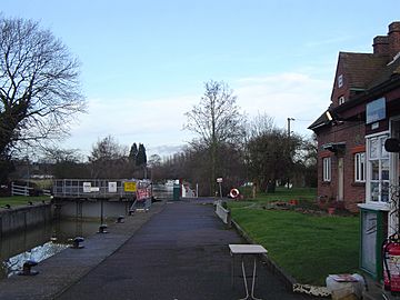
Clifton Lock - gates showing some ambivalence over board status (yellow or red)
|
|
| Waterway | River Thames |
|---|---|
| County | Oxfordshire |
| Maintained by | Environment Agency |
| Operation | Hydraulic |
| First built | 1822 |
| Length | 39.57 m (129 ft 10 in) |
| Width | 5.79 m (19 ft 0 in) |
| Fall | 1.03 m (3 ft 5 in) |
| Above sea level | 153' |
| Distance to Teddington Lock |
79 miles |
Clifton Lock is a special kind of gate system on the River Thames in Oxfordshire, England. It helps boats travel safely along the river. You can find it south of a village called Clifton Hampden and north of Long Wittenham. It's also at the start of the Clifton Cut, which is a man-made channel that helps the river flow smoothly. The lock was finished in 1822 by the Thames Navigation Commissioners.
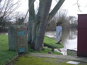
The main weir, which is like a small dam, was built thirteen years after the lock. It stretches across the old path of the river. There's also a smaller weir located just above the lock itself.
Contents
History of Clifton Lock
Why Clifton Lock Was Built
Clifton Lock is unique because it's one of the few places on the non-tidal part of the river that didn't have a weir or a simple "flash lock" before. However, there was an important ferry crossing here. People had known for a long time that it was hard for boats to get through this area. Ideas for building a lock near Clifton Ferry first came up in 1793 and again in 1811.
Building the Lock and Weir
Building the new river channel, called the lock cut, was delayed for a while. This was because of a problem with the land owner. But finally, the lock and the new channel were completed in 1822. At first, no weir was built, which caused some complaints. For example, in 1826, the Lord Mayor of London visited Oxford by boat. His boats were "detained at Clifton a considerable length of time" because of the lack of a proper weir.
The weir was eventually built on the old river path in 1835. After this, the old path used by horses to pull boats (called the towpath) was no longer used. By 1877, the weir was made bigger, and a "tumbling bay" was added near the lock. A tumbling bay is where water flows over a low wall. The bridges over the lock cut were rebuilt in 1884.
How to Get to Clifton Lock
Finding the Lock Access Path
The lock is at the end of a long path. This path starts on the A415 road to Abingdon, just after you leave Clifton Hampden village. You might see signs that say "10 mph." As you go along this path towards the lock, you'll meet another path coming from the end of High Street in Clifton Hampden.
Important Access Information
It's important to know that the status of these paths isn't always clear. Some signs say "Farm only." The path from the A415 to the lock is not a public road. It's usually limited to people who are authorized to be there, like staff working at the lock.
The River Above Clifton Lock
The Clifton Cut and River Flow
The Clifton Cut is the man-made channel that takes boats for almost a mile. After this channel, the river meets its natural course again, flowing past Long Wittenham. This part of the river flows next to farmland. About halfway along, you'll see the Appleford Railway Bridge crossing over the river.
River Paths and Divisions
Just before Sutton Bridge, the river splits again. One part is an old river course, which is now a weirstream, flowing past an old mill at Sutton Courtenay and Sutton Pools. The main navigation path for boats follows the Culham Cut. The river's natural bends have some public walking paths. However, the official Thames Path follows the navigation channel and the northern bank all the way to Culham Lock.
 | Anna J. Cooper |
 | Mary McLeod Bethune |
 | Lillie Mae Bradford |


