Old Windsor Lock facts for kids

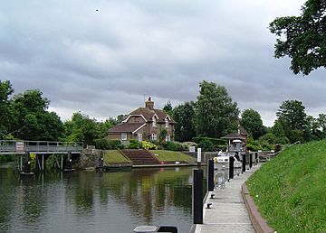
Old Windsor Lock from the upstream side
|
|
| Waterway | River Thames |
|---|---|
| County | Berkshire |
| Maintained by | Environment Agency |
| Operation | Hydraulic |
| First built | 1822 |
| Latest built | 1954 |
| Length | 54.55 m (179 ft 0 in) |
| Width | 7.36 m (24 ft 2 in) |
| Fall | 1.74 m (5 ft 9 in) |
| Above sea level | 53 |
| Distance to Teddington Lock |
20 miles |
| Power is available out of hours | |
Old Windsor Lock is a special gate system on the River Thames in England. It's located on the right side of the river, next to the village of Old Windsor in Berkshire. This lock is important because it marks the start of a new, straighter part of the river called the "New Cut." This shortcut was built in 1822 and helped create an island called Ham Island. The lock also has a wide footbridge that lets people cross over to Ham Island. There are two weirs (small dams) nearby that help control the water level. Old Windsor Lock is the ninth lowest lock out of 45 on the River Thames.
Contents
The Story of Old Windsor Lock
Before the lock was built, this spot was known as "Top of Caps." People first suggested building a lock here way back in 1770.
In 1822, the "lock cut" (the new channel) and the lock itself were built by the Thames Navigation Commissioners. These were people in charge of managing the river. Building this new section made the river much shorter and easier for boats to travel. Instead of a weir, there were "eel bucks" (special traps for catching eels) that helped hold back the water. These were near two small islands, one of which is now called Lion Island.
The first person in charge of the lock had some problems, including damaging the new bridge. Later, in 1836, a proper weir was built. In 1868, there was talk of removing the lock, but instead, it was made bigger. The lock was rebuilt again in 1957, making it more modern.
Getting to Old Windsor Lock
You can reach Old Windsor Lock by following the Thames Path. This path is great for walkers and cyclists and connects to Ham Lane. There's also another footpath that comes from a road leading to The Manor and The Priory.
Exploring the River Upstream
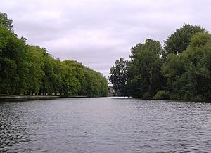
The "New Cut" is about half a mile long. It's crossed by Ham Bridge, which connects the main part of Old Windsor to Ham Island. A smaller island called Lion Island is at the top of the cut, where the river splits.
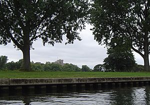
Further upstream, you'll see Albert Bridge, which crosses to Datchet. There's also a thin island called Sumptermead Ait nearby. On the Windsor side (the right bank), the river curves past farmland and the Home Park of Windsor Castle.
Next, you'll find Victoria Bridge, which connects to the upper part of Datchet. After that, there's a golf course, and then the Black Potts Railway Bridge. This railway bridge has a large brick support pillar on Black Potts Ait. Behind this island, the Jubilee River joins back with the Thames. On the left bank, you'll see the playing fields of Eton College.
The area around Black Potts, up to Romney Island, is a popular spot for fishing. Even famous people like Isaak Walton, who wrote a well-known book about fishing, and King Charles II enjoyed fishing here centuries ago.
The Thames Path
The Thames Path for walkers crosses to the other side of the river at Albert Bridge, going through Datchet and Sumptermead. It then crosses back to the right bank using Victoria Bridge. There's a short part of the river near Datchet, opposite Home Park, Windsor, where the path doesn't follow the riverbank.
 | Anna J. Cooper |
 | Mary McLeod Bethune |
 | Lillie Mae Bradford |


