Cookham Lock facts for kids

Cookham Lock, Berkshire
|
|
| Waterway | River Thames |
|---|---|
| County | Berkshire |
| Maintained by | Environment Agency |
| Operation | Hydraulic |
| First built | 1830 |
| Latest built | 1957 |
| Length | 55.77 m (183 ft 0 in) |
| Width | 7.62 m (25 ft 0 in) |
| Fall | 1.30 m (4 ft 3 in) |
| Above sea level | 81' |
| Distance to Teddington Lock |
33 miles |
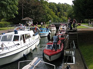
Cookham Lock is a special water gate, called a lock, on the River Thames. It's near Cookham, Berkshire, a bit downstream from Cookham Bridge. The lock is built in a special channel, or "lock cut." This area has four streams and is surrounded by beautiful woods.
On one side of the lock is Sashes Island. On the other side is Mill Island, which is connected to Formosa Island. Formosa Island is the biggest island on the non-tidal part of the Thames!
There are also several weirs nearby. Weirs are like small dams that control the water level. Hedsor weir was built in 1837 across an old boat channel. There's also a lower weir and Odney weir, which is near Formosa Island.
A short distance from the lock is Odney. The Odney Club is located on an ait, which is a small island in a river. You can reach the Odney Club by boat, but the water is very shallow. This makes it hard for boats to get there.
Contents
Cookham Lock: A Look Back in Time
Why Was the Lock Needed?
Before the lock, boats used a different route called Hedsor Water. There was only one weir there, connected to a mill. After Marlow Lock was built in 1773, the water upstream of Cookham became too shallow. People suggested building something at Cookham to hold the water back.
In 1794, this part of the river was very dangerous. Chalk rocks often fell into the Thames. Plans for a new lock and channel were made in 1807. But seven years later, nothing had been done! In 1826, a barge carrying stone crashed and broke in half. This showed how badly a lock was needed.
Building the Lock
Finally, in 1829, everyone agreed to build a new channel and lock. The channel went through an island called The Sashes. Part of it used an existing stream. The lock officially opened on November 1, 1830. Building the lock and channel cost about £8,400. The lock raised the water level by about 2 feet (0.6 m).
When the lock was first built, getting to it was a bit tricky. If you were traveling upstream from Boulter's Lock, you had to use several ferries. These ferries helped people and horses cross the river.
Changes and Updates
In 1832, a local landowner, Baron Boston, received money because the new lock affected his land. In 1837, a weir was built near the lock for £650. This weir doubled the water level change at the lock to about 4 feet (1.2 m).
Lord Boston wasn't happy about the new weir either. He owned a wharf (a place for boats to load and unload) that lost business. As a compromise, a "flash lock" was built in the weir. A flash lock was a simple gate that could be opened to let boats through quickly. This flash lock was removed in 1869 when the main lock was rebuilt.
The Cookham Lock we see today was rebuilt in 1957.
Visiting Cookham Lock
You can reach Cookham Lock by road from Cookham. This road is open to people walking, but a gate stops most cars.
The Thames Path is a long walking trail along the river. It doesn't go directly past the lock. To visit the lock from the Thames Path, you need to walk almost 1 kilometer across Formosa Island and Mill Eyot to Sashes Island. Then you walk back the same way. This is because some old ferries that used to connect the path to the lock no longer run.
The River Above the Lock
Before the river splits into different streams above the lock, it is crossed by Cookham Bridge. Further along the river, on the Buckinghamshire side, is Bourne End. Here, the River Wye joins the Thames. The Bourne End Railway Bridge, which also has a walkway, crosses the river here.
On the Berkshire side, you'll see wide, flat areas called water meadows. There are also special markers near Bourne End Railway Bridge. These "navigation transit markers" help boat users check how fast they are going.
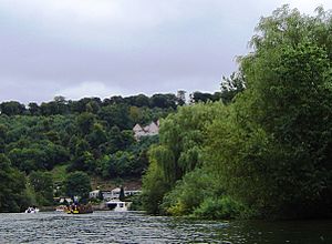
Further upstream, near the Berkshire bank, are the Gibraltar Islands. These islands are in front of Quarry Wood. Then, the hills become steep and hang over the river at Cookham Dean. This is where "The Mount" house is located. The famous author Kenneth Grahame lived there as a child. He used this part of the Thames as inspiration for his classic book, The Wind in the Willows. This area is often called "Wind in the Willows country."
As the land becomes flatter again, the Marlow By-pass Bridge crosses the river. This bridge is a little downstream from Marlow Lock.
Literature and Art
Cookham was the home of the artist Stanley Spencer. One of his famous paintings is called Swan Upping at Cookham.
 | Aaron Henry |
 | T. R. M. Howard |
 | Jesse Jackson |


