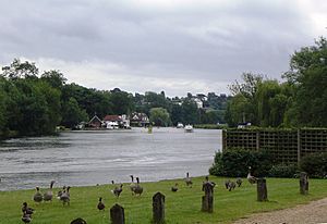
Marsh Lock facts for kids
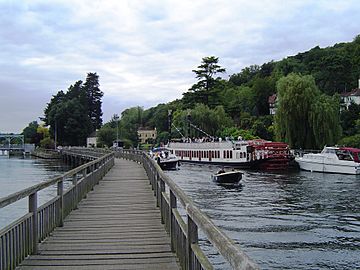
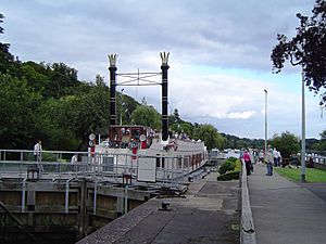
Marsh Lock from the upstream walkway with the weir on the left
|
|
| Waterway | River Thames |
|---|---|
| County | Berkshire |
| Maintained by | Environment Agency |
| Operation | Hydraulic |
| First built | 1773 |
| Latest built | 1914 |
| Length | 41.19 m (135 ft 2 in) |
| Width | 6.42 m (21 ft 1 in) |
| Fall | 1.33 m (4 ft 4 in) |
| Above sea level | 105' |
| Distance to Teddington Lock |
46 miles |
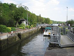
Marsh Lock is a special kind of gate system for boats, called a lock, and a small dam, called a weir. Both are found on the River Thames in England. This lock is located near Henley-on-Thames, in Oxfordshire.
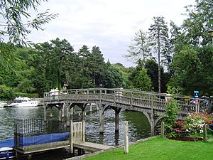
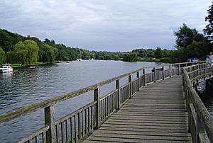
The lock is actually closer to the Berkshire side of the river. However, you can only reach it from the Oxfordshire side. To do this, you walk across two long wooden paths. The path closer to the town is near Mill Meadows.
The weir is made of iron gates that stretch from the lock to the Oxfordshire riverbank. It helps control the water level. The weir is located between the two long walkways.
History of Marsh Lock
The very first record of a simple gate system, called a flash lock, here was in 1580. But the lock and weir likely existed even before that time.
The current type of lock, known as a pound lock, was built in 1773. It was one of the first eight locks constructed after a new law in 1770. This first pound lock was made of fir wood.
Humphrey Gainsborough, a minister from Henley, helped build this lock. He was also an inventor and the brother of the famous artist Thomas Gainsborough.
By 1780, the lock was already falling apart. So, in 1787, it was rebuilt using stronger oak wood. The first house for the lock keeper was built in 1813.
In 1843, the lock was in bad shape again. There were ideas to move it to the other side of the river, but this never happened. Around this time, the lower wooden walkway was built.
The weir was rebuilt after 1879. People complained it wasn't very pretty. The lock itself was rebuilt again in 1886 with stronger timber. Its most recent major rebuild was in 1914. The weir was also rebuilt more recently in 2004.
How to Reach the Lock
Marsh Lock is unusual because it's on the opposite side of the river from the main walking path, called the towpath. To solve this, a long wooden bridge was built. This bridge carries the towpath from the Oxfordshire bank out to the lock island. It then goes back to the riverbank above the weir. This unique bridge system is found only at Marsh Lock on the River Thames.
The River Above Marsh Lock
Just past Marsh Lock, on the Berkshire side, you'll see steep hills. These hills soon lead to Wargrave Marsh, which is an open area of water meadows. This is where the Hennerton Backwater joins the main river.
In the past, a boat called Bolney Ferry used to cross the river here. You'll also see several islands in this area. These include Ferry Eyot, Poplar Eyot, and Handbuck Eyot. These islands are located near many large houses in a place called Shiplake.
Further upstream, the river passes the village of Wargrave on the Berkshire bank. On the Shiplake bank, you'll see open farmland. The River Loddon flows into the Thames on the Berkshire side.
The Shiplake Railway Bridge crosses the river just before Shiplake Lock. Every August, a fun event called the Wargrave & Shiplake Regatta takes place on the river section just below this railway bridge.
Thames Path Walkway
The Thames Path is a long walking trail that follows the River Thames. It usually stays on the western bank. However, near Marsh Lock, the path takes a detour through Shiplake. It rejoins the river again at Shiplake Lock.
This detour happens for a few reasons. In the past, the towpath used to cross the river at Bolney Ferry and then cross back at Lashbrook Ferry. Also, there isn't an easy way to get back onto the path between Lashbrook Ferry and Shiplake Lock.
 | DeHart Hubbard |
 | Wilma Rudolph |
 | Jesse Owens |
 | Jackie Joyner-Kersee |
 | Major Taylor |


