King's Lock facts for kids
 |
|
| Waterway | River Thames |
|---|---|
| County | Oxfordshire |
| Maintained by | Environment Agency |
| Operation | Manual |
| First built | 1928 |
| Length | 34.46 m (113 ft 1 in) |
| Width | 4.97 m (16 ft 4 in) |
| Fall | 0.77 m (2 ft 6 in) |
| Above sea level | 192' |
| Distance to Teddington Lock |
97 miles |
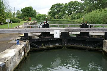
King's Lock is a special kind of gate system, called a lock, on the River Thames in England. It helps boats move between different water levels. You can find it in the countryside north of Oxford, in Oxfordshire. It sits on the southern side of the river.
King's Lock was one of the last "pound locks" built on the Thames. It was created in 1928 by the Thames Conservancy. This new lock replaced an older, simpler type of lock called a "flash lock." Near the lock, there's a big island. Behind this island, the Wolvercote Mill Stream begins. This stream leads to Duke's Cut, which connects the Thames to the Oxford Canal. The Mill Stream eventually flows back into the Thames below Godstow Lock. The weir, which controls water flow, is on the other side of the island. There's also a small visitor information center at the lock.
History of King's Lock
People knew about a weir at King's as early as the 1500s. A weir is like a small dam that helps control water levels. In 1817, someone suggested building a pound lock here, but it didn't happen. Another idea for a lock came up in 1845.
The old weir often caused problems. People complained about the water level being too high or too low. They also said that no one was usually there to help with the old "flash lock." Around 1872, a special ramp was built. This ramp, called a boatslide, helped small boats get past the weir. The weir itself was rebuilt in 1885. However, the modern pound lock wasn't built until 1928.
How to Get to King's Lock
You can reach King's Lock by following a long path. This path starts from the Godstow road. It's just where the road goes under the A34 Oxford by-pass. There is a public walking path that crosses both the lock and the weir.
The River Above King's Lock
Just a short distance upstream from King's Lock, the River Thames reaches its most northern point. Above the lock, on the northern side, you'll find the connection to Dukes Cut. Further along, on the southern bank, the Seacourt Stream branches off. This stream later rejoins the Thames near Kennington Railway Bridge.
The river flows through open countryside in this area. About halfway along this section, the River Evenlode joins the Thames from the north. After that, the Cassington Canal, which is now part of the Evenlode, also joins. The Wharf Stream also flows into the Thames on the same side, just before Eynsham Lock. The Thames Path, a long-distance walking trail, follows the southern bank of the river all the way to Eynsham Lock.
 | Toni Morrison |
 | Barack Obama |
 | Martin Luther King Jr. |
 | Ralph Bunche |

