Abingdon Lock facts for kids

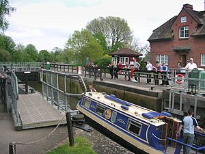
Abingdon Lock with Abingdon downstream in the distance. The silver parasols are to shade the lock-keeper while operating the controls. Yellow boards on the gates indicate a high stream
|
|
| Waterway | River Thames |
|---|---|
| County | Oxfordshire |
| Maintained by | Environment Agency |
| Operation | Hydraulic |
| First built | 1790 |
| Latest built | 1905 |
| Length | 36.57 m (120 ft 0 in) |
| Width | 5.71 m (18 ft 9 in) |
| Fall | 1.89 m (6 ft 2 in) |
| Above sea level | 167' |
| Distance to Teddington Lock |
85 miles |
| Coordinates | 51°40′14″N 1°16′09″W / 51.670535°N 1.269202°W |
Abingdon Lock is a special kind of gate system on the River Thames in England. It helps boats move up and down the river where the water level changes. This lock is located just east of Abingdon, Oxfordshire, on the opposite side of the river from the town. It was first built a long time ago, in 1790.
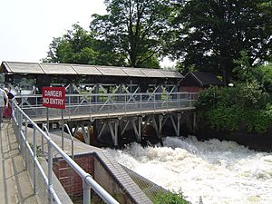
A weir (a small dam that controls water flow) stretches from the Abingdon side to a small island where the lock is. You can even walk across this weir! The house where the lock-keeper lives was built in 1928. For over 30 years, people have been able to buy ice creams and drinks right from the house door.
History of Abingdon Lock
The way boats traveled on the River Thames near Abingdon has changed a lot over hundreds of years. Originally, the main path for the river was a channel called the Swift Ditch, which is a bit further east.
The part of the river that goes through Abingdon town was made by monks from Abingdon Abbey. They are believed to have built the first weir here around the 10th century. Later, in 1635, a "pound lock" was built on the Swift Ditch. This made the Swift Ditch the main route for boats.
However, in 1788, people in Abingdon wanted the main boat route to come back to the town. This was also because a new canal, the Wilts & Berks Canal, was planned to connect to the river right at Abingdon. So, Abingdon Lock was built near the town and opened in late 1790.
How to Visit Abingdon Lock
You can get to Abingdon Lock by following a path that goes north from Abingdon Bridge. This path is on the Andersey Island side of the river. Another way to reach it is to walk along the river from the town center. You'll go through Abbey Meadows and then cross the weir. It's a nice walk!
Exploring the River Above the Lock
Right above the weir, towards the town, you'll see the channel that the monks of Abingdon Abbey dug in the 10th century. They made this channel for boats and to get water for their mill.
As you go upstream, the river actually turns back on itself for a short distance. This means the northern bank is temporarily on your southern side! On the same side as the lock is Andersey Island, which was formed by the Swift Ditch. You'll pass two channels flowing out from the river. One is where the old lock used to be, and the other is the original weir stream.
Further upstream, you'll see the Nuneham Railway Bridge, also known as Black Bridge. This bridge used to carry a railway line to Oxford. Even further up, the river turns north again near a heavily wooded island called Lock Wood Island. On the opposite side, you might spot the old Radley Boathouse.
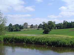
Beyond the island, the river flows past Nuneham Park, which belongs to Nuneham House. You can see the old Jacobean Carfax Water Tower on a hill in the park, before the grand Palladian house itself. On the western side of the river, there are open farmlands, with the town of Radley beyond. Near here, you'll find the Radley College boathouse. On the other side, green meadows stretch all the way to Sandford Lock.
The Thames Path, a walking trail, crosses the river at Abingdon Lock. From here, it follows the western bank of the river all the way to Sandford Lock.
 | Mary Eliza Mahoney |
 | Susie King Taylor |
 | Ida Gray |
 | Eliza Ann Grier |


