
Hounslow facts for kids
Quick facts for kids Hounslow |
|
|---|---|
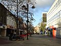
 High Street |
|

Hounslow
|
|
| Population | 103,337 (2011 Census) |
| OS grid reference | TQ140760 |
| • Charing Cross | 10.7 mi (17.2 km) ENE |
| London borough | |
| Ceremonial county | Greater London |
| Region | |
| Country | England |
| Sovereign state | United Kingdom |
| Post town | HOUNSLOW |
| Postcode district | TW3–TW6 |
| Dialling code | 020 |
| Police | Metropolitan |
| Fire | London |
| Ambulance | London |
| EU Parliament | London |
| UK Parliament |
|
| London Assembly |
|

.jpg)


Hounslow is a big town in West London, England. It's about 17 kilometers (10.5 miles) west of central London. Hounslow is the main town for the London Borough of Hounslow. It's also known as one of the 14 important 'metropolitan centres' in Greater London.
It has other towns around it: Isleworth to the east, Twickenham to the south, Feltham to the west, and Southall to the north.
Hounslow's postcode area includes TW3, TW4, TW5, and TW6. Most of this area is in the London Borough of Hounslow. But some parts, like Heathrow Airport, are in nearby areas like the London Borough of Richmond upon Thames and the London Borough of Hillingdon.
Contents
Hounslow's Past
What's in a Name?
In old records, Hounslow was spelled 'Hundeslow'. This name comes from an old Anglo-Saxon phrase. It means 'the Hound's barrow' or 'the burial mound of a person named Hound'.
How Hounslow Grew
Hounslow started around the Holy Trinity Priory, a type of monastery, built in 1211. The priory helped a small village grow into a town. It had regular markets and places for travelers going to and from London.
Even after the priory closed in 1539, Hounslow stayed important. It was a key stop on the Bath Road, a major route.
When the Great Western Railway line was built in 1838, fewer people traveled on the Bath Road. This made the town less busy. By 1842, a local newspaper said the town was struggling. It used to stable 2,000 horses, but things were changing.
The Hounslow Loop Line railway was built in 1850. This helped Hounslow grow again. Hounslow Hospital opened in 1876. The Hanworth Road drill hall was built for soldiers.
In the 1920s, the Great West Road was built. This new road brought factories and company offices to Hounslow. Many new homes were also built. After a quiet period in the 1970s, offices replaced factories. More hotels and homes started to appear.
Hounslow Heath's Story
Hounslow Heath has a long history, going back to the Norman period. It even gave its name to a small village called Heathrow. The Heath was famous for highwaymen and footpads. These criminals would rob rich travelers.
The Heath was important because its roads connected London to the west of Britain. The Staines Road, on the north side of the Heath, was once a Roman Road. It was later called the Devils Highway. There are old stories about Roman army camps near the Heath. Both Oliver Cromwell and James II used the Heath for military camps.
In 1784, the first accurate measurements for Britain's Ordnance Survey maps were made here. King George IV and Joseph Banks, a famous scientist, were there.
In 1793, the Cavalry Barracks were built for soldiers. Between 1914 and 1920, the Heath became Hounslow Heath Aerodrome, an airfield. It was a grass airfield used from 1910 to 1920. In 1919, the first regular international flights started from here.
Local Services
Emergency Services
The police force in Hounslow is the Metropolitan Police. The Hounslow Police Station is on Montague Road.
The fire and rescue service is the London Fire Brigade. The nearest fire station is in Isleworth on London Road.
The closest hospital for emergencies is West Middlesex University Hospital in Isleworth. It is part of the Chelsea and Westminster Hospital NHS Foundation Trust. The London Ambulance Service provides emergency ambulance services.
How Hounslow is Governed
Hounslow is part of the London Borough of Hounslow. It is run by Hounslow Council, located at Hounslow House. As part of Greater London, it also follows rules from the London Assembly and the Mayor of London.
Hounslow first grew where the old areas of Heston and Isleworth met. In 1835, Hounslow became its own church area.
In 1875, a local government district was created for Heston and Isleworth. It was run by an elected board. This district became an urban district in 1894.
In 1927, people voted to change the district's name to Hounslow. Most people wanted the change, but the county council said no. The urban district became the Municipal Borough of Heston and Isleworth in 1932.
In 1965, this borough was removed. Its area joined with Municipal Borough of Brentford and Chiswick and Feltham Urban District. Together, they became the London Borough of Hounslow.
Hounslow's Location
Hounslow is separated from Twickenham by Hanworth Road and other smaller roads and parks.
It is separated from Isleworth by Hall Road, the Hounslow Loop Line, and the Piccadilly Line.
The Norwood Green area separates Hounslow and Southall. The River Crane and Cranford Park form a natural border with Hayes.
Historically, Hounslow's western border was the River Crane. Now, it includes Heathrow Airport.
People of Hounslow
In 2011, the population of Hounslow and its nearby areas like Cranford, Heston, Hounslow West and Lampton was 103,337 people. The wider borough had about 254,000 people.
Hounslow has many people from different backgrounds. It is a very diverse town. A large part of the population identifies as BAME (Black, Asian, and minority Ethnic). The town has a large British Asian community.
Hounslow's Economy
Hounslow is an important business area in West London. It has a large shopping centre and many restaurants and cafes. Many businesses here work with product assembly, marketing, and phones.
Heathrow Airport is nearby and provides many jobs. Many local people work there. Hounslow is also part of the London Commuter Belt. This means people can easily travel to Central London for work.
DHL Air UK has its main office in Orbital Park in Hounslow.
Hounslow Town Centre is a busy place for shopping. It has the Treaty Centre, a large shopping mall that opened in 1987. It has popular shops like JD, Next, and H&M, plus a food court. There's also a big ASDA supermarket in the Blenheim Centre, which opened in 2006. This centre also has a B&M store, a Barnado's charity shop, a health centre, a gym, and a children's play area.
A new shopping area called the High Street Quarter is being built. It will have a tall residential tower, shops, restaurants, and a ten-screen Cineworld cinema.
Culture and Community
Hounslow Heath is a large public park and nature reserve in Hounslow. It covers about 81 hectares (200 acres). This is just a small part of the much larger historic Hounslow Heath.
Bell Square is an outdoor space for performances next to the Bell pub. The Hounslow Community Land Project was a community garden and sports area.
Twin Towns
Hounslow is twinned with several places around the world:
 Issy-les-Moulineaux, France
 Lahore, Pakistan
 Ramallah, Palestine
 Jalandhar, India
The London Borough of Hounslow also has a sister agreement with Leningradsky District in Krasnodar Krai, Russia.
Famous Places
One of the oldest houses in Hounslow is The Lawn. It's made of brown brick with large windows.
Nearby country houses include Osterley House, Syon House, Hanworth Park House, and Worton Hall.
Getting Around Hounslow

Main Roads
Hounslow has three main roads. The A4 'Great West Road' and the 'Bath Road' go east-west. They connect Hounslow to Central London and Slough. The A30 'Great South West Road' connects Hounslow to Staines-upon-Thames. These roads meet at Henlys Roundabout in Hounslow West.
The A312 'The Causeway' and 'The Parkway' go north-south. They connect Hounslow to Hampton in the south and Harrow to the north.
Other important roads include the A314 'Hanworth Road'. The historic A315 'London Road' goes through Hounslow High Street. It connects Hounslow to places like Kensington, Hammersmith, Brentford, and Isleworth.
Trains and Underground

Hounslow has three main London Underground stations: Hounslow East, Hounslow Central, and Hounslow West. All these stations are on the Piccadilly line. The District line used to serve Hounslow, and there are old, unused stations from that line, like Hounslow Town.
Hounslow railway station is run by South Western Railway. Trains from here go to London Waterloo. Westbound trains go to places like Reading and Windsor. The Hounslow Loop Line, opened in 1850, also offers services to Twickenham and Richmond. This station is a bit far from the town centre, so fewer people use it compared to the Underground stations.
Bus Services

Hounslow has a bus garage and a bus station near the High Street. The bus garage is owned by the RATP Group.
Hounslow has many bus services during the day. It also has the N9 night service from Heathrow Airport to Central London.
Schools in Hounslow
St Mark's Catholic School is on Bath Road. Lampton School was once called Spring Grove Grammar School. Kingsley Academy used to be Hounslow Manor School. Hounslow Heath School was formed when Hounslow Heath Infant and Nursery School and Hounslow Heath Junior School joined together.
Places of Worship

Hounslow has a large community from South Asia. Because of this, it has many places of worship for Muslims, Hindus, and Sikhs, as well as Christians.
Mosques in the area include Hounslow Central Mosque and the Islamic Integration Community Centre.
Mandirs (Hindu temples) include the Lakshmi Narayan Temple.
Gurdwaras (Sikh temples) include Gurdwara Sri Guru Singh Sabha.
Churches include Our Lady Queen of Apostles and Holy Trinity Church.
Sports in Hounslow
In 1935, there might have been a motorcycle speedway race in Feltham, called the Hounslow Speedway.
In the late 1900s, Hounslow Hockey Club was very successful. It later joined with Barnes Hockey Club. Hounslow Heath Golf Centre closed in 2016.
The 2002 movie Bend It Like Beckham is set in Hounslow. It shows a made-up football team called The Hounslow Harriers.
The Irish Guards GAA club is also based in Hounslow.
Famous People from Hounslow
Images for kids
-
High Street
