Devil's Highway (Roman Britain) facts for kids

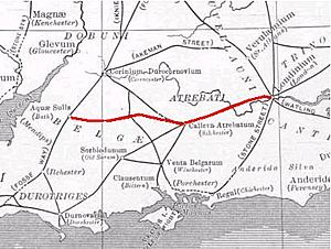
The Devil's Highway was an important Roman road in Britain. It connected Londinium (modern London) to Staines (then called Pontes) and then to Calleva Atrebatum (modern Silchester). This road was the main way to travel west in Britain during the Roman period. Over time, other roads became more popular, and parts of the Devil's Highway were no longer used.
Contents
What Was the Devil's Highway?
This ancient road got its name because people in later times didn't know much about its Roman builders. They thought it was so old and straight it must have been built by the Devil! The road was a key route for the Romans.
Where Did It Go?
The Devil's Highway started in London. It went west to Pontes (Staines), where bridges likely crossed near Church Island. From there, it continued to Calleva Atrebatum (Silchester).
Calleva was a major crossroads. From this town, the Devil's Highway connected to other important Roman roads:
- The Port Way led to Sorviodunum (near modern Salisbury).
- The Ermin Way went to Glevum (modern Gloucester).
- Another road led to Aquae Sulis (modern Bath).
The London Section
The part of the Devil's Highway in London was found again in the 1600s. This happened when Christopher Wren was rebuilding St Mary-le-Bow church after the Great Fire of London. Experts believe this section was built in AD 47 or 48.
How Was It Built?
Around London, the road was about 7.5 to 8.7 meters (25 to 29 feet) wide. It was paved with gravel. The Romans rebuilt this part of the road several times. This included at least twice before Boudica's attack on London in AD 60 or 61.
The road went straight from the Thames river crossing. It passed through what would become Newgate in the London Wall. It then went over Ludgate Hill and the Fleet river. Here, the Devil's Highway split from Watling Street, another Roman road that went northwest to Verulamium (St Albans).
Through Berkshire's Forests

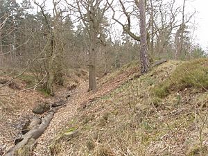
The Devil's Highway travels through Windsor Forest. You can still see it clearly in places like Swinley Forest near Crowthorne. It's used today as a footpath and a track for forestry vehicles. This helps keep its original path clear.
Road Features
The road surface still has some stones, and it often has drainage ditches on its sides. The ground underneath is sandy and gravelly. This area was once open heathland before trees like Scots pine and Sitka spruce were planted. Even today, this part of the road feels as quiet and lonely as it would have been in Roman times. In some places, the Romans cut into the soil to keep the road straight on steep slopes.
Nearby Roman Sites
The road passes about half a mile south of Caesar's Camp. This was an ancient hillfort. A smaller road connected the highway to the hillfort's southern entrance.
Along this connecting road, there was a small Roman settlement called Wickham Bushes. Roman pottery and other items have been found there. It was probably a place where travelers could rest and get supplies.
From Crowthorne, the main highway becomes a sand track and footpath through woods. It crosses a bank that forms a dam for a small lake called Heath Pond. Some of this land is looked after by the National Trust. The road then goes near Finchampstead church. There might have been a Roman signal station or temple here.
The End in Hampshire

The Devil's Highway ends at the Roman town of Calleva Atrebatum. This town was the main center for the Iron Age tribe called the Atrebates. Calleva was a very important crossroads. The Devil's Highway connected it to Londinium (London), the capital of the Roman province.
Calleva Atrebatum Town
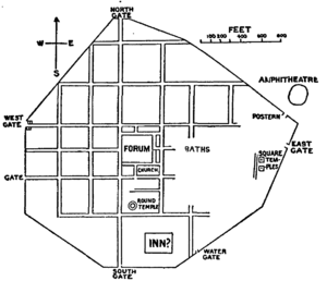
After the Roman conquest of Britain in AD 43, an older Iron Age settlement grew into the Roman town of Calleva Atrebatum. It was quite large, about 40 hectares (100 acres). The town was built with a clear grid pattern of streets. It had many public buildings and thrived until the early Anglo-Saxon period.
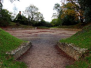
Near the South Gate, there was a large mansio. This was like a hotel for official travelers, with three parts built around a courtyard. The Devil's Highway entered the town near the restored Roman amphitheatre, close to the eastern gate. The town has been well-dug up by archaeologists, and you can visit the ruins today. Many of the things found there are on display at the Reading Museum.
 | Claudette Colvin |
 | Myrlie Evers-Williams |
 | Alberta Odell Jones |


