Devil's Causeway facts for kids
Quick facts for kids Devil's Causeway |
|
|---|---|

|
|
| Location | Northumberland, England, UK |
| OS grid | NU108092 |
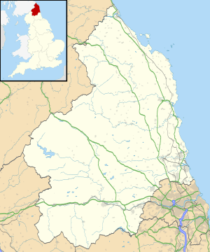
| Coordinates | 55°18′29″N 1°48′32″W / 55.308°N 1.809°W |
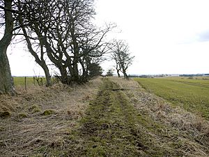
The Devil's Causeway is an ancient Roman road in Northumberland, England. It was built by the Romans a very long time ago! This road starts near Corbridge and stretches for about 55 miles (89 km) north. It ends near Berwick-upon-Tweed, close to the mouth of the River Tweed.
Contents
What is the Devil's Causeway?
The Devil's Causeway is a Roman road that was likely built even before Hadrian's Wall. It began at a place called the Portgate, just north of Corbridge. Here, it branched off from another important Roman road, Dere Street. Dere Street continued north into Redesdale on its way to Caledonia (which is now Scotland).
The Devil's Causeway went all the way to Berwick-upon-Tweed. The Romans probably used this road to support a military port there. This port would have been important for moving supplies and soldiers by sea.
Who Guarded the Road?
Less than a mile (1.6 km) east of the Portgate was a Roman fort called Onnum (also known as Halton Chesters). It's very likely that Roman soldiers, especially cavalry (soldiers on horseback), from this fort patrolled the Devil's Causeway. They would have kept it safe for travelers and military movements.
A Fort on Hadrian's Wall
The fort at Halton Chesters was built right across the line of Hadrian's Wall. It faced north, ready to protect against any threats. This fort was quite large, covering about 4 acres (1.6 hectares).
A special stone slab found at the fort's west gate tells us something important. It says:
|
LEG VI V P F FEC "The Victorious Sixth Legion, Loyal and Faithful, made this." |
This means the Sixth Legion built the fort. We don't know for sure which group of soldiers first lived there. However, it was probably a cohors quingenaria equitata. This was an auxiliary (helper) army unit with about 500 soldiers, and half of them were on horseback.
These units were perfect for this location. The foot soldiers could guard the fort and the Wall. The cavalry could patrol along Dere Street and the Devil's Causeway to the north.
The Road's Journey North
The Devil's Causeway passes by many interesting places as it heads north.
- It goes near Great Whittington.
- Then it heads northeast to Hartburn. Just west of Hartburn, it crosses the Hart Burn, a small river that flows into the River Wansbeck.
- It continues east of Netherwitton. Near Netherwitton, there was once a building known as Devil's Causeway Tower. Some old maps show it as a tower, but it might have been the remains of a cottage. It was also called Highbush Wood. Some people thought it was a Peel tower, which was a small castle or fortified house. However, it's not certain if it was a medieval fort.
After Netherwitton, the road passes to the west of Longhorsley. It keeps going north until it crosses the River Coquet east of Brinkburn Priory. From there, it starts to turn slightly west. It passes the western edge of Longframlington.
North of Longframlington, the Roman road touches the A697 road and then crosses it. It then passes west of Edlingham. Near the village of Whittingham, there was another Roman fort at Learchild. From Learchild, another Roman road went west to meet Dere Street at Bremenium (High Rochester).
Just north of the Learchild fort, the Devil's Causeway crosses the A697 again. It then passes Glanton and reaches Powburn.
Towards Berwick-upon-Tweed
At Powburn, the modern A697 road follows the path of the Devil's Causeway for about 2 miles (3.2 km). It crosses the River Breamish here.
The Roman road then heads west of north, passing Newtown, Northumberland. It crosses the River Till just before Horton. At Horton, the road continues as a local road for about 7 miles (11 km) past Lowick.
Lowick is a small village in northern Northumberland, about 9 miles (14 km) south of Berwick-upon-Tweed. It's interesting because an ancient road used by monks from Lindisfarne to Durham crosses the Devil's Causeway here. Lowick started to grow at these crossroads.
Finally, the Devil's Causeway passes through Berrington. From there, it heads towards Tweedmouth and the mouth of the River Tweed, its final destination.
 | Delilah Pierce |
 | Gordon Parks |
 | Augusta Savage |
 | Charles Ethan Porter |


