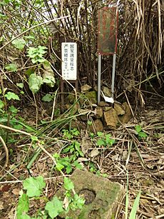
State Bureau of Surveying and Mapping facts for kids
The State Bureau of Surveying and Mapping is China's main organization for making maps and understanding the Earth's shape. It is located in Beijing, China. This bureau helps create accurate maps and geographic information for the whole country.
What is the State Bureau of Surveying and Mapping?
The State Bureau of Surveying and Mapping (also known as Chinese: 国家测绘地理信息局) is a very important government agency in China. It focuses on two main areas:
- Geodesy: This is the science of measuring and understanding the Earth's shape, size, and gravity. It helps us know exactly where places are on the planet.
- Cartography: This is the art and science of making maps. It involves collecting data and then drawing maps that are easy to read and understand.
What Does It Do?
This bureau has many important jobs. Its main goal is to provide accurate geographic information for China. This information is used for many things, like:
- Making Maps: They create all kinds of maps, from detailed road maps to large-scale national maps.
- Land Management: They help manage land use by providing precise measurements and boundaries.
- Disaster Relief: When natural disasters happen, their maps and data help rescue teams and aid workers.
- National Development: The information they gather is vital for planning new cities, roads, and other big projects.
- Setting Standards: They set the rules and standards for how maps are made and how geographic data is collected in China.
When Was It Started?
The State Bureau of Surveying and Mapping was first set up in 1959. Since then, it has grown and changed to use new technologies. Over the years, it has played a key role in mapping China and helping its development.
 | Madam C. J. Walker |
 | Janet Emerson Bashen |
 | Annie Turnbo Malone |
 | Maggie L. Walker |


