Stuttgart, Kansas facts for kids
Quick facts for kids
Stuttgart, Kansas
|
|
|---|---|

|
|
| Country | United States |
| State | Kansas |
| County | Phillips |
| Founded | 1888 |
| Elevation | 1,998 ft (609 m) |
| Population
(2020)
|
|
| • Total | 44 |
| Time zone | UTC-6 (CST) |
| • Summer (DST) | UTC-5 (CDT) |
| Area code | 785 |
| FIPS code | 20-68750 |
| GNIS ID | 471923 |
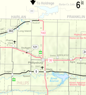
Stuttgart is a small community in Phillips County, Kansas, in the United States. It's called a "census-designated place" (CDP) because it's a special area the government tracks for population counts, even though it's not an official city. In 2020, only 44 people lived there. You can find Stuttgart in northern Kansas, right along U.S. Route 36, located between the towns of Prairie View and Phillipsburg.
Contents
History of Stuttgart
Stuttgart was first settled by people in the early 1870s. It officially became a community on February 6, 1888. Over time, it grew into a busy place.
Life in Early Stuttgart
In its early days, Stuttgart had many important buildings and businesses. There were two Lutheran churches, where people went to worship. Kids attended a public school. The town also had a hotel, a cafe, and even a bank. For entertainment, there was a cinema.
Other businesses included a hairdresser, a wood yard, and a grocer's shop for food. A railway depot helped transport goods and people. Farmers used a grain silo to store their crops. There was also a repair shop, a blacksmith, and a dairy.
Stuttgart Today
A post office opened in Stuttgart in 1888. It served the community for many years until it closed in 1986. Today, Stuttgart is much smaller. It still has a Lutheran church, a grain elevator, a garage, and a gas station.
Population and People
What is a Census?
A census is like a big count of all the people living in a place. The United States government does a census every ten years. This helps them understand how many people live in different areas.
Stuttgart's Population Over Time
The most recent count for Stuttgart was in 2020. At that time, 44 people lived there. This number helps us see how the community has changed over the years.
| Historical population | |||
|---|---|---|---|
| Census | Pop. | %± | |
| 2020 | 44 | — | |
| U.S. Decennial Census | |||


