Tamasopo facts for kids
Tamasopo is a town and a larger area called a municipality in the Mexican state of San Luis Potosí. It is famous for its beautiful natural places, especially its waterfalls and green rainforests. The town is located at 21°55′21″N 99°23′33″W / 21.92250°N 99.39250°W. The municipality covers about 1,329 square kilometres (513 sq mi). In 2010, about 28,848 people lived in the municipality. The town of Tamasopo itself had 4,326 residents.
Contents
Exploring Tamasopo's Geography
Tamasopo is nestled at the base of the Sierra Madre Oriental mountains. The town itself is about 366 meters (1,200 feet) above sea level. The mountains surrounding it can reach heights of about 1,500 meters (5,000 feet). Tamasopo is well-known for its stunning waterfalls, which are found in a lush, green rainforest.
Amazing Waterfalls and Rivers
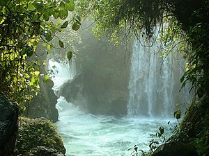
El Puente de Dios (The Bridge of God) is a fantastic spot about 3 kilometers (2 miles) northwest of Tamasopo town. It features waterfalls that drop into a narrow canyon and a cave. The Gallinas river flows quickly through an arch in the rock. You can find clear, blue pools for swimming both above and below the cave.
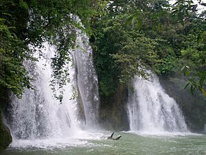
The Cascada de Tamasopo is another beautiful waterfall located about 3 kilometers (2 miles) north of the town. It has three cascades that tumble about 20 meters (66 feet) into pools. These pools are separated by natural rock ledges made of travertine. Some visitors say these waterfalls remind them of Havasu Falls in the Grand Canyon.
Close by is El Trampolin. This area has smaller waterfalls that flow into clear, deep pools. It's a perfect place to relax in the middle of a tropical forest.
Tamasopo's Climate and Weather
| Climate data for Tamasopo | |||||||||||||
|---|---|---|---|---|---|---|---|---|---|---|---|---|---|
| Month | Jan | Feb | Mar | Apr | May | Jun | Jul | Aug | Sep | Oct | Nov | Dec | Year |
| Mean daily maximum °C (°F) | 24.2 (75.6) |
27.0 (80.6) |
30.5 (86.9) |
33.1 (91.6) |
34.2 (93.6) |
33.0 (91.4) |
30.9 (87.6) |
31.3 (88.3) |
29.1 (84.4) |
27.6 (81.7) |
26.2 (79.2) |
24.0 (75.2) |
29.3 (84.7) |
| Daily mean °C (°F) | 17.0 (62.6) |
19.0 (66.2) |
22.0 (71.6) |
25.0 (77.0) |
27.0 (80.6) |
27.0 (80.6) |
26.0 (78.8) |
27.0 (80.6) |
26.0 (78.8) |
23.0 (73.4) |
20.0 (68.0) |
18.0 (64.4) |
23.0 (73.4) |
| Mean daily minimum °C (°F) | 9.2 (48.6) |
10.5 (50.9) |
13.4 (56.1) |
16.1 (61.0) |
19.2 (66.6) |
20.2 (68.4) |
19.5 (67.1) |
19.4 (66.9) |
18.6 (65.5) |
16.0 (60.8) |
13.3 (55.9) |
9.9 (49.8) |
15.4 (59.7) |
| Average precipitation mm (inches) | 37 (1.5) |
31 (1.2) |
28 (1.1) |
54 (2.1) |
102 (4.0) |
311 (12.2) |
324 (12.8) |
279 (11.0) |
380 (15.0) |
168 (6.6) |
64 (2.5) |
42 (1.7) |
1,818 (71.6) |
| Source: Weatherbase | |||||||||||||
The climate in Tamasopo is considered sub-tropical. This means it generally has warm temperatures throughout the year and gets a good amount of rain. The weather box above shows the average temperatures and rainfall for each month.
A Look at Tamasopo's History
Tamasopo is part of the Huasteca region. This area is named after the indigenous people who have lived there for a very long time. In the municipality, there are 4,461 indigenous people. About 2,950 of them speak an indigenous language. Most of these people belong to two main groups: the Huastecas and the Pame. The Huastecas traditionally lived in the southern part of the municipality, while the Pame lived in the northern part.
See also
 In Spanish: Tamasopo para niños
 | Victor J. Glover |
 | Yvonne Cagle |
 | Jeanette Epps |
 | Bernard A. Harris Jr. |


