
San Luis Potosí facts for kids
Quick facts for kids
San Luis Potosí
|
||
|---|---|---|
| Free and Sovereign State of San Luis Potosí Estado Libre y Soberano de San Luis Potosí (Spanish) |
||
|
||
.svg)
State of San Luis Potosí within Mexico
|
||
| Country | Mexico | |
| Capital | San Luis Potosí | |
| Largest City | San Luis Potosí | |
| Municipalities | 58 | |
| Admission | December 22, 1823 | |
| Order | 6th | |
| Area | ||
| • Total | 61,137 km2 (23,605 sq mi) | |
| Ranked 15th | ||
| Highest elevation | 3,180 m (10,430 ft) | |
| Population
(2020)
|
||
| • Total | 2,822,255 | |
| • Rank | 19th | |
| • Density | 46.1628/km2 (119.5611/sq mi) | |
| • Density rank | 20th | |
| Demonym(s) | Potosino (a) | |
| GDP | ||
| • Total | MXN 662 billion (US$33.0 billion) (2022) |
|
| • Per capita | (US$11,556) (2022) | |
| Time zone | UTC−6 (CST) | |
| • Summer (DST) | UTC−5 (CDT) | |
| Postal code |
78-79
|
|
| Area code |
Area codes 1 and 2
|
|
| ISO 3166 code | MX-SLP | |
| HDI | ||

San Luis Potosí, officially known as the Free and Sovereign State of San Luis Potosí (Estado Libre y Soberano de San Luis Potosí in Spanish), is one of Mexico's 32 states. It is divided into 58 municipalities, and its capital city is San Luis Potosí.
This state is located in eastern and central Mexico. It shares borders with seven other Mexican states: Nuevo León to the north, Tamaulipas to the northeast, Veracruz to the east, Hidalgo, Querétaro, and Guanajuato to the south, and Zacatecas to the northwest. Besides the capital, other important cities include Ciudad Valles, Matehuala, Rioverde, and Tamazunchale.
Contents
- Discovering San Luis Potosí's Past
- Exploring San Luis Potosí's Geography
- Understanding San Luis Potosí's Government and Cities
- San Luis Potosí's Economy
- People and Culture of San Luis Potosí
- Learning in San Luis Potosí
- News and Travel in San Luis Potosí
- Famous People from San Luis Potosí
- Coat of Arms
- Images for kids
- See also
Discovering San Luis Potosí's Past
Before the Spanish arrived, the land of San Luis Potosí was home to different cultures. The northern and central-western parts were lived in by Otomi and Chichimeca tribes. These groups were nomads, meaning they moved around to hunt and gather food. Even though many native people faced challenges during Spanish rule, Huasteco, Pame, and Náhua groups still live there today.

The Start of a New Era
In 1592, a big discovery of gold and silver changed everything. This led to the creation of the first town, "San Luis de Mezquitique," which is now the capital city, San Luis Potosí. Juan de Oñate became the first mayor of this new town.
The state was named "San Luis Rey" to honor Louis IX of France, a king. The "Potosí" part came from the rich silver mines in Potosí, Bolivia. People hoped San Luis Potosí would be just as wealthy, but it never quite reached that level. In the 1600s and 1700s, religious groups like the Franciscans, Augustinians, and Jesuits came to the area. They built many churches and buildings, some of which are now museums and universities.
Independence and Growth
In 1821, after Mexico won its independence, San Luis Potosí also declared its freedom. The state wrote its first constitution on October 16, 1826. Later, during the Mexican–American War (1846–1847), San Luis Potosí was called "San Luis de la Patria" (Saint Louis of the Homeland). This was because it provided important leaders and ideas during the conflict with the United States.
During the Reform War and the French Intervention in 1863, the city of San Luis Potosí even became the capital of Mexico for a short time under President Benito Juárez. In 1866, a telegraph line connected San Luis Potosí to Mexico City. This helped improve communication and started the state's journey towards becoming more industrialized.
Exploring San Luis Potosí's Geography
Most of San Luis Potosí is on the Mexican Plateau. However, the eastern part of the state drops into the tropical valley of the Tampaon River. This river flows northwest and becomes the Pánuco River, which separates San Luis Potosí from Tamaulipas. The plateau is mostly flat, with some low, wooded mountains.
The Sierra Madre Oriental mountain range runs through the state from north to south. It separates the Mexican Plateau from the Gulf Coastal Plain to the east. These mountains are home to the Sierra Madre Oriental pine–oak forests. The easternmost part of the state is on the Gulf Coastal Plain and has Veracruz moist forests. This eastern area is often called "La Huasteca."
Rivers and Climate
The Tampaón River and its smaller rivers drain the southern and southeastern parts of the state. The northern and central parts, including the capital, are in an interior drainage basin, meaning their water does not flow to the sea.
The average elevation is about 6,000 feet (1,800 meters), which gives most of the state a mild climate. The northern part is dry, but the southern half gets more rain from winds called "Nortes." However, rainfall can be unpredictable in the western and northern regions, and many parts of the state do not have large rivers.
The soil is fertile. In good seasons, farmers grow wheat, corn, beans, and cotton in the uplands. In the warm, tropical valleys, they grow sugar, coffee, tobacco, peppers, and fruits. Raising livestock like sheep, cattle, and pigs is also important. Fine wood for furniture and building is also produced.
Mining History
San Luis Potosí was once one of Mexico's top mining areas. The area around Real de Catorce has some of the richest silver mines in the country. Other well-known silver mining areas include Peñón Blanco, Ramos, and Guadalcázar. The Guadalcázar mines, which started in 1620, also produce gold, copper, zinc, and bismuth.
- Flora and fauna of San Luis Potosí
-

Eleutherodactylus guttilatus
-
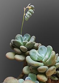
Pachyphytum oviferum


.jpg)

.jpg)


_Pachyphytum_oviferum_-_Habitus.jpg)


Understanding San Luis Potosí's Government and Cities
Municipalities and Major Cities
The State of San Luis Potosí is divided into 58 municipalities. Each municipality is led by a municipal president, similar to a mayor. These municipalities are grouped into four zones: Altiplano (Highlands), Centro (Center), Media, and Huasteca.
Here are some of the major cities in the state:
- San Luis Potosí, San Luis Potosí (the state capital)
- Soledad de Graciano Sánchez
- Ciudad Valles
- Matehuala
- Rioverde
- Tamazunchale
- Cerritos
- Villa De Pozos
- Taquian de Escobedo
- San Ciro de Acosta
- Cárdenas
- Ciudad del Maiz
Protected Natural Areas
San Luis Potosí has several special places that are protected by the government to preserve nature. These include:
- El Gogorrón National Park (created in 1936)
- El Potosí National Park (created in 1936)
- Sierra del Abra Tanchipa Biosphere Reserve (created in 1994)
- Sierra de Álvarez Flora and Fauna Protection Area (created in 1981)
- Sierra La Mojonera Flora and Fauna Protection Area (created in 1981)
There is also a Ramsar site called Arrochas y Manantiales de Tanchachín, which is a wetland of international importance.
The state also protects 12 other natural areas, such as:
- Natural Monument of "La Hoya de las Huahuas"
- Natural Monument of "The Basement of the Swallows"
- La Media Luna Spring State Park
- Palma Larga Manantial State Park
- Urban Park Paseo de la Presa de San José
- Ejido San Juan de Guadalupe Urban Park
- Sacred Natural Site «Caves of Wind and Fertility»
- Wirikuta Natural Sacred Site and the Huichol People's Historical Cultural Route
- "Real de Guadalcázar" State Reserve
- Sierra del Este and Sierra de En Medio State Reserve
- Spiny Forest Relic «Adolfo Roque Bautista Forest»
- Tancojol State Reserve
San Luis Potosí's Economy
San Luis Potosí has a great location for business. It is between three major Mexican cities: Mexico City, Monterrey, and Guadalajara. It is also close to four important ports: Tampico, Altamira, Manzanillo, and Mazatlán. This location, along with its varied climate and good transportation, makes it an attractive place for businesses.
Key Industries
Historically, mining has been a major industry in San Luis Potosí. Today, basic metallurgy (working with metals) still contributes the most to the state's economy. The main metals mined here are zinc, copper, lead, gold, silver, mercury, manganese, and arsenic. Other important industries include chemicals, food and beverages, tobacco, and textiles.
The services sector, which includes things like shops, hotels, and restaurants, is the second largest contributor to the state's income. These industries together employ more than half of the working population.
Agriculture and Manufacturing
Agriculture has always been a traditional activity, especially in the Huasteca region. While it doesn't contribute as much to the state's overall economy now, it still employs about 20% of the working population. Farmers grow crops like maize, beans, barley, sugar cane, oranges, coffee, sour lemon, prickly pear, and mango. Livestock farming focuses on raising sheep, cattle, and pigs.
The state is also important for Mexico's large automotive industry. General Motors has a plant called San Luis Potosí Assembly that can produce many vehicles each year. The BMW Group also opened a new plant in San Luis Potosí in 2019. This plant is eco-friendly, using 100% CO2-free electricity, and creates many jobs. Cummins has also had a manufacturing presence in San Luis Potosí since 1980.
Large industrial parks can be found throughout the state, especially in cities like the capital, San Luis Potosí.
People and Culture of San Luis Potosí
The state of San Luis Potosí has a population of over 2.8 million people. The population is relatively young, with 60% of residents being under 30 years old. People in the state generally live as long as the national average.
Indigenous Heritage
About 15% of the state's population is indigenous. The most common indigenous language spoken is Nahuatl, followed by Huasteco. The native people of the state include the Huastec and Pame peoples.
Learning in San Luis Potosí
The average person over 15 years old in San Luis Potosí has about 7.7 years of education. The literacy rate, which is the percentage of people who can read and write, is about 90.8%. Most of the people who cannot read and write are from older generations.
The main university in the state is the Autonomous University of San Luis Potosí (UASLP). Other higher education institutions include:
- Instituto Tecnológico de San Luis Potosí (ITSLP)
- Instituto Tecnológico y de Estudios Superiores de Monterrey, Campus San Luis Potosí (ITESM)
- Universidad del Valle de México, Campus San Luis Potosí (UVM)
- Universidad Cuauhtémoc, Campus San Luis Potosí (UCSLP)
- Universidad Tecnológica de San Luis Potosí (UTSLP)
- Universidad Politécnica de San Luis Potosí (UPSLP)
- College of San Luis Potosí (COLSAN)
- Universidad del Centro de México (UCEM)
News and Travel in San Luis Potosí
Media Outlets
Some newspapers in San Luis Potosí include: Diario Regional El Mañana de Valles, El Sol de San Luis, Esto del Centro, Gran Diario Regional Zona Media El Mañana de Rioverde, La Jornada de San Luis, La Prensa del Centro, and Pulso Diario de San Luis.
Transportation Options
The Ponciano Arriaga International Airport serves the capital city, San Luis Potosí. It has many daily flights to other cities in Mexico and to other countries. Other cities like Matehuala, Tamuin, and Rioverde also have airports, but they only serve flights within Mexico.
The state also has a good network of roads. Most roads in cities and highways are paved. However, some smaller towns still have cobblestone streets.
Famous People from San Luis Potosí
Many talented people have come from San Luis Potosí:
Arts and Sciences
- Ana Bárbara – a singer-songwriter
- Cenobio Hernandez – a composer
- Julián Carrillo Trujillo – discovered the Thirteenth Sound theory in music
- Francisco González Bocanegra – wrote the Mexican National Anthem
- Manuel José Othón – a poet
- Eugenia Campbell Nowlin – an American artist and art administrator
Politics
- Ponciano Arriaga
- Miguel Barragán – a former President of Mexico
- Salvador Nava Martínez
Sports
- Ivan Becerra – a former professional football (soccer) player
- Jesús Cruz – a Major League Baseball pitcher
- Nery Castillo – a former professional football (soccer) player
- Alberto Del Rio – a WWE wrestler
- José Garfias – a racing driver
- Jorge Goeters – a NASCAR driver
- Mil Máscaras – a professional wrestler
- Luis Enrique Muñoz – a professional football (soccer) player
- Juan Sánchez Purata – a professional football (soccer) player
Journalism
- Jesús Blancornelas – a prize-winning journalist
Coat of Arms
The state's coat of arms shows Louis IX of France, who the state is named after. He is standing on a hill in Cerro de San Pedro, where gold and silver were found. Because the state was known for its mines, there are two gold bars on the left and two silver bars on the right. The blue background represents night, and the yellow background represents day.
Images for kids
-
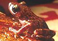
Eleutherodactylus guttilatus
-

Pachyphytum oviferum
See also
 In Spanish: San Luis Potosí para niños
