San Luis Potosí (city) facts for kids
Quick facts for kids
San Luis Potosí
|
|
|---|---|
|
City
|
|
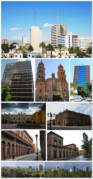
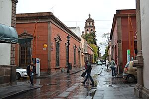
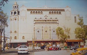
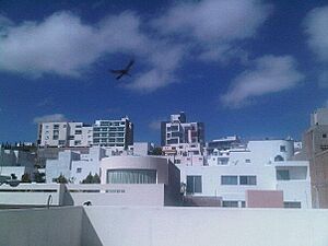
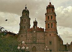
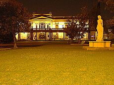
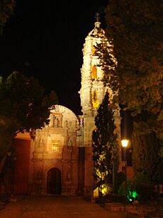
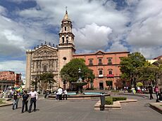
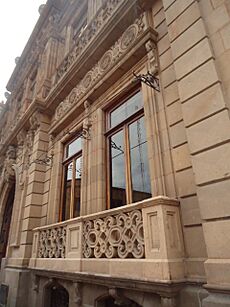
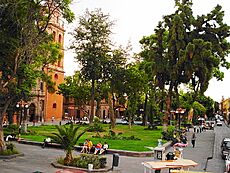
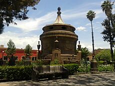
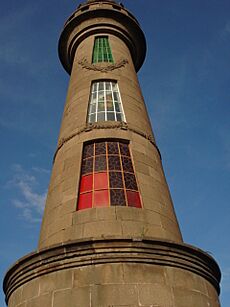
From left to right and from top to bottom: buildings at Avenida Carranza, Secretariat of Foreign Affairs tower, St. Louis Cathedral, National Institute of Statistics and Geography tower, Plaza de San Francisco, Museo Nacional de la Máscara, Calle Universidad, San Luis Potosí historical centre, panorama of San Luis Potosí
|
|
| Nickname(s):
La Ciudad de los Jardínes
(City of Gardens) |
|
| Country | |
| State | |
| Founded | November 3, 1592 |
| Founded as | Pueblo de San Luis Mesquitique |
| Area | |
| • Municipality | 385 km2 (149 sq mi) |
| Elevation | 1,864 m (6,115 ft) |
| Population
(2015)
|
|
| • Municipality | 824,229 |
| • Metro | 1,221,526 |
| • Demonym | Potosino (a) |
| GDP (PPP, constant 2015 values) | |
| • Year | 2023 |
| • Total | $35.8 billion |
| • Per capita | $28,300 |
| Time zone | UTC−6 (CST) |
| • Summer (DST) | UTC−5 (CDT) |
| Website | ayuntamientoslp.gob.mx |
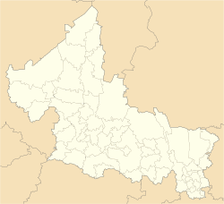
San Luis Potosí, often called San Luis or SLP, is a major city in Mexico. It is the capital and largest city of the Mexican state of San Luis Potosí. The city is located high up, about 1,864 meters (6,115 feet) above sea level.
In 2015, the city had about 824,229 people. Its larger metropolitan area, which includes nearby towns like Soledad de Graciano Sánchez, has about 1,221,526 people. This makes it the eleventh largest metropolitan area in Mexico.
The city is in the west-central part of the state. It is named after Louis IX of France, who is the city's patron saint. The name Potosí was added because of the very rich silver and gold mines found nearby. These mines were the main reason the city was founded in 1592.
Today, San Luis Potosí is an important industrial center in central Mexico. Many foreign companies have invested here. This is because the city is located perfectly between Mexico City and the United States border. It is also in the middle of the "triangle" formed by Mexico's three biggest cities: Mexico City, Guadalajara, and Monterrey.
Besides its strong industry, San Luis Potosí is also becoming a popular place for tourists. Its historic center has amazing buildings with different art styles. In 2010, this historic center became a UNESCO World Heritage Site. It is part of the old trade route called Camino Real de Tierra Adentro.
Contents
A Look at San Luis Potosí's Past
Early History: Before the Spanish Arrived
Before the Spanish came, the area of San Luis Potosí was home to two main cultural groups. The southern and eastern parts of the state had Otomi and Huastec kingdoms. But the northern and central-west areas, where San Luis Potosí city is now, were lived in by the Chichimeca.
The Chichimeca were nomadic groups. This means they moved around a lot and did not build big cities like other ancient civilizations. They were known as fierce warriors who often fought among themselves.
When Spanish explorers arrived in Mexico, it took them about 100 years to settle in these northern lands. The first Spanish settlers in the late 1500s faced constant attacks from the Guachichil tribes, a group of Chichimeca. These tribes attacked traders traveling to Zacatecas. The Spanish called this area "El Gran Tunal," meaning "Grand Place of Tuna Fruit." Finally, in 1589, peace was made between the Chichimeca and the Spanish. This ended the Chichimeca War.
Colonial Times: The City's Founding
A Franciscan religious mission was set up in the area in 1583. This was nine years before the city was officially founded. In early 1592, rich mines were found in a place called Cerro de San Pedro. However, there wasn't enough water there to properly get the minerals out.
A short distance away, there was a valley with plenty of water. This led to the creation of a new town to help with the mining work. The city of San Luis Potosí was officially founded on November 3, 1592. It was started by Miguel Caldera and Juan de Oñate.
Mexico's Independence and Revolution
For a short time in 1863, San Luis Potosí became the capital of Mexico. This happened during the French invasion, when President Benito Juárez led the government from here.
The Plan of San Luis Potosí was a very important document. It was issued on November 20, 1910, and it started the Mexican Revolution. This revolution was against the leader Porfirio Díaz. He had arrested his opponent, Francisco I. Madero, during the 1910 election. Madero escaped and then called on Mexicans to fight the government.
San Luis Potosí Today
Today, the city's downtown area is full of beautiful plazas and old colonial buildings. The "Plaza de Armas" is home to a grand cathedral and the governor's palace, which was built in 1770. The nearby "Templo de Nuestra Señora del Carmen" is famous for its colorful domes and altars. It is considered one of Mexico's most beautiful churches. San Luis Potosí also has a bullring called Plaza de Toros Fermin Rivera.
Outside the historic center, a modern industrial city has grown. The Universidad Autónoma de San Luis Potosí (UASLP) is a well-known university in the city. It started as a Jesuit College in 1624 and became a university in 1923. It is now one of the best universities in Latin America.
With about one million people, San Luis Potosí is now the twelfth largest metropolitan area in Mexico. It is a major center for business and industry. Its location in the middle of the "triangle" of Mexico's three largest cities makes it very important for the economy.
In recent years, many European and American companies have invested in San Luis Potosí. The city's stable political and economic situation has encouraged large international companies to set up businesses here. A survey by The Investor magazine even named San Luis Potosí and its surrounding area the third-best place to live in Mexico.
| UNESCO World Heritage Site | |
|---|---|
| Part of | Camino Real de Tierra Adentro |
| Criteria | Cultural: II, IV |
| Inscription | 2010 (34th Session) |
| Area | 70.34 ha |
| Buffer zone | 133.49 ha |
Geography and Climate
City Climate
San Luis Potosí has a cold semi-arid climate. This means it is generally dry, but not extremely hot. Because the city is high up, it only has a few very hot days each year. Temperatures stay fairly steady throughout the year, though January and February are cooler, and April and May are warmer.
The city gets about 392.1 mm (15.44 inches) of rain each year. Most of this rain falls from May to October. Snow is very rare in the city center. However, it can sometimes snow in the higher parts of the San Luis Potosí area during winter. Recent snowfalls happened in 1967, 1997, 2011, 2016, and 2017.
| Climate data for San Luis Potosí (1951–2010, extremes 1949–present) | |||||||||||||
|---|---|---|---|---|---|---|---|---|---|---|---|---|---|
| Month | Jan | Feb | Mar | Apr | May | Jun | Jul | Aug | Sep | Oct | Nov | Dec | Year |
| Record high °C (°F) | 35.0 (95.0) |
35.6 (96.1) |
35.8 (96.4) |
36.4 (97.5) |
39.8 (103.6) |
43.2 (109.8) |
34.5 (94.1) |
35.8 (96.4) |
34.9 (94.8) |
34.2 (93.6) |
31.8 (89.2) |
29.5 (85.1) |
43.2 (109.8) |
| Mean daily maximum °C (°F) | 20.6 (69.1) |
22.5 (72.5) |
25.4 (77.7) |
27.7 (81.9) |
28.4 (83.1) |
26.7 (80.1) |
24.8 (76.6) |
25.0 (77.0) |
23.8 (74.8) |
23.2 (73.8) |
22.4 (72.3) |
20.7 (69.3) |
24.3 (75.7) |
| Daily mean °C (°F) | 13.0 (55.4) |
14.7 (58.5) |
17.4 (63.3) |
19.8 (67.6) |
21.0 (69.8) |
20.4 (68.7) |
19.1 (66.4) |
19.2 (66.6) |
18.3 (64.9) |
17.0 (62.6) |
15.3 (59.5) |
13.6 (56.5) |
17.4 (63.3) |
| Mean daily minimum °C (°F) | 5.5 (41.9) |
6.8 (44.2) |
9.3 (48.7) |
11.9 (53.4) |
13.7 (56.7) |
14.1 (57.4) |
13.4 (56.1) |
13.4 (56.1) |
12.9 (55.2) |
10.8 (51.4) |
8.2 (46.8) |
6.4 (43.5) |
10.5 (50.9) |
| Record low °C (°F) | −8.0 (17.6) |
−6.5 (20.3) |
−3.0 (26.6) |
−3.4 (25.9) |
1.0 (33.8) |
6.0 (42.8) |
1.5 (34.7) |
4.7 (40.5) |
1.0 (33.8) |
0.7 (33.3) |
−3.0 (26.6) |
−11.0 (12.2) |
−11.0 (12.2) |
| Average precipitation mm (inches) | 13.6 (0.54) |
7.9 (0.31) |
6.4 (0.25) |
19.6 (0.77) |
38.2 (1.50) |
64.3 (2.53) |
66.6 (2.62) |
58.6 (2.31) |
65.2 (2.57) |
30.7 (1.21) |
11.2 (0.44) |
9.8 (0.39) |
392.1 (15.44) |
| Average precipitation days (≥ 0.1 mm) | 2.2 | 1.6 | 1.5 | 2.9 | 5.6 | 7.4 | 7.9 | 7.0 | 8.4 | 5.0 | 1.8 | 1.9 | 53.2 |
| Average relative humidity (%) | 58.6 | 53.2 | 45.6 | 46.9 | 53.2 | 62.0 | 67.9 | 66.9 | 70.2 | 66.7 | 61.5 | 59.7 | 59.4 |
| Mean monthly sunshine hours | 215.7 | 229.0 | 268.8 | 258.6 | 284.2 | 260.3 | 244.4 | 251.6 | 193.5 | 219.8 | 227.3 | 218.5 | 2,871.7 |
| Source 1: Servicio Meteorológico Nacional | |||||||||||||
| Source 2: NOAA (relative humidity and sun 1981–2010), Meteomanz(extremes since 2018) | |||||||||||||
Local Food and Drink
People from San Luis Potosí, called Potosinos, are very proud of their bright orange enchiladas potosinas. These are often served with refried beans and guacamole.
The nearby town of Santa María del Río is known for its sparkling mineral water, called Agua de Lourdes.
Famous Buildings and Landmarks
San Luis Potosí has many beautiful old buildings. It also has some very modern and interesting structures.
In recent years, many new buildings and museums have been built. One of the most notable is the Laberinto Museum of Science and Arts. This museum cost over $200 million pesos to build. It covers 9,000 square meters (96,875 square feet) in Tangamanga I Park. The museum was designed by architect Ricardo Legorreta. It is an interactive museum where visitors can explore science, art, and technology. Its gardens feature plants native to the region.
The two tallest buildings in the city are the EME Building and the Muniz Werger Building. The EME Building, built in 1988, is 98 meters (321 feet) tall with its antenna. It has 17 floors of offices. The Muniz Werger Building, finished in 1993, is 80 meters (262 feet) tall with its antenna. It has 15 floors and is considered a very modern building.
Shopping and Getting Around
The main shopping centers in San Luis Potosí are Plaza Tangamanga, Plaza el Dorado, Plaza Sendero, Plaza Citadella, and Plaza San Luis.
Many banks also operate in the city, including BBVA Bancomer, Banamex, HSBC, Banorte, and Santander.
The city has a public transportation system with buses that travel throughout the metropolitan area. There are also many taxis available.
The main airport for the city is Ponciano Arriaga International Airport. It is about 17 kilometers (10.5 miles) from downtown. It is the most important airport in the state.
Higher Education and Research
San Luis Potosí is home to many places where you can get a bachelor's degree. Some of these include:
- El Colegio de San Luis
- Instituto Potosino de Investigación Científica y Tecnológica, A.C. (IPICYT)
- Instituto Tecnologico de San Luis Potosí (ITSLP)
- Instituto Tecnologico y de Estudios Superiores de Monterrey - Campus San Luis (ITESM)
- Polytechnic University of San Luis Potosí
- Universidad Autonoma de San Luis Potosí (UASLP)
- Universidad del Centro de Mexico (UCEM)
- Universidad Cuauhtemoc - Campus San Luis Potosí
- Universidad Interamericana del Norte - Campus San Luis
- Universidad Interamericana para el Desarrollo - Campus San Luis
- Universidad Marista - Campus San Luis Potosí
- Universidad Pedagogica Nacional - Campus San Luis Potosí
- Universidad Politécnica de San Luis Potosí (UPSLP)
- Universidad Potosina
- Universidad Tangamanga
- Universidad Tec Milenio
- Universidad Tecnológica de San Luis Potosí
Some of these, like IPICYT, UASLP, and El Colegio de San Luis, are also top research institutions. They offer advanced degrees, including doctorates.
Local News and Media
Newspapers in San Luis Potosí include El Sol de San Luis, Pulso, El Heraldo de San Luis, La Prensa, San Luis Hoy, La Jornada San Luis, and Tribuna.
Sister Cities Around the World
San Luis Potosí has many sister cities, both in Mexico and in other countries. These partnerships help build friendships and cultural exchange.
 Spokane, Washington, United States
 Tulsa, Oklahoma, United States
 Pico Rivera, California, United States
 St. Louis, Missouri, United States
 Pharr, Texas, United States
 Azusa, California, United States
 McAllen, Texas, United States
 Almadén, Spain
 Santander, Cantabria, Spain
 Sant Joan de les Abadesses, Spain
 Potosí, Bolivia
 Guadalajara, Jalisco, Mexico
 Aguascalientes, Aguascalientes, Mexico
 Guadalupe, Zacatecas, Mexico
 Zacatecas, Zacatecas, Mexico
 Ciudad Victoria, Mexico
 Ciudad Guzmán, Mexico
 Idrija, Slovenia
 Manizales, Colombia
 Bucaramanga, Colombia
 Antigua Guatemala, Guatemala
Festivals and Celebrations
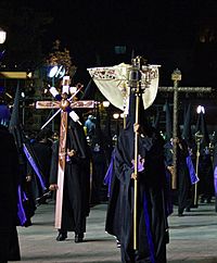
The Procession of Silence is a special event held every year. It remembers the story of Christ's suffering and death. It takes place on the night of Good Friday. The procession starts at the Templo del Carmen and moves through the historic streets of San Luis Potosí. Drums and bugles play music, but the people in the procession and those watching do not speak. This is why it is called the "Procession of Silence." It is one of the most important Easter celebrations in Mexico. In 2013, it was recognized as part of the cultural heritage of the state of San Luis Potosí.
See also
 In Spanish: San Luis Potosí (México) para niños


