Tangamandapio facts for kids
Quick facts for kids
Santiago Tangamandapio
|
||
|---|---|---|

Tangamandapio, Michoacán
|
||
|
||
| Country | ||
| State | Michoacán | |
| Foundation | December 10, 1831 | |
| Elevation | 1,658 m (5,440 ft) | |
| Population
(2010)
|
||
| • Total | 10,463 | |
| Time zone | UTC-6 (Central Standard Time) | |
| • Summer (DST) | UTC-5 (Central Daylight Time) | |
| Postal code |
59920
|
|
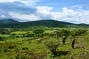
Santiago Tangamandapio, often called Tangamandapio, is a special kind of area in the Mexican state of Michoacán. It is like a local government district. This place is about 165 kilometers (around 102 miles) away from Morelia, which is the capital city of Michoacán.
Tangamandapio is located at 19° 57' North and 102° 26' West. This means it is in the northern half of the Earth and in the western half. The area also includes a community called Tarécuato.
About Tangamandapio
Santiago Tangamandapio was officially founded a long time ago, on December 10, 1831. It is a place with its own unique history and culture within Mexico.
Climate and Weather
Tangamandapio has a climate that gets a lot of rain in the summer and is quite dry in the winter. This type of weather is called a humid subtropical climate.
Summer Weather
During the summer months, from June to September, Tangamandapio gets a lot of rain. This is when the weather is humid, meaning there is a lot of moisture in the air. The temperatures are warm but not extremely hot, usually around 25 to 27 degrees Celsius (77 to 81 degrees Fahrenheit).
Winter Weather
In contrast, the winter months, from December to February, are much drier. There is not much rain during this time. The temperatures are cooler but still mild, often around 15 to 17 degrees Celsius (59 to 63 degrees Fahrenheit).
See also
 In Spanish: Santiago Tangamandapio para niños


