Tartigou River facts for kids
Quick facts for kids Tartigou River |
|
|---|---|

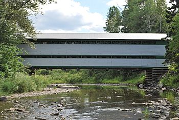
Tartigou river in Métis-sur-Mer.
|
|
| Native name | Rivière Tartigou |
| Country | Canada |
| Province | Quebec |
| Physical characteristics | |
| Main source | Bon-Dieu Lake 48°30′12″N 67°53′46″W / 48.50333°N 67.89611°W |
| River mouth | Baie-des-Sables, Saint Lawrence River 48°45′19″N 67°47′41″W / 48.75528°N 67.79472°W |
| Length | 45 km (28 mi) |
The Tartigou River is a river in Quebec, Canada. It flows for more than 45 kilometers (about 28 miles). This river starts at Bon-Dieu Lake in Saint-Moïse. It ends by flowing into the mighty Saint Lawrence at Baie-des-Sables.
What's in a Name? The Tartigou River's Story
The name Tartigou has an interesting history. It comes from the Mi'kmaq word tlagatigotj. The word Tartig means "river of the little colony." It can also mean "little river of the colony." This tells us a bit about the area's past.
Where Does the Tartigou River Flow?
The Tartigou River gets its water from the Matapedia Valley. This valley is in the Bas-Saint-Laurent region of the Gaspé Peninsula. The river first flows northeast for about 10 kilometers (6 miles). It heads towards a town called Saint-Noël.
After that, the river turns west. It follows a railroad for about 5 kilometers (3 miles). Then, the Tartigou River changes direction again. It flows northeast until it reaches the big Saint Lawrence. This meeting point is in Baie-des-Sables, which is also in the Bas-Saint-Laurent region.
 | Stephanie Wilson |
 | Charles Bolden |
 | Ronald McNair |
 | Frederick D. Gregory |

