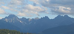
Tatra mountains facts for kids
The Tatra Mountains, also called the Tatras, are a tall mountain range. They form a natural border between two countries: Slovakia and Poland. In both Slovak and Polish languages, they are known as Tatry.
Most of the Tatras are in Slovakia, covering about 600 square kilometers (230 square miles). The highest point in the Tatras is Gerlachovský štít, which is 2,655 meters (8,711 feet) tall and located in Slovakia. The highest peak on the Polish side is Rysy, standing at 2,499 meters (8,199 feet).
The Tatra Mountains are the tallest part of the larger Carpathian Mountains. Even though they are smaller than the famous Alps, they have a similar "alpine" look. This means they have sharp, rocky peaks, deep valleys, and often snow and glaciers. Because they are so grand and easy to visit, many tourists and scientists love to explore them.
Contents
Exploring the Tatra Mountains
The Tatras are a fantastic place for many outdoor activities. People come here to hike, climb, and enjoy the stunning views. There are many trails for different skill levels, from easy walks in the valleys to challenging climbs up steep peaks.
Hiking and Nature Trails
Hiking is one of the most popular ways to see the Tatras. You can find paths that lead through green forests, past sparkling lakes, and up to amazing viewpoints. Many trails are well-marked, making it easy to explore safely. Remember to wear good hiking shoes and bring water!
Wildlife and Plants
The Tatras are home to many unique animals and plants. You might spot a Tatra chamois, which is a type of goat-antelope that lives in the high mountains. There are also brown bears, wolves, and many kinds of birds. The mountains are also rich in beautiful wildflowers, especially in spring and summer.
Unique Animals of the Tatras
One special animal is the Tatra chamois (Rupicapra rupicapra tatrica). These agile creatures are perfectly adapted to life in rocky, high-altitude areas. They have excellent balance and can move quickly across steep slopes. They are a protected species, meaning they are very important to the region's natural heritage.
Plant Life in the Mountains
The plant life changes as you go higher up the mountains. In the lower parts, you'll find forests of spruce and fir trees. Higher up, the trees become smaller and eventually give way to alpine meadows filled with colorful flowers like the Gentiana punctata. These plants are tough and can survive in the cold, windy conditions of the high mountains.
Protecting the Tatras
Both Slovakia and Poland have created national parks to protect the Tatra Mountains. These parks help keep the environment safe for animals and plants, and they also manage tourism so that the mountains remain beautiful for future generations. Rules are in place to ensure visitors respect nature, like staying on marked trails and not leaving any trash.
Images for kids
See also
 In Spanish: Montes Tatras para niños
 | Sharif Bey |
 | Hale Woodruff |
 | Richmond Barthé |
 | Purvis Young |


