
Te Uku Wind Farm facts for kids
Quick facts for kids Te Uku Wind Farm |
|
|---|---|
.jpg)
The wind farm in June 2012
|
|
| Country | New Zealand |
| Location | Te Uku, near Raglan |
| Coordinates | 37°52′42″S 174°57′47″E / 37.87833°S 174.96306°E |
| Status | Operational |
| Construction began | October 2010 |
| Commission date | 19 November 2011 |
| Construction cost | $230m |
| Owner(s) | Meridian Energy and New Zealand |
The Te Uku Wind Farm is a large power station that uses wind to make electricity. It is located near Raglan in a place called Te Uku. This wind farm has 28 huge wind turbines. Together, they can produce 64 megawatts of electricity. That's enough power for many homes!
Building the wind farm finished in March 2011. It cost about $200 million to build. The farm covers a big area, about 2 square kilometers. The Te Uku Wind Farm is owned by two companies: WEL Networks and Meridian Energy.
The idea for the wind farm was approved in May 2008. Construction started in 2010. The companies that built it, Hick Bros Civil and Spartan Construction, even won an award for their planning. The Prime Minister officially opened the wind farm in February 2011. It started working fully on March 10, 2011.
The Te Uku Wind Farm is controlled from Wellington. This is where Meridian Energy has its main control center. From there, they manage all their power stations in New Zealand that use water (hydro) and wind to make electricity.
The electricity from the wind farm travels to the main power network of New Zealand. It connects to the national grid at a place called Te Kowhai substation. This connection uses about 17 kilometers of power lines on 159 steel poles. There's also an underground cable for part of the journey, making the total connection about 25 kilometers long.
Building the Wind Farm
Each wind turbine is very tall, about 130.5 meters high, and weighs 318 tonnes. It took about 2 or 3 days to build each one. Four large cranes were used, with the biggest one able to lift 600 tonnes. The towers of the turbines came in three parts from Korea.
On top of the towers are parts made by Siemens Wind Power. These include an 81-tonne "nacelle" (which is like the engine room of the turbine), a hub, and three long turbine blades. The blades are huge! They are about 49 meters long and weigh 10.9 tonnes each.
Transporting these massive parts was a big job. They were moved by special trucks from September 2010 to January 2011. It was a careful process to get them to the wind farm site.
-
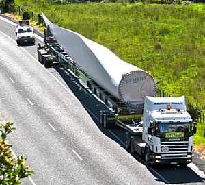
A huge 10.9 tonne, 49-meter long Siemens turbine blade waits on SH23 in November 2010. The road had to be closed for it to pass safely.
-
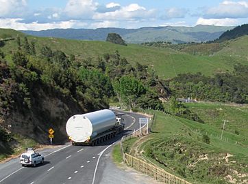
A 54-tonne, 27-meter long part of a wind farm tower, made in Korea, being moved on SH23 in November 2010. It came from Ports of Auckland.
-
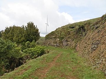
This photo shows a path being made through Okete Volcanics rock. It has been made wider since 2003.
-
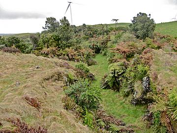
This picture shows Plateau Road, which drops through a rock cutting. It's about 300 meters long, 3 meters wide, and up to 3 meters deep.


Pipiwharauroa Way Walking Track
As part of the wind farm project, a special walking and cycling track was created. It's called Pipiwharauroa Way. This track starts from a car park on Kawhia Road, near the beautiful Bridal Veil Falls.
The track is about 6 kilometers long and climbs 280 meters up to the wind farm on Wharauroa Plateau. You can save some walking by starting from a gate at the end of Plateau Road. From there, you might even see Lake Disappear after it rains a lot!
This track follows an old Maori path. Warriors used to use this path when traveling between Waikato and Kawhia long ago. The road to the wind farm mostly followed this old path, which was first started around 1900 but then left unfinished for many years.
Microwave Tower

Since the mid-1950s, there has been a microwave tower on the hill overlooking Te Uku. This tower helps with communication. Today, it's also part of a "smart metering" network, which helps measure electricity use. There is also a VHF radio repeater near the tower.
