Raglan, New Zealand facts for kids
Quick facts for kids
Raglan
Whāingaroa, or Whaaingaroa
|
|
|---|---|
|
Minor urban area
|
|

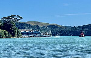
Mt. Karioi, Raglan and Whāingaroa Harbour
|
|
| Country | New Zealand |
| Region | Waikato |
| District | Waikato District |
| Ward | Raglan Ward |
| Community | Raglan Community |
| Electorates |
|
| Area | |
| • Total | 7.22 km2 (2.79 sq mi) |
| Population
(June 2023)
|
|
| • Total | 3,880 |
| • Density | 537.4/km2 (1,391.8/sq mi) |
| Postcode(s) |
3225
|
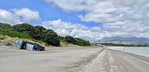
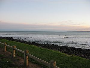
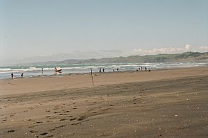
Raglan (Māori: Whāingaroa or Rakarana) is a small town on the coast of New Zealand. It is about 48 kilometers west of Hamilton, New Zealand. Raglan is famous for its amazing surfing waves. It also has unique black sand beaches, which come from volcanoes.
Contents
Raglan's History
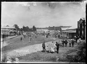
The Ngāti Māhanga people, a Māori tribe, lived around Raglan in the late 1700s. There are many old sites in the area, mostly near the coast. Some of these sites date back to about 1400 AD. The Māori people called this place Whaingaroa, which means "the long pursuit."
The first Europeans to live here were missionaries, James and Mary Wallis, in 1835. Local Māori welcomed them. More Europeans moved in during the mid-1850s. This happened after a large amount of land was sold by a Māori chief named Wiremu Neera Te Awaitaia.
The town was named "Raglan" in 1858. This name honors Fitzroy Somerset, 1st Lord Raglan. He was a British leader in the Crimean War (1853–1856).
Raglan's economy first grew by exporting flax and timber. Later, farming became the main way people made a living. Farming is still very important today.
Raglan got its first coach service to Hamilton in 1880. A telegraph wire was set up in 1884, and telephones arrived in 1904. The town got electricity in 1935 and a sewage system in 1977.
Today, tourism and art are big parts of Raglan's economy. The Raglan and District Museum has old items and records from the area. A new museum building was built in 2011. You can also see some of the museum's collection online.
Raglan's Wharves
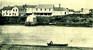
Raglan has had four main jetties, also called wharves. These are like docks where boats can load and unload goods.
How Goods Traveled
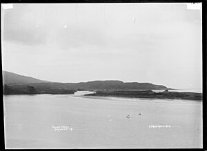
In 1878, the government helped start regular boat services from Manukau Harbour. These trips took about 8 hours. Before the main road was paved in 1921, most goods came and went by sea. The wharf was very important until the 1950s. In 1954, 38 ships handled over 15,000 tons of goods.
One problem was the shallow sandbar at the harbor entrance. Large ships sometimes got stuck there. In the 1960s, new ferries that could carry trucks and cars made small ports less important. Many workers at the wharf lost their jobs. Since 1982, only fish from fishing boats have been unloaded at the harbor.
Four Public Wharves
Before 1874, goods were moved directly off the beach. A small wooden jetty was built in 1874. This was replaced by a stone jetty in 1881, which is still there today.
In 1889, a long wooden pier was built. This allowed bigger ships to dock in deeper water. Only two old wooden piles remain from that pier. The current concrete wharf opened in 1921. It was made bigger in the 1960s and 70s to handle cement for building projects. In 2010, a fire destroyed the old shed on the wharf. In 2023, a floating dock was added to the wharf.
Raglan Airfield History
In the 1970s, Raglan became a place where people protested peacefully. During World War II (1939–1945), the New Zealand government took land from local Māori families. They built a military airfield on this land.
After the war, the government did not give all the land back. Instead, a 62-acre part of it became a public golf course in 1968. This led to many protests. In 1978, 20 Māori protesters were arrested on the golf course.
Eventually, the land was returned to its original Māori owners. This event became important for the Māori sovereignty movement. In 2021, the council suggested that returning the rest of the land could still take time. In August 2022, local leaders voted to start the process of returning the airfield land to its Māori owners.
Raglan's Population Growth
In 1859, the population of Whāingaroa was about 424 Māori people. There were also about 122 Europeans. Many Europeans left in 1860 and 1863 because of war threats.
After that, Raglan's population grew slowly. It increased more after the main road to Hamilton was paved in 1921. It grew even more after the road was fully sealed with tar in 1961.
The Raglan area had 4,680 people in 2006. This number grew to 4,920 in 2013. The graph below shows how Raglan's population has changed over the years.
<graph>{ "version": 2, "width": 850, "height": 200, "padding": "auto", "data": [ { "name": "table", "values": [ { "year": 1878, "population": 68 }, { "year": 1881, "population": 70 }, { "year": 1886, "population": 56 }, { "year": 1891, "population": 83 }, { "year": 1896, "population": 137 }, { "year": 1901, "population": 114 }, { "year": 1906, "population": 154 }, { "year": 1911, "population": 246 }, { "year": 1916, "population": 217 }, { "year": 1921, "population": 302 }, { "year": 1931, "population": 350 }, { "year": 1936, "population": 377 }, { "year": 1945, "population": 518 }, { "year": 1951, "population": 895 }, { "year": 1961, "population": 1013 }, { "year": 1971, "population": 1058 }, { "year": 1981, "population": 1414 }, { "year": 1991, "population": 2316 }, { "year": 1996, "population": 2634 }, { "year": 2001, "population": 2667 }, { "year": 2006, "population": 2637 }, { "year": 2013, "population": 2736 }, { "year": 2018, "population": 3279 } ] }, { "name": "annotation", "values": [ { "start": 2000, "end": 2000, "text": "" }, { "start": 2000, "end": 2000, "text": "" } ] } ], "scales": [ { "name": "x", "type": "ordinal", "range": "width", "zero": false, "domain": { "data": "table", "field": "year" } }, { "name": "y", "type": "linear", "range": "height", "nice": true, "domain": { "data": "table", "field": "population" } }, { "name": "color", "type": "ordinal", "domain": { "data": "annotation", "field": "text" }, "range": [ "#ddd", "#ffc0cb" ] } ], "axes": [ { "type": "x", "scale": "x", "format": "d", "title": "Year", "ticks": 15 }, { "type": "y", "scale": "y", "title": "population", "grid": true } ], "marks": [ { "type": "rect", "from": { "data": "annotation" }, "properties": { "enter": { "x": { "scale": "x", "field": "start" }, "x2": { "scale": "x", "field": "end" }, "y": { "value": 0 }, "y2": { "signal": "height" }, "fill": { "scale": "color", "field": "text", "value": "steelblue" }, "width": { "scale": "x", "band": "true", "offset": -1 } } } }, { "type": "line", "from": { "data": "table" }, "properties": { "enter": { "interpolate": { "value": "monotone" }, "x": { "scale": "x", "field": "year" }, "y": { "scale": "y", "field": "population" }, "stroke": { "value": "steelblue" }, "strokeWidth": { "value": 3 } } } }, { "type": "symbol", "from": { "data": "table" }, "properties": { "enter": { "x": { "scale": "x", "field": "year" }, "y": { "scale": "y", "field": "population" }, "stroke": { "value": "steelblue" }, "fill": { "value": "white" }, "size": { "value": 30 } } } }, { "type": "text", "properties": { "enter": { "x": { "signal": "width", "mult": 0.5 }, "y": { "value": -10 }, "text": { "value": "population" }, "fill": { "value": "black" }, "fontSize": { "value": 16 }, "align": { "value": "center" }, "fontWeight": { "value": "bold" } } } } ], "legends": [ { "fill": "color", "title": "", "properties": { "symbols": { "strokeWidth": { "value": 0 } }, "legend": { "": { "value": 5 }, "fill": { "value": "white" } } } } ] }</graph>
Raglan covers about 7.22 square kilometers. As of 2018, it had an estimated population of 3,279 people. This means there were about 454 people per square kilometer.
In 2018, Raglan's population was 3,279. This was a big increase of 573 people since 2013. There were 1,251 households. The average age was 39.6 years. About 20.5% of the people were under 15 years old.
Most people in Raglan (82.9%) were European/Pākehā. About 26.5% were Māori. Other groups included Pacific peoples (2.9%) and Asian (2.5%). About 21.4% of people were born outside New Zealand.
Many people (61.8%) said they had no religion. About 25.1% were Christian.
Looking ahead, Raglan expects to have about 500 more households by 2045. The population could reach 12,500 by 2070. Property prices have gone up a lot since 2000.
Marae in Raglan
Raglan has several marae nearby. A marae is a special meeting place for Māori people. These marae are connected to different hapū (sub-tribes) of Waikato Tainui.
- Poihākena Marae is a meeting place for Ngāti Tāhinga and Tainui hapū.
- Te Kōpua Marae is a Tainui meeting place. Its meeting house was destroyed in 1941 to build the airfield.
- Te Kaharoa Marae is for Ngāti Māhanga and Ngāti Tamainupō. It is near the Waitetuna valley.
Another meeting place, Mai Uenuku ki te Whenua Marae, is in the inner harbor. In 2020, the government gave money to upgrade this marae. This project also created 8 jobs.
Raglan's Geography
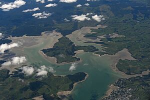
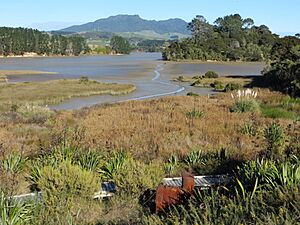
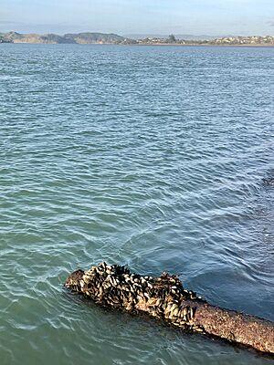
Raglan is on the west coast of New Zealand's Waikato region. It is located on the Whāingaroa Harbour, also known as Raglan Harbour. The harbor is 12 kilometers long and usually less than 2 kilometers wide.
The harbor is a "drowned river valley." This means it was once a river valley that filled with seawater. It is the northernmost of three large inlets on the Waikato coast. The other two are Aotea Harbour and Kawhia Harbour.
Many rivers and streams flow into the harbor. The biggest are the Waingaro and Waitetuna rivers. These two rivers drain 60% of the land around the harbor.
Most of the land around the harbor (70%) is used for farming. About 20% is covered in native plants.
Southwest of Raglan town is the old volcano, Mt Karioi. A Māori legend says Karioi was a princess who lay down to rest after losing her love.
North of the harbor mouth, there are large sand dunes and lakes. These dunes and beaches have a lot of ironsand. People have thought about mining this sand many times. Groups like KASM, based in Raglan, have formed to oppose seabed mining.
The area also has the beautiful Bridal Veil Falls. These falls are about 20 kilometers southeast of Raglan. Another interesting spot is Lake Disappear, which sometimes vanishes!
Raglan's Suburbs
Raglan has several suburbs, which are smaller areas or neighborhoods within the town.
Raglan East
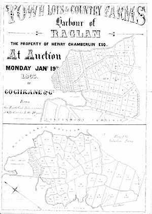
Raglan East was the first suburb of Raglan. It was created when Henry Chamberlin sold his land in 1863.
Raglan West
Raglan West grew after a farm was surveyed between 1940 and 1952. This farm included the site of an old missionary station.
Rangitahi
Rangitahi was once a farm. In 2019, a concrete bridge was built from Raglan West to Rangitahi. Work then started to build over 550 new houses in stages on 117 hectares of land.
Raglan's Climate
Raglan has a mild climate. The average rainfall is about 1.354 meters per year. The average high temperature in February is 24°C. The average low temperature in July is 8°C. Raglan usually has very few frosty mornings in winter.
| Climate data for Raglan, New Zealand (1981–2010) | |||||||||||||
|---|---|---|---|---|---|---|---|---|---|---|---|---|---|
| Month | Jan | Feb | Mar | Apr | May | Jun | Jul | Aug | Sep | Oct | Nov | Dec | Year |
| Mean daily maximum °C (°F) | 23.3 (73.9) |
23.9 (75.0) |
22.5 (72.5) |
19.9 (67.8) |
16.9 (62.4) |
14.6 (58.3) |
14 (57) |
14.8 (58.6) |
16.2 (61.2) |
17.7 (63.9) |
19.7 (67.5) |
21.6 (70.9) |
18.8 (65.8) |
| Daily mean °C (°F) | 18.6 (65.5) |
19.1 (66.4) |
17.7 (63.9) |
15.3 (59.5) |
12.6 (54.7) |
10.4 (50.7) |
9.6 (49.3) |
10.5 (50.9) |
12 (54) |
13.5 (56.3) |
15.3 (59.5) |
17.1 (62.8) |
14.3 (57.8) |
| Mean daily minimum °C (°F) | 13.9 (57.0) |
14.3 (57.7) |
13 (55) |
10.8 (51.4) |
8.3 (46.9) |
6.2 (43.2) |
5.3 (41.5) |
6.3 (43.3) |
7.9 (46.2) |
9.4 (48.9) |
11 (52) |
12.6 (54.7) |
9.9 (49.8) |
| Average precipitation mm (inches) | 88 (3.5) |
83 (3.3) |
99 (3.9) |
106 (4.2) |
128 (5.0) |
151 (5.9) |
149 (5.9) |
131 (5.2) |
120 (4.7) |
113 (4.4) |
104 (4.1) |
107 (4.2) |
1,379 (54.3) |
| Source: Climate Data | |||||||||||||
Education in Raglan
Raglan Area School is a state school for all students from Year 1 to Year 13. It has about 500 students. Schools have been in Raglan since 1866. The current school opened in 1937.
There are also primary schools in nearby places like Te Mata, Te Uku, and Waitetuna. Many students from these schools come to Raglan Area School for high school. This is because it is close by and welcoming.
Surfing in Raglan
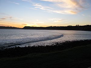
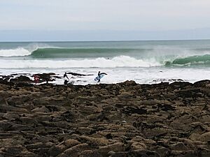
Raglan is most famous for its surfing. About eight kilometers from town, there are several great surf spots. These include Indicators, Whale Bay, Manu Bay, and Vortex Bay. Manu Bay was even shown in the 1966 movie The Endless Summer. The Māori name for Manu Bay is 'Waikeri', meaning "surging or swirling waters."
- Indicators is a left-hand wave that can break for up to 600 meters. It is a fast wave with occasional hollow sections.
- Whale Bay is also a left-hand wave, breaking up to 200 meters long. It has an inner section close to the rocks and a slower outer section.
- Manu Bay is another left-hand wave, breaking over 300 meters. It has both hollow and wall sections.
- Vortex Bay is a softer wave that breaks when the main surf spots are too big.
There is also a beach break further from Manu Point. Ruapuke is another beach break further west.
Raglan hosted a world championship surfing event at Manu Bay in 1998. Raglan is also home to New Zealand's first official surf school, which started in 1999.
Arts and Culture
Raglan has a lively arts scene. Visual artists often show their work at the Raglan Old School Art Centre. Fabric artists display their creations in the ArtoWear competition every two years. There is also an Arts Trail Guide, with an Open Studio Weekend in January. For Matariki, there are displays of Māori art. You can see local art in galleries and cafes around town. The Arts Centre is in an old school building from the 1800s.
Local Markets
Every second Sunday of the month, there is a market at the Raglan Old School Arts Centre. This Raglan Creative Market sells local crafts, food, and art.
Music Scene
Raglan has a great live music scene. The International Soundsplash Eco Reggae Festival used to happen every summer. It brought in big names in reggae and dub music.
The main place for live music in Raglan is the Yot Club. Many New Zealand musicians play there. You can also find live music at the Orca Restaurant and Bar, the Harbour View Hotel, and The Raglan Club.
New Zealand reggae bands like Cornerstone Roots and Zionhill started in Raglan.
Walking and Cycling
Whāingaroa has many different walks. You can take an easy stroll over the footbridge. Or, you can try the harder tracks on Mount Karioi. Walking has been popular here since at least 1915.
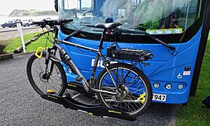
Raglan is also good for cycling. Parts of a "Town2Surf" cycle lane have been built. This lane will connect the town to Ngarunui Beach. The Te Ara Kākāriki Ocean Trails opened in 2016. These trails offer about 4 kilometers of mountain bike trails in a pine forest. There used to be a bike race around Mt Karioi every July.
Protecting the Environment
Raglan has many people who care deeply about the environment. This is shown by the number of environmental groups in the area. Many people in Raglan support the Green Party.
Local government policy also recognizes Raglan's passion for protecting its environment.
Whāingaroa Harbour Care
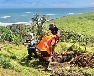
Whāingaroa Harbour Care is a group that started in 1995. They have planted over 2 million trees to help the harbor.
The group formed after people discussed the poor state of the harbor. They set up a plant nursery to grow native trees from local seeds. These trees are planted along streams to stop pollution from running into the harbor. By 2013, over 40 farmers had fenced and planted about 450 kilometers of stream banks.
Recycling Efforts
Recycling in Raglan is managed by a non-profit group called Xtreme Zero Waste. Their goal is to create a waste management system where no waste goes to landfills. The group started in 2000 after Raglan's old landfill closed.
Xtreme Waste has recycled more and more waste each year. By 2010, they were stopping almost three-quarters of the town's waste from going to landfills. They have a recycling center that is open to the public.
Actor Antonio Te Maioha, who lives in Raglan, has talked about how good Raglan is at recycling. He mentioned that Raglan is one of the few towns in New Zealand with recycling bins on the main street.
Raglan's Water Supply
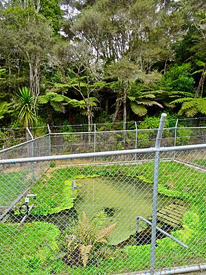
Raglan gets its water from a well and a spring called Waipatukahu (or Riki) Spring. This spring is about 3 kilometers south of Raglan. The water comes from rain that soaks into volcanic rocks.
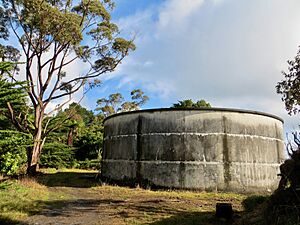
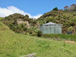
The water is treated with chlorine. Then, it is pumped to a large tank and sent through about 42 kilometers of pipes. Two other tanks help keep the water pressure steady. Raglan uses less than half of the water it is allowed to take from the spring. Water meters were planned to be installed by 2017.
Water Supply History
The Riki Spring has been used for fresh water for a long time. In 1862, a dam was built there to power a flax mill. In the 1950s, the spring powered a water-wheel to pump water for a farm.
Many residents used to get water from their own wells or rainwater tanks. In 1938, people asked the council for a public water supply. The DSIR (a science department) reported on the Waipatukahu Spring. They said it had "beautifully clear water" and a good flow.
In 1961, the council finally got a loan to bring water from Riki Springs. A pump lifted the water up a hill to tanks. From there, it flowed by gravity to the town.
In October 1963, a dry spell caused water shortages. By Christmas 1963, houses were getting water from the new pipes. The water supply was upgraded in 1972. In 1981, another large water tank was built.
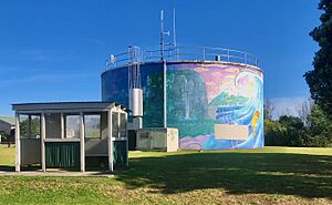
In the late 1980s, a mural was painted on one of the water towers. It was repainted in 2015.
Famous People from Raglan
- Angeline Greensill (born 1948), a Māori rights activist and scholar.
- Anna Coddington, a modern musician.
- Antonio Te Maioha (born 1970), an actor.
- Dave Currie (born 1945), a sports leader.
- Joan Fear (1932–2022), a painter.
- Hallyburton Johnstone (1897–1970), a Member of Parliament and farmer.
- David Pretty (1878–1947), a champion axeman and athlete.
- Edward Puttick (1890–1976), a retired soldier.
- Eva Rickard (1925–1997), a Māori rights activist.
- Cort and Annie Jane Schnackenberg, missionaries in the 1860s–1870s.
- Jordan Riki (2000–2017), a rugby league player for the Brisbane Broncos and Māori All Stars.
 | Ernest Everett Just |
 | Mary Jackson |
 | Emmett Chappelle |
 | Marie Maynard Daly |


