Tenabo facts for kids
Quick facts for kids
Tenabo
|
||
|---|---|---|
|
||
| Country | ||
| State | Campeche | |
| Municipality | Tenabo | |
| Founded | 1450 | |
| Encomienda | 1544 | |
| Elevation | 10 m (30 ft) | |
| Population
(2010)
|
||
| • Total | 7,543 | |
| Time zone | UTC−6 (Central (US Central)) | |
| • Summer (DST) | UTC−5 (Central) | |
| Postal code |
24700
|
|
| Area code(s) | 996 | |
| Demonym | Tenabeño | |
| Website | www.tenabo.gob.mx | |
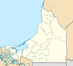
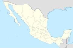
Tenabo is a city found in the Mexican state of Campeche. It's located in the northern part of the state. The city is about 35 kilometers (22 miles) from Campeche, which is the state capital. It's also 110 kilometers (68 miles) from Mérida, Yucatán. You can reach Tenabo by using Federal Highway 180. Tenabo is also the main city, or municipal seat, for the municipality of the same name. In 2010, about 7,543 people lived in Tenabo.
Geography of Tenabo
Tenabo is located in a part of Mexico that has a warm climate. Understanding the climate helps us know what the weather is usually like there.
Tenabo's Climate
The climate in Tenabo is generally warm throughout the year. It has distinct wet and dry seasons. The information below shows the average temperatures and rainfall for the city.
| Climate data for Tenabo (1951–2010) | |||||||||||||
|---|---|---|---|---|---|---|---|---|---|---|---|---|---|
| Month | Jan | Feb | Mar | Apr | May | Jun | Jul | Aug | Sep | Oct | Nov | Dec | Year |
| Record high °C (°F) | 38.2 (100.8) |
39.0 (102.2) |
41.9 (107.4) |
44.0 (111.2) |
46.2 (115.2) |
42.5 (108.5) |
39.5 (103.1) |
39.5 (103.1) |
38.5 (101.3) |
37.3 (99.1) |
39.3 (102.7) |
38.8 (101.8) |
46.2 (115.2) |
| Mean daily maximum °C (°F) | 30.3 (86.5) |
32.0 (89.6) |
34.6 (94.3) |
36.9 (98.4) |
36.9 (98.4) |
35.4 (95.7) |
34.5 (94.1) |
34.5 (94.1) |
33.6 (92.5) |
32.4 (90.3) |
31.3 (88.3) |
30.1 (86.2) |
33.5 (92.3) |
| Daily mean °C (°F) | 24.0 (75.2) |
25.0 (77.0) |
27.5 (81.5) |
29.7 (85.5) |
30.0 (86.0) |
29.4 (84.9) |
28.6 (83.5) |
28.6 (83.5) |
28.2 (82.8) |
26.8 (80.2) |
25.2 (77.4) |
23.9 (75.0) |
27.2 (81.0) |
| Mean daily minimum °C (°F) | 17.7 (63.9) |
18.1 (64.6) |
20.5 (68.9) |
22.5 (72.5) |
23.1 (73.6) |
23.5 (74.3) |
22.8 (73.0) |
22.7 (72.9) |
22.8 (73.0) |
21.1 (70.0) |
19.1 (66.4) |
17.7 (63.9) |
21.0 (69.8) |
| Record low °C (°F) | 9.5 (49.1) |
8.5 (47.3) |
8.5 (47.3) |
10.5 (50.9) |
16.1 (61.0) |
15.6 (60.1) |
19.0 (66.2) |
19.1 (66.4) |
19.1 (66.4) |
10.5 (50.9) |
10.0 (50.0) |
8.3 (46.9) |
8.3 (46.9) |
| Average precipitation mm (inches) | 21.7 (0.85) |
8.9 (0.35) |
13.4 (0.53) |
20.7 (0.81) |
88.3 (3.48) |
161.0 (6.34) |
145.0 (5.71) |
174.6 (6.87) |
219.9 (8.66) |
102.9 (4.05) |
41.5 (1.63) |
29.4 (1.16) |
1,027.3 (40.44) |
| Average precipitation days (≥ 0.1 mm) | 2.7 | 1.2 | 1.1 | 1.4 | 4.7 | 9.9 | 11.5 | 11.8 | 12.8 | 8.0 | 3.5 | 2.1 | 70.7 |
| Source: Servicio Meteorológico National | |||||||||||||
See also
 In Spanish: Tenabo para niños
 | Anna J. Cooper |
 | Mary McLeod Bethune |
 | Lillie Mae Bradford |


