
Campeche facts for kids
Quick facts for kids
Campeche
|
||
|---|---|---|
| Free and Sovereign State of Campeche Estado Libre y Soberano de Campeche (Spanish) Xóot' Noj Lu'umil Kaampech (Yucatec Maya) |
||
|
||
| Anthem: Himno Campechano | ||
 Location in Mexico Location in Mexico Campeche and its neighbors Campeche and its neighbors |
||
| Country | Mexico | |
| Capital and largest city |
San Francisco de Campeche | |
| Municipalities | 13 | |
| Admission | April 29, 1863 | |
| Order | 25th | |
| Area | ||
| • Total | 57,507 km2 (22,204 sq mi) | |
| Ranked 17th | ||
| Highest elevation | 390 m (1,280 ft) | |
| Population
(2020)
|
||
| • Total | 928,363 | |
| • Rank | 30th | |
| • Density | 16.14348/km2 (41.8114/sq mi) | |
| • Density rank | 29th | |
| Demonym(s) | Campechano (a) | |
| GDP | ||
| • Total | MXN 521 billion (US$25.9 billion) (2022) |
|
| • Per capita | (US$27,562) (2022) | |
| Time zone | UTC−6 (CST) | |
| Postal code |
24
|
|
| Area code |
Area codes
|
|
| ISO 3166 code | MX-CAM | |
| HDI | ||
| a. Separated from Yucatán on May 3, 1858, was federal territory from 1858 to 1863. | ||

Campeche (Yucatec Maya: Kaampech), officially known as the Free and Sovereign State of Campeche, is one of the 31 states that, along with Mexico City, form the 32 Federal Entities of Mexico. It is located in southeast Mexico. Campeche shares borders with Tabasco to the southwest, Yucatán to the northeast, and Quintana Roo to the east. To the south, it borders the Petén region of Guatemala, and to the southeast, the Orange Walk District of Belize. To the west, it has a coastline along the Gulf of Mexico.
The capital city, also called Campeche, was named a World Heritage Site in 1997. This means it is a place of special cultural or physical importance recognized by UNESCO. The state's history began with this city, founded by the Spanish in 1540 during their conquest of the Yucatán Peninsula. Campeche City was a rich and important port during the time Mexico was a Spanish colony. However, it became less important after Mexico gained independence.
Campeche was once part of the larger Yucatán province. It became a separate state in the mid-19th century due to political disagreements, mainly with the city of Mérida. A big reason for Campeche's recent economic growth is the discovery of oil offshore in the 1970s. This made coastal cities like Campeche and Ciudad del Carmen very important for the economy. The state also has many important Maya and colonial sites.
The state's government has two main parts. The governor of Campeche leads the executive branch, like a president for the state. The legislative branch, which makes laws, is called the Congress of Campeche. It has 35 members called deputies.
Contents
- What's in a Name? The Meaning of Campeche
- Exploring Campeche's Geography
- A Look at Campeche's Past
- Campeche's Economy: What People Do
- Campeche's Vibrant Culture
- Learning in Campeche: Education
- Who Lives in Campeche? Demographics
- How Campeche is Divided: Municipalities
- Connecting Campeche: Communications and Transportation
- Discovering Campeche: Tourism
- Images for kids
- See also
What's in a Name? The Meaning of Campeche
The name Campeche comes from "Can Pech." This was the Maya name for a local kingdom that existed when the Spanish arrived in the 1500s. The main city of Can Pech was called "Ah-Kin-Pech," which is where Campeche City is today.
When the Spanish first landed in 1517, they named the area Lazaro. This was because they arrived on St. Lazarus' Sunday. The original Maya name "Can Pech" means "place of snakes and ticks."
Exploring Campeche's Geography
Campeche is a mostly flat part of Mexico. It has about 523 kilometers (325 miles) of coastline along the Gulf of Mexico. Most of the land is made of sedimentary rock, which often forms from layers of sand and mud in ancient seas.
The highest areas are found near the borders with Guatemala and Quintana Roo. However, these hills are separated by large flat lands. In the south, there are rolling hills called the Sierra Alta or Puuc. These hills are usually between 40 and 60 meters (130-200 feet) high, with some reaching 100 meters (330 feet).
Campeche's Rich Plant and Animal Life
Campeche is home to many types of rainforests. These include tall, evergreen forests and forests where trees lose their leaves in some seasons. Away from the coast, you can find open grassland areas called savannas. Along the coast, there are sand dunes, mangrove wetlands, and estuaries (where rivers meet the sea).
Some important trees in the rainforests are Spanish cedar, oxhorn bucida, and wild tamarind. You can also find valuable tropical hardwoods like mahogany. Along the coast, palm trees like coconut and royal palms are common.
The state's wildlife includes amazing animals like the jaguar, ocelot, puma, deer, and Yucatan spider monkey. Many bird species live here, such as pelicans and toucans. Reptiles include rattlesnakes, boa constrictors, and crocodiles. Even though there's still a lot of wildlife, some populations have shrunk because of farming, logging, and hunting. The Bay of Campeche is rich in sea life, including many types of fish, crabs, and oysters.
Rivers and Waterways of Campeche
Most of Campeche's fresh water, like rivers and small lakes, is in the south and southwest. In the north, rainwater quickly sinks into the ground. The rivers in the south and southwest flow into different river systems. The largest is the Grijalva River, which includes the Candelaria, Chumpán, and Mamantal Rivers. The Usumacinta River also flows through the state.
The Laguna de Términos is a large lagoon in the southwest, close to the Tabasco border. It is separated from the Gulf of Mexico by Isla del Carmen. This lagoon gets fresh water from Campeche's rivers and salt water from the Gulf. This mix of fresh and salt water creates a special home for many sea creatures like sea bass, small sharks, crabs, and oysters. It is the most important lake-lagoon system in Mexico.
Climate and Natural Regions
Campeche is in the tropics, so it has a humid climate. It has a clear rainy season and a drier season from late winter to early spring. The average yearly rainfall is between 900 and 2000 millimeters (35-79 inches). The hottest and most humid areas are along the coast. The average temperature is 26°C (79°F), with summer highs up to 36°C (97°F) and winter lows of 17°C (63°F).
The state has different natural environments, from rainforests to savannas, coasts, and the sea. It is divided into four main environmental regions:
- Coastal Region: This includes the entire coastline and shallow waters offshore with coral reefs and small islands. It has large areas of mangroves and palm trees. Birds and reptiles like storks, pelicans, and turtles are common here.
- Mountain Region: In the north and east, this region has low hills and savannas. It is known for tropical hardwoods and the chicle or gum tree. Deer, armadillos, and quail live here.
- Rainforest Region: Located in the center and south, this area has many types of trees, including mahogany. Many plants used in local cooking, like achiote and tropical fruits, come from here.
- River Region: In the southwest, this region is named after its many rivers that flow into the Laguna de Términos. It has the hottest and most humid climate in Campeche.
Protected Natural Areas
Campeche has four important protected areas that help save its unique nature:
- Calakmul Biosphere Reserve: This huge reserve, created in 1989, covers over 723,185 hectares (1.7 million acres). It protects different types of moist forests and aquatic plants.
- Laguna de Términos Reserve: Established in 1994, this reserve covers the lagoon and its surroundings, about 705,017 hectares (1.7 million acres).
- Ría Celestún Biosphere Reserve: This area protects coastal ecosystems.
- Los Petenes Biosphere Reserve: This reserve has isolated patches of rainforest mixed with mangrove areas. Its wildlife depends on a complex system of fresh and brackish water. It covers about 382 hectares (944 acres).
A Look at Campeche's Past

The first people to live in and rule the Campeche area were the Maya. They came from places like Guatemala, Honduras, and Chiapas. Important Maya cities in Campeche included Edzná, Xtampak, and later Calakmul and Becán. The Maya civilization was at its strongest between 600 AD and 900 AD. After 1000 AD, for reasons still unknown, many Maya cities were left empty. This led to smaller settlements and a mix of Maya and Chontal people in the south.
Spanish Arrival and Pirate Attacks
The first Spaniards arrived in 1517, led by Francisco Hernández de Córdoba. They landed at a Maya village called Can-Pech. He renamed it San Lázaro. Later, he and his men were attacked by warriors in Chakanputon (now Champotón). Hernández de Córdoba died from his injuries, and the Spanish called this area the "Bay of the Bad Fight."
The Spanish began their serious conquest of Campeche and the Yucatán Peninsula in 1540. They introduced new crops like sugar cane. However, the most important part of the area was the port of Campeche, founded in 1540 on the site of the old Maya village.
During the colonial period, Campeche was a very busy port, as important as Havana in Cuba. It shipped valuable goods like farm products, tropical woods, and logwood (a dye used in Europe). Gold and silver from other parts of Mexico also passed through here on their way to Spain. Luxury items like Italian marble were imported.
Because it was so rich, the city of Campeche attracted buccaneers and pirates like John Hawkins and Henry Morgan. These pirates were a constant threat. Most attacks were on the port of Campeche, but Champotón also suffered. To protect itself, the city of Campeche began building forts and walls as early as 1610.
The worst pirate attack happened in 1685, when Laurens de Graaf and his crew raided Campeche City and the surrounding farms for over a month. They killed about a third of the people living there. This led to much stronger defenses, including a large wall around the city that was 2,560 meters (8,400 feet) long. Most of the forts still stand today, but only about 500 meters (1,640 feet) of the original wall remain. These defenses greatly reduced pirate attacks. Campeche was officially recognized as a city in 1774.
From Colony to State
Campeche remained a wealthy port until the early 1800s. In 1811, a new port opened in Sisal, Yucatán, taking away much of Campeche's trade. Also, when Mexico gained independence, slavery was abolished, which affected farming.
In September 1821, Campeche declared its support for Mexico's independence. At first, Campeche and Mérida were the two most important cities on the Yucatán Peninsula. However, they had political differences. Campeche was more liberal and supported a federal republic for Mexico. In 1824, Campeche wanted the peninsula to be divided into two states, but this didn't happen.
Later, both cities joined an uprising in 1839 to create an independent state of Yucatán. After some victories, the Yucatán declared independence in 1841. But this didn't solve the internal problems. Campeche wanted to rejoin Mexico because its trade with Mexico City was cut off. More fighting came with the Caste War in 1847, a rebellion by indigenous people. This, along with other pressures, led the Yucatán to formally rejoin Mexico in 1849.
The Mexican Constitution of 1857 finally led to the split between Campeche and Mérida. In 1858, representatives from both cities signed an agreement to divide the peninsula, making the separation official.
During the French Intervention in Mexico, French forces took Campeche. But local fighters later defeated them and regained the state's independence in 1867.
Modern Campeche: Oil and Growth
During the Mexican Revolution, people in Campeche also fought for change. Slavery on large farms was ended. In 1917, Campeche wrote its current constitution.
The state's economy started to improve in the 1950s with more fishing and logging. But the biggest change came with the discovery of oil offshore in the Sonda de Campeche in the 1970s. A fisherman named Rudesindo Cantarell found an oil slick in 1971. By 1975, the first oil platform, Chac Number One, began operating.
This oil discovery made Campeche the top oil producer in Mexico, providing 70% of the country's oil. The oil boom caused the population of Campeche City to triple in ten years. Ciudad del Carmen, once a small fishing village, also grew rapidly. This oil money helped to restore Campeche City starting in the 1980s. Many old buildings were bought and restored to become museums, schools, and theaters. More than a thousand building fronts and monuments in the historic center were fixed up.
In the 1990s, new factories, especially textile mills, opened in the state. The capital city was declared a World Heritage Site by UNESCO. The newest municipality, Candelaria, was created in 1998. In 2017, a long-standing border dispute with Quintana Roo was settled, giving Campeche more land.
Campeche's Economy: What People Do
Campeche contributes about 1.83% to Mexico's total economy. The average yearly salary in the state is higher than the national average. However, there's a big difference between high-paid oil workers (many from outside the state) and local people who don't work for the national oil company, PEMEX.
Most land (61%) is owned as community property under the ejido system. About 29% is privately owned. Most homes (three out of four) are in cities and usually have basic services like running water and electricity. Rural homes often use local materials like wood or palm fronds.
Farming, Fishing, and Forests
Only 3.3% of the state's land is used for growing crops because of the soil. Most of this is for seasonal crops like corn, rice, and sorghum. Other important crops include jalapeño chili peppers, watermelon, and tropical fruits like citrus and mango.
Cattle are raised in the center and south of the state for meat and milk. In the north, chickens and turkeys are common. Forestry, which means cutting down trees for wood, is still important, even though some forests have been damaged. Fishing is big along the coast, with shrimp being the most valuable catch.
Industry and Oil Production
The industrial part of Campeche's economy is mostly in the coastal areas. Mining, especially oil production, makes up 52.8% of the state's economy. The oil is found offshore in the Sonda de Campeche. Campeche produces 37% of Mexico's total oil and gas.
Campeche doesn't have metal mines, but it has building materials like sandstone, marble, and limestone. There are also deposits of sand, gravel, and clay. In the far north, there are important salt deposits.
Construction and manufacturing make up 6.7% of the state's economy. The most common industries are related to food, like seafood processing, soft drinks, and sugar. Other industries make building materials like cinderblocks and wood products. Since the 1990s, "maquiladora" factories (which assemble products for export) have opened in the state, making things like shirts and other textiles.
Trade and Tourism
Trade and services make up 33.2% of Campeche's economy. Most businesses are small and serve local needs. In larger cities, you can find supermarkets and malls. The state trades seafood, farm products, and wood with other places. All oil products are sold by the national oil company, PEMEX.
Campeche has about 500 businesses related to tourism. About half of these are restaurants, and many are bars or handicraft shops. There are 126 major hotels, mostly in Campeche City, Ciudad del Carmen, and Champotón.
Campeche's Vibrant Culture

Campeche has two main government-supported cultural festivals: the Festival del Centro Histórico and the Festival de Jazz. The Festival del Centro Histórico happens in November and December. It brings together many artists, thinkers, and scholars for concerts, theater, dance, and workshops. The Festival de Jazz started in 1999 and has featured famous jazz musicians. Another fun event is the "Jipi" Sombrero Festival in Bécal in April and May.
Festivals and Music
The biggest religious festival in the state is Carnival in Campeche City. Carnival started in 1582. Over time, it grew to include orchestras and formal dances. Later, street parties became popular, with different neighborhoods organizing their own events. Now, it's a city-wide celebration with traditional dances like Baile del Pavo and various forms of tropical jaranas.
Other important religious festivals include:
- Candlemas (Candelaria) in Hool, Champotón, and Campeche.
- Feast day of Our Lady of Mount Carmen in Ciudad del Carmen.
- Feast day of Saint Joachim in Palizada.
- Feast day of Saint Roman in Campeche.
- Feast of San Isidro Labrador in Calkiní in May.
- Feast of the Cristo Negro in San Román.
- Day of the Dead (celebrated throughout the state).
- Feast of the Holy Cross in Sabancuy, Carmen in May.
- Feast of Our Lady of Mount Carmen in Ciudad del Carmen in July.
- Feast of the Señor de la Salud in Hecelchakán in April.
During these festivals, you can hear and see the state's most traditional music, called jarana, and traditional dances.
Delicious Campeche Cuisine
Since it's a Maya region, corn has been a main food in Campeche since ancient times. It's often eaten with beans, vegetables, tropical fruits, and seafood. There are two main types of cooking: "mestizo" (a mix of Spanish and indigenous styles) and Maya (mostly indigenous).
Some dishes have changed over time. For example, papak'sul (or papadzul) was originally made with beans and chili peppers. Today, it's a tortilla filled with cooked egg and squash seed sauce. Common seasonings include salt, oregano, pepper, habanero chili peppers, achiote, cloves, and vinegar.
Popular regional dishes include:
- Cochinita pibil: Pork cooked in an underground pit.
- Beans with pork.
- Shark tacos.
- Tamales: Filled with ground pork or chicken.
- Pan de cazón: A layered dish with shark meat.
- Pibipollos: Chickens roasted in underground pits, often for Day of the Dead.
The main bread is the corn tortilla. The town of Pomuch is famous for its bread. Cheese, like queso de bola, shows Dutch influence, likely from pirates.
Learning in Campeche: Education
On average, people over 15 in Campeche have 8.5 years of schooling, meaning most finish middle school. This is just under the national average. Over 55% finish primary school, and over 35% go on to technical training or university.
The state has more than 1,800 schools, from preschool to university. This includes 17 colleges for training teachers and 28 other higher education institutions.
The first school in the state was the Colegio Clerical de San José, founded by the Jesuits in 1756. In 1859, the Instituto Campechano was started in the same building. This institute later became the Universidad Autónoma de Campeche in 1957, which is the state's first major university. It offers many bachelor's and graduate degrees.
The Instituto Tecnológico de Campeche was founded in 1976. It is part of a national system of technical colleges and offers specialized training.
Who Lives in Campeche? Demographics

As of 2015, Campeche has a total population of 899,931 people. About 75% live in cities along the coast, and 25% live in rural areas. The most populated area is Campeche Municipality. The state's population has grown a lot since 1970, when it was only 215,600.
Languages and Cultures
The most common indigenous language spoken in Campeche is Yucatec Maya, with over 71,000 speakers. Other indigenous languages include Chol, Tzeltal, and Q'anjob'al. In total, about 12% of the state's population speaks an indigenous language. About 14% of these speakers do not speak Spanish.
There are also about 7,000 Plautdietsch-speaking Mennonites of German descent in Campeche, mostly around Hopelchen and Hecelchakán. These Mennonites moved here in the 1980s from other Mennonite communities in Mexico.
According to the 2020 Census, about 2.08% of Campeche's population identified as Black, Afro-Mexican, or of African descent.
Religion in Campeche
| Religion in Campeche (2010 census) | ||||
|---|---|---|---|---|
| Roman Catholicism | 63.1% | |||
| Other Christian | 21.1% | |||
| Other Religion | 0.1% | |||
| No religion | 11.5% | |||
| Unspecified | 4.2% | |||
As of 2010, 63% of the people in Campeche are Catholic. Most of those who are not Catholic belong to Evangelical or Protestant churches. The National Presbyterian Church in Mexico also has many followers in the state.
How Campeche is Divided: Municipalities
The state of Campeche is in southeast Mexico, on the west side of the Yucatan Peninsula. It covers about 56,858.84 square kilometers (21,953 square miles), which is 2.6% of Mexico's total area. It borders the states of Yucatán, Quintana Roo, and Tabasco. To the south is Guatemala, and to the west is the Gulf of Mexico.
Politically, Campeche is divided into thirteen municipalities:
- Calakmul
- Calkiní
- Campeche
- Candelaria
- Carmen
- Champotón
- Dzitbalché
- Escárcega
- Hecelchakán
- Hopelchén
- Palizada
- Seybaplaya
- Tenabo
Connecting Campeche: Communications and Transportation
Media in Campeche
Campeche has 18 radio stations (15 of them commercial) and 17 television channels. One TV channel is local, ten are from Mexico City, and the rest are cable or satellite. There are four local newspapers, plus others from Mexico City. Some newspapers include Crónica de Campeche and Novedades de Campeche. While landline phone service is still common, cell phone service is growing.
Getting Around Campeche: Transport
.jpg)
The state has about 3,872.69 kilometers (2,406 miles) of highways, with about a third being federal roads that connect cities. There are 89 main bridges, mostly south of Campeche City and near Ciudad del Carmen. The two largest bridges, Puente de la Unidad and Zacatal, connect Ciudad del Carmen to the mainland.
Federal Highway 180 is the main road in the state. It runs along the coast, connecting Ciudad del Carmen and Campeche with Mérida in Yucatán state. There are also about 403.84 kilometers (250 miles) of railway lines.
Campeche has two main airports: one in Campeche City and one in Ciudad del Carmen. The Ciudad del Carmen airport also has a heliport. There are 25 other small air strips in the state. The coastline has 37 commercial and military docks. The presence of PEMEX (the national oil company) is the main reason for building and maintaining port facilities. Public transportation, like buses and taxis, is available in most towns, with the best service in Campeche City.
The Campeche airport, officially named Ing. Alberto Acuña Ongay International Airport, serves Campeche City. It mainly has flights to Mexico City. It opened in 1965 and served about 100,000 passengers in 2009.
Discovering Campeche: Tourism


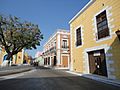
Campeche City is one of Mexico's less-known colonial cities. It is often overlooked by tourists visiting other famous places in the Yucatán. However, its historic buildings are protected to keep them from being changed. Campeche was a very important port in New Spain (colonial Mexico). It suffered more than 21 major pirate attacks during the colonial era.
After 1685, the city began building strong fortifications, which took 24 years to complete. These defenses successfully stopped major pirate attacks. The fortifications included a strong wall with four main gates and several forts like San Carlos and Santa Rosa. There are old stories about secret tunnels in mansions to escape pirates, but none have ever been found.
Historic Churches and Haciendas
The state has many churches from the colonial period. The Asunción church in Dzitbalché was built in the 18th century. The Guadalupe Church in Bécal, Calkiní, also dates from the 18th century. The San Diego Apóstol Church in Nunkiní was built in the late 16th and early 17th centuries.
The church and former monastery of San Luis Obispo in Calkiní were built in the 17th century over an old Maya temple. The Catedral de Nuestra Señora de la Purísima Concepción is from the 16th century. The San Francisco Church in Campeche, built in the 17th century, marks the spot where the first Catholic mass was held on mainland America.
Outside of Campeche City, many notable old buildings are found on former large farms called haciendas. Many of these haciendas have been turned into hotels, spas, and other tourist attractions.
- Hacienda Blanca Flor: In Hecelchakán, it was a site of a bloody battle during the Caste War.
- Hacienda Santa Cruz: Between Campeche and Calkiní, it was a cattle farm from the mid-18th century.
- Hacienda San José Carpizo: In Champotón, founded in 1871, it was one of the most important cattle farms in the Yucatán.
- Hacienda Uayamón: Near Campeche City, it dates back to the 16th century and is now a luxury hotel.
- Hacienda Tankuché: Once used for growing dye-wood, it later switched to henequen (a plant used for fiber).

Museums and Natural Attractions
Important museums in Campeche include:
- Del Carmen Archeological Museum.
- Museo de las Estelas Mayas in Ciudad del Carmen.
- Camino Real Archeological Museum in Hecelchakán.
- Museo Fuerte de San Miguel: Located in one of Campeche's old forts, this museum tells the story of the state. It opened in 2000 and is one of the newest and most modern museums in Campeche.
Most popular beaches are in the municipalities of Campeche, Champotón, and Ciudad del Carmen.
- In Campeche: Mar Azul, San Lorenzo, and Playa Bonita.
- In Ciudad del Carmen: La Maniagua, Bahamita, Sabancuy, Playa Caracol, and Playa Norte.
- In Champotón: Acapulquito, Costa Blanca, Payucán, and Sihoplaya.
Inland, there are water parks like El Remate in Tankuché and San Vicente Chuc-Say. These parks use local rivers, springs, and natural wells called cenotes. For ecotourism, you can explore caves like Xculhoc and Xtacumbilxuna'an.
Ancient Maya Sites in Campeche

Much of Campeche is filled with ancient archeological sites, almost all of them Maya. These sites are less visited than famous ones like Chichen Itza and Tulum to the east.
- Edzná: Located near Campeche City, Edzná was a very important ceremonial center during the early Maya period (300–900 CE). Its buildings show different Maya architectural styles. It has a large acropolis (a high part of the city) surrounded by temples, with the Pyramid of the Five Floors being the most important. Edzná was discovered in the 1920s. It was likely a center for collecting farm products, which were then sent to the city of Tikal. A special feature is that the setting sun lights up a stucco mask in one of the pyramid's rooms in May and August, likely connected to farming seasons.
- Calakmul: This is the largest archaeological site in the state. Its name means "twin heaps" in Maya. It is located deep in the rainforest near the Guatemala border, within a biosphere reserve named after it. Calakmul was one of the biggest cities in ancient Mesoamerica, covering over 70 square kilometers (27 square miles). Its temples were mainly for worshipping ancestors. There are an estimated 6,000 structures here, but only a few have been restored. The two most important structures are the twin pyramids of Temple II and Temple VII, similar to those at Tikal. Temple II is the tallest at 50 meters (164 feet) high.
While most sites are in the rainforest, there are also 55 archaeological sites along the coast, mostly small village remains. Isla de Jaina is one of the best-preserved coastal sites because it's on an island surrounded by water. It was a true city and requires special permission to visit.
Other important Maya sites in Campeche include:
- Acanmul
- Balamkú
- Becán
- Bolonchén
- Chactún
- Chicanná
- Chunlimón
- Lagunita
- Río Bec
- Isla Uaymil
- Xculoc
- Xpuhil
- Xtampak
Images for kids
-
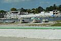
Ciudad del Carmen
-
Champotón


See also
 In Spanish: Campeche para niños
