
Yucatán Peninsula facts for kids

Satellite image of the Yucatán Peninsula
|
|
 |
|
| Geography | |
|---|---|
| Location | North America |
| Coordinates | 19°33′04″N 89°17′47″W / 19.55111°N 89.29639°W |
| Adjacent bodies of water |
|
The Yucatán Peninsula (also Spanish: Península de Yucatán) is a large piece of land in southeast Mexico. Parts of it also reach into Belize and Guatemala. This peninsula stretches northeast, separating the Gulf of Mexico from the Caribbean Sea. The Yucatán Channel connects these two bodies of water. It lies between the peninsula's northeastern tip and Cuba.
The peninsula covers about 181,000 square kilometers (70,000 square miles). It is mostly flat and made of a soft, porous rock called limestone. The peninsula is east of the Isthmus of Tehuantepec. This isthmus is a narrow strip of land in Mexico. It separates the Atlantic Ocean (including the Gulf of Mexico and Caribbean Sea) from the Pacific Ocean. Some people think this isthmus is the natural border between Central America and the rest of North America. This would place the Yucatán Peninsula in Central America. However, all of Mexico, including the Yucatán, is usually seen as part of North America. Guatemala and Belize are considered part of Central America.
Contents
What Does "Yucatán" Mean?
The exact meaning of the word Yucatán is a topic of much discussion. A historian named Diego López de Cogolludo shared two main ideas in the 1600s.
Early Theories About the Name
One idea comes from the first Spanish explorers. In 1517, Francisco Hernández de Córdoba arrived on the peninsula. He asked the local people for the name of a settlement. The Yucatec Mayan people replied with words that sounded like "I don't understand" to the Spaniards. This sounded like yucatán. Many different Mayan phrases could have been said. This story was first told by Hernán Cortés in his letters to the king. Other early historians also repeated this version. Some stories say it was Juan de Grijalva's expedition a year later.
Another main idea is that the name is linked to the yuca plant. This was written by Bernal Díaz del Castillo. Other theories suggest it comes from a Chontal Maya word. This word, yokat'an, means "speaker of the Yoko ochoco language". Another idea is that it's a wrong Nahuatl term, yokatlan. This was supposedly meant to mean "place of richness."
History of the Yucatán Peninsula
The Yucatán Peninsula has a long and exciting history. It goes back millions of years before humans even existed.
Ancient Earth: The Asteroid Impact

The Yucatán Peninsula is famous for the Chicxulub crater. This giant crater was made 66 million years ago. It happened when a huge asteroid, about 10 to 15 kilometers (6 to 9 miles) wide, crashed into Earth. This event marked the end of the Cretaceous Period. Many scientists believe this impact caused the mass extinction of the dinosaurs. It also affected many other living things on Earth. The crash sent tons of sulfur into the air. This caused a worldwide blackout and freezing temperatures for at least ten years.
Early Human Life in Yucatán
In 2020, archaeologists explored the Chan Hol cave. This cave is near the Tulum ruins in Quintana Roo. They found the skeleton of a woman who lived at least 9,900 years ago. She was about 30 years old when she died. Her skull shape was similar to other ancient skulls found in Tulum caves.
This new skeleton was found 140 meters from another site, Chan Hol 2. At first, people thought it was the missing Chan Hol 2 skeleton. But studies showed they were different people. Researchers believe there were at least two different groups of people living in Mexico long ago. This was during the time when the Pleistocene Ice Age was ending and the Holocene period began.
The Amazing Maya Civilization

The Yucatán Peninsula was a very important place for the ancient Maya civilization. Much of their culture was centered here. The Maya culture also spread south into Guatemala, Honduras, and parts of Chiapas.
Today, you can find many Maya archaeological sites across the peninsula. Some well-known ones are Chichen Itza, Coba, Tulum, and Uxmal. Many Maya people and Mestizos (people of mixed Maya and Spanish descent) still live here. They often speak Mayan languages.
Spanish Arrival and Conquest
The Spanish arrived in the Yucatán Peninsula in the 1500s. This led to the Spanish conquest of Yucatán. It was a long and difficult process for the Spanish.
Geology of the Peninsula

The Yucatán Peninsula is part of a larger area called the Yucatan Platform. This whole area is made of carbonate and soluble rocks. It is mostly limestone, but also has dolomite and other minerals. The entire peninsula is a flat karst landscape. This means it has many underground caves and sinkholes. These sinkholes are called cenotes and are common in the northern lowlands.

The deeply buried Chicxulub crater is located off the northern coast. It is near the town of Chicxulub. A famous "Ring of Cenotes" outlines one of the shock waves from this ancient impact. This ring of sinkholes shows where the asteroid hit about 66 million years ago. Scientists have found evidence like shocked quartz and tektites (a type of glass from impacts) to support the crater's existence.
Climate and Weather
The peninsula has a tropical climate. This means it's warm all year round. It can be semi-dry in the northwest and very humid in the south.
Rainfall and Seasons
The amount of rain changes across the peninsula. The driest parts in the northwest get less than 800 mm (31 inches) of rain each year. The southern areas, like the Petén Basin, can get up to 2000 mm (79 inches). Rain also changes with the seasons. August and September are usually the wettest months.
Hurricanes and Storms
The Yucatán Peninsula is in the Atlantic Hurricane Belt. This means it can be hit by large storms called hurricanes. Because the land is very flat, it is easily affected by these storms. Many hurricanes have caused damage here, like Hurricane Gilbert, Hurricane Emily, Hurricane Wilma, and Hurricane Dean.
Strong storms called nortes can also arrive quickly. These storms bring heavy rains and strong winds. But they usually don't last long, clearing up after about an hour. The number of rainy days changes each month. April has the fewest rainy days (7%), while October has the most (25%). Breezes from the coast can help cool things down. However, the air is generally very humid, especially in the rainforest areas.
Water Resources
The northern part of the peninsula has no rivers above ground. This is because of its extreme karst nature. Any lakes or swamps have marshy water that is usually not safe to drink.
Cenotes: Natural Wells
The entire peninsula is located near the coast. It has a large underground water system called an aquifer. Fresh rainwater floats on top of salty ocean water that seeps in from the coast. Thousands of sinkholes, known as cenotes, provide access to this underground water. The Maya people have relied on these cenotes for water for thousands of years.
Ecology and Nature
The plants and natural areas of the peninsula change from north to south.
Forests and Plants
The dry northwestern part has Yucatán dry forests. These include dry forests, scrublands, and cactus areas. The middle and eastern parts have Yucatán moist forests. These are semi-deciduous forests, meaning 25% to 50% of the trees lose their leaves in the dry summer. In Belize, you can find Belizian pine forests in some areas. The southernmost part of the peninsula is a wet evergreen rainforest called the Petén–Veracruz moist forests.
Large areas of tropical rainforest still exist in northern Guatemala (El Petén), Mexico (Campeche and Quintana Roo), and western Belize. However, these forests are facing a lot of deforestation, meaning trees are being cut down.
Coastal Ecosystems
Along the coast, you can find Mangrove forests. These include the Usumacinta mangroves in the southwest and the Petenes mangroves along the west coast. The Ría Lagartos mangroves are on the northern shore. The Mayan Corridor mangroves and Belizean Coast mangroves are along the eastern Caribbean Sea.
The Mesoamerican Barrier Reef System is a huge coral barrier reef. It stretches over 1,100 kilometers (700 miles) along the eastern coast of the peninsula. It is one of the largest reef systems in the world.
Government and Regions
The Yucatán Peninsula includes several different regions and countries. It is made up of three Mexican states: Yucatán, Campeche, and Quintana Roo. It also includes Guatemala's Petén Department and almost all of Belize.
Economy and Jobs
In the past, the Yucatán Peninsula was known for cattle ranching and logging. It also produced chicle (used for chewing gum) and henequen (a fiber from a plant).
Tourism and Development
Since the 1970s, the economy has shifted towards tourism. This is especially true in the Mexican state of Quintana Roo. Besides tourism, logging and chicle industries are still important, especially in Belize. Oil has also been found in some parts of the Yucatán, creating more jobs.
Cancún, once a small fishing village, has become a busy city. The Riviera Maya is a coastal area between Cancún and Tulum. It has over 50,000 hotel beds for tourists. Popular places there include Playa del Carmen, the nature parks Xcaret and Xel-Há, and the ancient Maya ruins of Tulum and Coba.
Population and People
The population of the Yucatán Peninsula varies greatly from one area to another. Population density and the mix of ethnic groups play a role in the total number of people.
Where People Live
The most populated area is Mérida in Yucatán state and the surrounding region. In contrast, Quintana Roo is the least populated part of the peninsula.
Ethnic Groups
Most of the people living in the Yucatán Peninsula are either Maya or Mestizos. Mestizos are people of mixed Maya and Spanish descent.
Images for kids
-
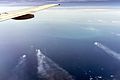
Cantarell oil field, an important economic site.

See also
 In Spanish: Península de Yucatán para niños
