
Laguna de Términos facts for kids
Quick facts for kids Laguna de Términos |
|
|---|---|
|
IUCN Category VI (Managed Resource Protected Area)
|
|

Laguna de Términos
|
|
| Lua error in Module:Location_map at line 420: attempt to index field 'wikibase' (a nil value). | |
| Location | Campeche, Mexico |
| Nearest town | Ciudad del Carmen |
| Area | 7,061.48 km2 (2,726.45 sq mi) |
| Designation | Flora and fauna protection area |
| Designated | 1994 |
| Governing body | National Commission of Natural Protected Areas |
| Official name: Área de Protección de Flora y Fauna Laguna de Términos | |
| Designated: | 2 February 2004 |
| Reference #: | 1356 |


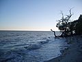
Laguna de Términos is a huge lagoon in Mexico. It's the biggest tidal lagoon in the Gulf of Mexico. It also has many different kinds of plants and animals. Many rivers and smaller lagoons connect to it. This makes it a very important water system in Mexico.
The lagoon is important for business and for nature. It's a safe home for many plants and animals. Its mangroves are especially important. They provide a safe place for birds that travel long distances.
Contents
Geography of Laguna de Términos
Laguna de Términos means "Lagoon of Ends." This is because many rivers in the area end here. It is made up of many rich lagoons and river mouths. These areas are full of sediment from the rivers. Two channels connect the lagoon to the Bay of Campeche. This bay is in the southern part of the Gulf of Mexico.
The lagoon is in the southwestern part of the Mexican state of Campeche. Most of it is in Carmen Municipality. A smaller part is in Palizada Municipality.
Size and Water Flow
The lagoon is about 72 kilometers (45 miles) long. It is also 24 kilometers (15 miles) wide. Its total area is about 1,550 square kilometers (598 square miles).
About half of the lagoon's water changes every nine days. This happens mostly because of ocean tides. Isla del Carmen is a long island that separates the lagoon from the Bay of Campeche.
There are two main channels that connect the lagoon to the bay. Boca de Puerto Real is to the east of Isla del Carmen. Boca del Carmen is to the west. Water from the bay usually flows into the lagoon through Boca de Puerto Real. It then flows out through Boca del Carmen.
Rivers and Surroundings
The shores of the lagoon are often wet and swampy. They are home to many mangrove trees. Several freshwater rivers flow into the lagoon. They often enter through smaller lagoons first.
The Candelaria River comes from the southeast. It flows through Panlao lagoon. The Chumpan River enters from the south through Balchacah lagoon.
Two branches of the Usumacinta River flow into the western part of the lagoon. The Palizada River enters through Viento Este and Vapor lagoons. The San Pedro y San Pablo River flows into a chain of lagoons, including Pom and Atasta. These are connected to the main lagoon.
The Palizada River brings about 75% of all the freshwater into the lagoon. Because of this, the western part of the lagoon has more nutrients and less salt.
Nearby Cities and Bridges
The city of Ciudad del Carmen is on Isla del Carmen. It sits between the lagoon and the Bay of Campeche. The Zacatal Bridge crosses the Boca del Carmen. This bridge connects Isla del Carmen to the mainland.
The bridge is part of Mexican Federal Highway 180. This highway runs along Mexico's Gulf coast. It also goes along Isla del Carmen. The highway also crosses the Boca de Puerto Real further east.
Plants and Animals of Laguna de Términos
About 29% of the lagoon is covered with seagrass. The Mexican government made the lagoon a protected area in 1994. This was because its river mouths are very important for many living things.
Scientists have found 1,468 different animal species in the protected area. Thirty of these species are found only in Mexico. Eighty-nine species are considered to be in danger. Also, 132 species are important for fishing and other businesses.
There are 279 types of birds and 34 types of mammals. At least 367 types of fish live here. Scientists are still finding new insect species.
Mangrove Forests
The Usumacinta mangroves grow around the edges of the lagoon. This is where fresh river water meets salty ocean water. These mangroves also spread westward into the Usumacinta-Grijalva river area.
The Usumacinta River branches bring a lot of freshwater and nutrients to the western lagoon. The mangroves near the Palizada River are the biggest and best developed. Some of these trees can grow taller than 30 meters (98 feet).
The Pantanos de Centla is a huge swamp forest. It is east and south of the mangroves. This area is flooded either part of the year or all the time. The Yucatán moist forests are east of the lagoon. These forests have a dry season.
Aquatic Life and Reproduction
The lagoon is a known place for yellow stingrays (Urobatis jamaicensis) to have their babies. The seagrass in the lagoon is very important for them when they give birth.
The wetlands in Campeche and Tabasco have mangrove zones, swamps, and lagoons. These are important homes for water reptiles. This includes crocodiles like the American crocodile, Morelet's crocodile, and caimans.
Nationally endangered sea turtles also come to the sandy shores to lay their eggs. These include the hawksbill turtle, green sea turtle, and Kemp's ridley sea turtle. Special efforts are made to protect the Kemp's ridley turtles.
Migratory Birds
The mangroves around the Lagoon of Términos are a key resting stop for many birds. At least 33% of the birds that migrate along the Mississippi River flyway use this area.
Mammals of the Lagoon
About 134 types of mammals live in the area. Some rare and endangered species include wild cats like the jaguar, ocelot, and margay. There are also Geoffroy's spider monkeys. Marine mammals like cetaceans (whales and dolphins) and the West Indian manatee also live here.
Bottlenose Dolphins
Bottlenose dolphins (Tursiops truncatus) often visit the lagoon. However, their safety might be at risk from human activities. A group called Instituto Via Delphi works to protect these dolphins. They study the dolphins' lives and work to keep them safe in the Mexican Gulf region.
History of the Area
There are several ancient Maya sites on the islands, beach ridges, and mangrove coast around the lagoon. These sites date back to the Late Postclassic period.
Juan de Grijalva was a Spanish explorer. He found the Boca de Términos during his trip in 1518.
Challenges for the Lagoon
The biggest challenge for the Laguna de Términos comes from Pemex. This is Mexico's state-owned oil company. Pemex operates inside the protected area. Drilling for oil and building pipelines can harm the natural homes of plants and animals. Oil spills are also a constant danger.
Other challenges include the growth of towns and cities nearby. More people can change the natural environment. Because of these issues, the Laguna de Términos Flora and Fauna Protection Area is considered to be in serious danger.
Pemex is very important for Mexico's economy. This means that managing the protected area requires working with the oil industry. They try to coordinate how resources are used to cause the least harm.
Local people and groups are aware of these problems. They speak out against Pemex plans that could harm the environment. Pemex has said they will listen to the protected area's management and others. They aim to reduce negative impacts on nature when planning projects.
Local populations of crocodiles and sea turtles are also in danger. This is because they have been hunted for their commercial value in the past.
Images for kids
-
Laguna de Términos
See also
 In Spanish: Laguna de Términos para niños
