Tiburón Island facts for kids
|
Native name:
Tahejöc
|
|
|---|---|
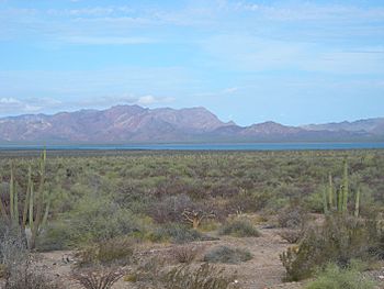
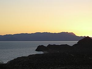
View of Tiburón Island across Infiernillo Channel, south of Punta Chueca
|
|
 |
|
| Etymology | Spanish word meaning 'shark' |
| Geography | |
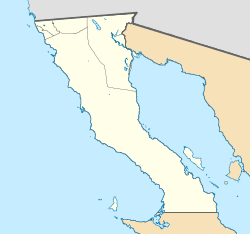
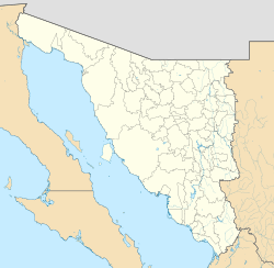
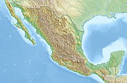
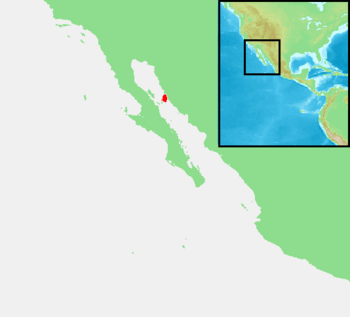
| Location | Gulf of California |
| Coordinates | 28°59′20″N 112°22′23″W / 28.98889°N 112.37306°W |
| Archipelago | Islas Grandés |
| Area | 1,201 km2 (464 sq mi) |
| Administration | |
| State | Sonora |
| Demographics | |
| Population | 0 |
| Languages | Seri (formerly) |
| Ethnic groups | Seri (formerly) |
| Additional information | |
| Time zone |
|
Tiburón Island is the biggest island in the Gulf of California. It is also the largest island in all of Mexico. The island covers an area of about 1,201 square kilometers (464 square miles). In 1963, the president at the time, Adolfo López Mateos, made Tiburón Island a special nature reserve. This means the island is protected to keep its nature safe.
Contents
What Does "Tiburón" Mean?
The name Tiburón comes from the Spanish language. It means 'shark'. The native people of the island, the Seri people, call it Tahejöc. This name was first written down in 1879. However, no one knows for sure what the Seri name means.
Where is Tiburón Island Located?
Tiburón Island is part of the Mexican state of Sonora. It belongs to the Hermosillo Municipality. The island is located along the eastern side of the Gulf of California. It is across from another island called Isla Ángel de la Guarda. Tiburón Island is one of a group of islands known as the Midriff Islands.
The island has a large system of mountains. These mountains were formed by volcanoes a long time ago.
Who Lived on Tiburón Island?
Tiburón Island has been the traditional home for some groups of the Seri people for many, many centuries.
In the 1960s and early 1970s, a man named Jesus Olivas ran a small camp on the north side of the island. People from America liked to visit this camp for hunting and fishing. He built some buildings, a dock, and even a small airstrip there. Today, you can still see the remains of these structures. Around 1995, the Mexican military made the airstrip unusable. They did this to stop smugglers from using it.
In 1975, the Mexican government officially gave the Seri people ownership of Tiburón Island. This was done through a special rule by President Luis Echeverría.
Is Anyone Living on the Island Now?
Today, no one lives on Tiburón Island permanently. However, the Mexican military has small camps on the eastern and southern parts of the island. The Seri tribal government works with the Mexican government to manage the island. They keep it as an ecological preserve, which means it's protected for its plants and animals.
What Animals Live on Tiburón Island?
In the 1980s, bighorn sheep were brought to the island. The Seri tribal government works with Mexican authorities to manage hunting of these sheep.
The island is also home to special animals found nowhere else. These include a unique type of coyote (called Canis latrans jamesi). There is also a special kind of mule deer (called Odocoileus hemionus sheldoni). These animals are endemic to the island, meaning they only live there.
How to Get to Tiburón Island?
You can reach Tiburón Island from a community called Punta Chueca. This is the closest town where members of the Seri tribe live. Another nearby place is Bahía de Kino, which is about 34 kilometers (21 miles) south.
The closest point on the island, Punta Tormenta, is about 3 kilometers (2 miles) from Punta Chueca. The water channel between the mainland and the island is called Canal del Infiernillo. This means 'Tiny Hell's Channel' in Spanish. It got this name because the strong tidal currents and shallow water can make it tricky to navigate boats there.
Visiting Tiburón Island
If you want to go hiking or stay overnight on Tiburón Island, you need two special permits. One permit comes from the Seri Governor's office in Punta Chueca. The other permit comes from the ISLAS office in Bahía de Kino.
See also
 In Spanish: Isla Tiburón para niños
 | Misty Copeland |
 | Raven Wilkinson |
 | Debra Austin |
 | Aesha Ash |


