Tillatoba, Mississippi facts for kids
Quick facts for kids
Tillatoba, Mississippi
|
|
|---|---|

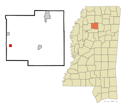
Location of Tillatoba, Mississippi
|
|
| Country | United States |
| State | Mississippi |
| County | Yalobusha |
| Area | |
| • Total | 1.01 sq mi (2.63 km2) |
| • Land | 1.01 sq mi (2.63 km2) |
| • Water | 0.00 sq mi (0.00 km2) |
| Elevation | 308 ft (94 m) |
| Population
(2020)
|
|
| • Total | 95 |
| • Density | 93.69/sq mi (36.16/km2) |
| Time zone | UTC-6 (Central (CST)) |
| • Summer (DST) | UTC-5 (CDT) |
| ZIP code |
38961
|
| Area code(s) | 662 |
| FIPS code | 28-73440 |
| GNIS feature ID | 0694981 |
Tillatoba is a small town located in Yalobusha County, Mississippi, in the United States. In 2010, about 91 people lived there.
The town is known for its farm products like cotton, corn, and raising animals such as chickens and cattle. Timber (wood from trees) is also important. The Holly Springs National Forest is located to the east of Tillatoba.
Contents
A Look Back: The History of Tillatoba
Tillatoba got its name from a nearby stream called Tillatoba Creek.
Where is Tillatoba?
Tillatoba covers an area of about 1 square mile (2.6 square kilometers). All of this area is land, with no large bodies of water.
Who Lives in Tillatoba?
| Historical population | |||
|---|---|---|---|
| Census | Pop. | %± | |
| 2020 | 95 | — | |
| U.S. Decennial Census | |||
In 2020, there were 95 people living in Tillatoba. There were 26 households and 12 families in the town.
People in Tillatoba: A Closer Look
| Group | Number | Percentage |
|---|---|---|
| White (not Hispanic) | 75 | 78.95% |
| Black or African American (not Hispanic) | 13 | 13.68% |
| Other/Mixed | 4 | 4.21% |
| Hispanic or Latino | 3 | 3.16% |
This table shows the different groups of people living in Tillatoba based on the 2020 census. Most residents are White, followed by Black or African American.
Learning in Tillatoba
Students in Tillatoba attend schools that are part of the Coffeeville School District.
Famous People from Tillatoba
- Jim Champion was a football player and coach in both American and Canadian football. He was born in Tillatoba.
See also
 In Spanish: Tillatoba para niños
 | Victor J. Glover |
 | Yvonne Cagle |
 | Jeanette Epps |
 | Bernard A. Harris Jr. |


