Totogalpa facts for kids
Quick facts for kids
Totogalpa
|
|
|---|---|
|
Municipality
|
|
| Country | |
| Department | Madriz |
| Area | |
| • Municipality | 51 sq mi (133 km2) |
| Population
(2005)
|
|
| • Municipality | 11,927 |
| • Density | 232.3/sq mi (89.7/km2) |
| • Urban | 1,794 |
| Climate | Aw |
Totogalpa (pronounced toto-GAL-pa) is a small town and a municipality in the country of Nicaragua. It is located in the Madriz department. A municipality is like a local government area, similar to a county or a borough.
Contents
Where is Totogalpa?
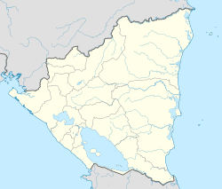
Totogalpa is found in the northern part of Nicaragua. It is part of the Madriz department, which is one of the 15 departments of Nicaragua. The coordinates for Totogalpa are 13°34′ North latitude and 86°30′ West longitude. This tells us its exact spot on the map.
How Big is Totogalpa?
The total area of the Totogalpa municipality is about 133 square kilometers. To give you an idea, this is roughly the size of a medium-sized city.
Who Lives in Totogalpa?
According to information from 2005, about 11,927 people lived in the entire municipality of Totogalpa. Out of these, around 1,794 people lived in the main urban area, which is the town itself. The rest of the population lives in the surrounding rural areas.
What is the Weather Like?
Totogalpa has a tropical savanna climate. This means it usually has warm temperatures all year round. There are typically two main seasons: a wet season with more rain and a dry season with less rain. This type of climate is common in many parts of Central America.
See also
 In Spanish: Totogalpa para niños
 | Kyle Baker |
 | Joseph Yoakum |
 | Laura Wheeler Waring |
 | Henry Ossawa Tanner |


