Trails in Ithaca, New York facts for kids
This is a list of fun trails in Ithaca, New York. These trails are great for walking, biking, and exploring the outdoors! Many of them follow old railroad lines, which means they are often flat and easy to use.
Contents
- Awesome Trails for Walking and Biking
- Cayuga Waterfront Trail: Explore the Lake Shore
- South Hill Recreation Way: A Path Through History
- East Ithaca Recreation Way: Trails on East Hill
- Jim Schug Trail / Dryden Lake Trail: Flat and Scenic
- Black Diamond Trail: A Big Connection
- Lansing Town Trail: Great Views
- East-South Trail (Planned): Connecting Hills
- Varna Trail / Fall Creek Trail (Planned): Through Nature Preserves
- Gateway Trail / Buttermilk Falls Corridor (Planned): Up South Hill
- East Shore Trail (Planned): Along Cayuga Lake
- Hiking Trails and Paths
- Cool Natural Spots to Visit
- State Parks with Amazing Trails
- Places to Access Water
Awesome Trails for Walking and Biking
Long ago, Ithaca was a big center for railroads. While most trains don't run here anymore, the old tracks left behind perfect paths for trails. These paths are now used by people walking, running, and biking. The city of Ithaca even has a plan to connect all these trails. This will make it easier for everyone to get around without needing a car.
Cayuga Waterfront Trail: Explore the Lake Shore
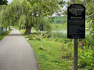
The Cayuga Waterfront Trail is a cool path that goes along the edge of Cayuga Lake. It connects Cass Park on one side of the lake to Stewart Park on the other.
This trail is about 10 to 12 feet wide and has a smooth surface, perfect for bikes and strollers. It links many fun places along the water. You can visit the Visitors' Center, the Ithaca Youth Bureau, the Farmers' Market, and even boathouses for Cornell and Ithaca College. It's a great way to see the waterfront!
South Hill Recreation Way: A Path Through History
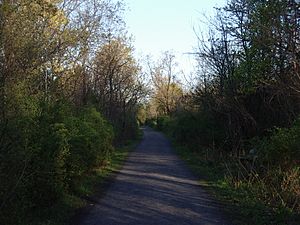
This trail is about 3.3 miles long and has a packed gravel surface. It was created in 1986. The trail mostly follows an old railroad line from 1849. This railroad was used to carry coal from Pennsylvania to Ithaca.
The South Hill Recreation Way is a gentle downhill path from Burns Road into Ithaca. You can find smaller paths leading off the main trail into the Six Mile Creek gorge. In winter, it's a popular spot for cross-country skiing. In summer, students from Ithaca College use it to reach Six Mile Creek.
You can find small parking areas at the end of Juniper Drive and at the corner of Burns Road and Coddington Road.
East Ithaca Recreation Way: Trails on East Hill
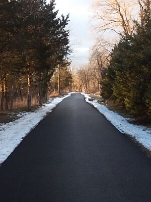
The East Ithaca Recreation Way is a paved trail for walking and biking on East Hill. It has several parts and connects with the Vincent and Hannah Pew Trail to the south. The trail is open from half an hour before sunrise until half an hour after sunset. You'll find many benches along the way, perfect for resting.
The northern part of the trail, from Game Farm Road to Maple Avenue, goes through natural areas owned by Cornell University. You can even ride horses here! This section is about 1.2 miles long and follows an old railroad line that closed in 1976.
To reach the next part of the trail, you walk about 0.3 miles west along Maple Avenue.
The middle section goes south from Maple Avenue to Honness Lane, crossing Mitchell Street. This part is about 0.9 miles long and is built on another old railroad line. It's a popular way for people to get to Cornell University.
To get to the last part, you go about 0.2 miles east up Honness Lane and then across Pine Tree Road.
The southernmost part is called the Vincent and Hannah Pew Trail. This section is about 0.8 miles long and goes through the Pine Tree Wildlife Preserve. There's a parking area and benches for trail users. The total length of the East Ithaca Recreation Way, including connecting streets, is about 3.3 miles.
Jim Schug Trail / Dryden Lake Trail: Flat and Scenic
The Jim Schug Trail is named after a local leader who helped create it. It's about 4.2 miles long and also follows an old railroad line. It starts on Main Street in Dryden and goes to the border of Cortland County, where it connects to the Finger Lakes Trail.
This trail is made of gravel and is great for biking because it's mostly flat. There are plans to make it even longer, connecting it to the village of Freeville and eventually to Ithaca.
Black Diamond Trail: A Big Connection
The Black Diamond Trail is a very important trail for the Ithaca area. A section of this trail, from Cass Park to Taughannock Falls State Park, opened in 2016. This part used to be a passenger train line called the "Route of the Black Diamond." It runs along the western side of Cayuga Lake, going uphill from the lake to about 840 feet above sea level near Taughannock Creek.
There are also plans for the trail to go south from Cass Park, following a flood control channel. This part would connect to different areas of the city and eventually to Robert H. Treman State Park. This city section needs new bridges to be built.
One planned connecting trail would branch off near the city line and go through Buttermilk Falls State Park towards the South Hill Recreation Way. There's even a bridge over Route 13 near Buttermilk Falls that was built for this future trail.
Lansing Town Trail: Great Views
The first part of the Lansing Town Trail opened in 2011. It's a 2.4-mile loop trail on farmland. It offers amazing views of the Cayuga Lake Valley and the hills around it. It's perfect for hiking, cross-country skiing, and snowshoeing.
East-South Trail (Planned): Connecting Hills
This planned trail would connect the South Hill Recreation Way to the Pew trail. It would cross Route 79 and go through Snyder Hill. Parts of this trail might be bike lanes along roads or simply signs telling bikes and cars to share the road.
Varna Trail / Fall Creek Trail (Planned): Through Nature Preserves
These trails would be one long path on an old railroad bed, going from Varna to the East Ithaca Recreation Way. It would pass through the Monkey Run nature preserve. Like many planned trails, some bridges need to be fixed or built before it can be finished.
Gateway Trail / Buttermilk Falls Corridor (Planned): Up South Hill
The Gateway trail is planned to go up South Hill. It would connect the Black Diamond trail in the city's southwest area with the northern part of the South Hill Recreation Way.
Lower Buttermilk Falls Section
This part of the planned trail is in good condition. It connects to the Buttermilk Falls parking lot.
Emerson Area Section
This part of the trail needs a lot of work. It still has old railroad ties and a bridge that needs to be improved. It would connect to Turner Place. Connecting this trail is important because it would link the popular South Hill Recreation Way to the southwest area of the city.
East Shore Trail (Planned): Along Cayuga Lake
This trail would go along the hillside above the eastern shore of Cayuga Lake, connecting Ithaca with Lansing. It would use another old railroad line. Bridges were removed from this line a long time ago.
Hiking Trails and Paths
Finger Lakes Trail System: Long-Distance Adventures
The main Finger Lakes Trail passes south of Ithaca. A connecting trail links it with the trails at Buttermilk Falls State Park. Volunteers help take care of the part of the Finger Lakes Trail between Watkins Glen and Caroline.
Cayuga Trail: Through Cornell's Campus
The Cayuga Trail is about 8.5 miles long. It starts at the Stewart Avenue bridge over Fall Creek and goes east through the Cornell University campus. It crosses Fall Creek on a cool suspension bridge. The Cayuga Trail was built and is cared for by volunteers.
Cool Natural Spots to Visit
Cascadilla Creek: A Gorge in the City
A trail leads from the College Avenue Bridge down along the Cascadilla Creek gorge to Court and Linn Street in Ithaca. This is a handy way to get between downtown Ithaca and the Cornell University campus. Another path goes through the Cornell Campus upstream from the College Avenue Bridge. This trail is closed during the winter.
Six Mile Creek: Nature and Water Fun
You can find access to this gorge trail within Ithaca. Two main spots to get to it are from the South Hill Recreation Way or from a small parking lot at Giles and Water streets. On a summer day, you might see people fishing or even a great blue heron! The trail also leads to the old City Reservoir, which is a popular (but not allowed and unsafe) swimming spot in the summer.
State Parks with Amazing Trails
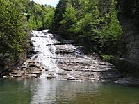
Allan H. Treman State Marine Park and Taughannock Falls State Park are both near Cayuga Lake. They have shorter, easier walks. Buttermilk Falls State Park and Robert H. Treman State Park are famous for their waterfalls. Their trails follow the creeks and can be more challenging, but they are very rewarding!
- Allan H. Treman State Marine Park
- Buttermilk Falls State Park
- Robert H. Treman State Park
- Taughannock Falls State Park
Places to Access Water
- Allan H. Treman State Marine Park
- Cayuga Inlet
- Fall Creek (you can get to it through Stewart Park)
- Beebe Lake
|
 | Anna J. Cooper |
 | Mary McLeod Bethune |
 | Lillie Mae Bradford |


