Treryn Dinas facts for kids
Quick facts for kids Treryn Dinas |
|
|---|---|

The headland
|
|
| Location | Cornwall |
| OS grid | SW398220 |
| Coordinates | 50°02′30″N 5°38′05″W / 50.0416°N 5.6348°W |
| Operator | National Trust |
| Designation | Scheduled monument |
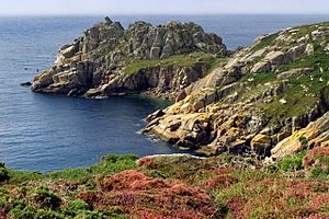
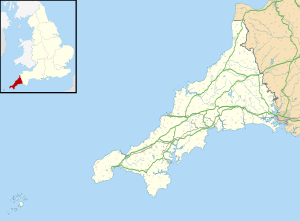
Treryn Dinas is a stunning piece of land that sticks out into the sea. It's called a headland. You can find it near a village called Treen in Cornwall, England. This special place is on the Penwith peninsula, located between Penberth Cove and Porthcurno.
It's a very old and important site. Because of its history, it's protected as a scheduled monument. This means it's a nationally important archaeological site or historic building. The land is looked after by the National Trust, a charity that protects special places in England, Wales, and Northern Ireland.
Contents
What is Treryn Dinas?
Treryn Dinas is more than just a beautiful headland. It's also the site of an ancient fort from the Iron Age. The Iron Age was a time in history when people started using iron to make tools and weapons. This period was roughly from 800 BC to AD 100 in Britain.
The fort here is known as a promontory fort. This type of fort uses natural defenses, like cliffs, to protect itself. At Treryn Dinas, the land drops steeply down to the sea on three sides. This made it very hard for enemies to attack from the water.
How Was the Fort Protected?
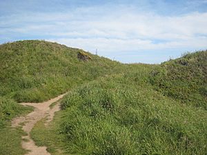
On the side facing the land, where it was easier to attack, the people built strong defenses. They created large earthworks, which are walls and ditches made from earth.
- The innermost wall, called a rampart, was about 2 meters (6.6 feet) high. It crossed the narrowest part of the headland, making it difficult to get past.
- Beyond this, there were two more curving ramparts, though they were not as tall.
- The outermost rampart was the biggest, standing about 6.1 meters (20 feet) high! It had a deep ditch on its northern side.
- There was also a special entrance with a causeway, which is a raised path, allowing people to get in and out safely.
Today, a walking path called the South West Coast Path runs right next to this outer rampart. It's a great way to see the ancient defenses.
The Famous Logan Rock
On the headland, you'll find a very famous and unusual rock formation called the Logan Rock. This giant rock is perfectly balanced on other rocks, about 30 meters (98 feet) above the sea. It's so well balanced that it used to rock back and forth with just a push!
In 1824, a group of sailors, led by a Lieutenant Goldsmith, knocked the Logan Rock off its perch. This caused a huge uproar because it was a beloved landmark. The Admiralty, the government department in charge of the navy, made Goldsmith put it back. It took many men and special equipment to move the massive rock back into place, but it no longer rocks as easily as it once did.
Treryn Dinas in Art
This amazing rocky headland has even been featured in art! In 1833, an engraving of Treryn Dinas appeared in a book called Fisher's Drawing Room Scrap Book. A poet named Letitia Elizabeth Landon also wrote a poem about it to go with the picture.
 | Aurelia Browder |
 | Nannie Helen Burroughs |
 | Michelle Alexander |


