Trollhättan Municipality facts for kids
Quick facts for kids
Trollhättan Municipality
Trollhättans kommun
|
||
|---|---|---|

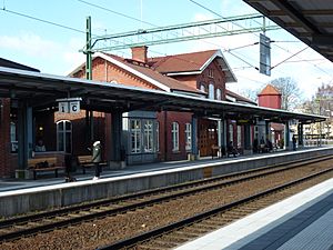
Trollhättan Railway Station
|
||
|
||
 |
||
| Country | Sweden | |
| County | Västra Götaland County | |
| Seat | Trollhättan | |
| Area | ||
| • Total | 430.24 km2 (166.12 sq mi) | |
| • Land | 412.14 km2 (159.13 sq mi) | |
| • Water | 18.1 km2 (7.0 sq mi) | |
| Area as of January 1, 2010. | ||
| Population
(June 30, 2012)
|
||
| • Total | 55,027 | |
| • Density | 127.8984/km2 (331.255/sq mi) | |
| Time zone | UTC+1 (CET) | |
| • Summer (DST) | UTC+2 (CEST) | |
| ISO 3166 code | SE | |
| Province | Västergötland | |
| Municipal code | 1488 | |
| Website | www.trollhattan.se | |
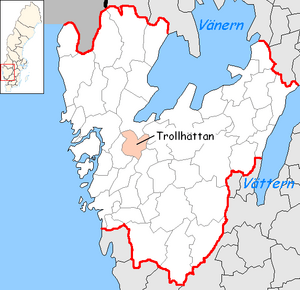
Trollhättan Municipality (also known as Trollhättans kommun or Trollhättans stad) is a special area in western Sweden. It is part of Västra Götaland County. The main town, or "seat," of this municipality is Trollhättan.
A municipality is like a local government area. It helps manage things like schools, roads, and other services for the people living there.
Contents
History of Trollhättan Municipality
The Trollhättan Municipality was created step-by-step between 1967 and 1974. This happened during a big change in how local governments were set up in Sweden. The City of Trollhättan, which became a city in 1916, joined with other nearby areas to form the municipality we know today.
Even though it includes countryside, the municipality often calls itself Trollhättans stad, which means City of Trollhättan. This is just a name and doesn't change its official status. For many years, until 2012, Trollhättan was home to the car company Saab Automobile.
Places in Trollhättan Municipality
The municipality is made up of several smaller towns and villages. Here are some of them:
- Lextorp
- Björndalen
- Sjuntorp
- Skogshöjden
- Trollhättan (This is the main town!)
- Upphärad
- Velanda
- Väne-Åsaka
- Skoftebyn
- Stavre
- Halvorstorp
- Hjulkvarn
- Hjortmossen (also known as Strömslund)
People and Population
In 2022, there were about 59,062 people living in Trollhättan Municipality. About 43,921 of these people were Swedish citizens old enough to vote.
The municipality gathers information about its residents. This helps them understand the community better. For example, they look at how many people are working and where people were born. This data helps local leaders make good decisions for everyone.
See also
 In Spanish: Municipio de Trollhättan para niños
 | Aaron Henry |
 | T. R. M. Howard |
 | Jesse Jackson |


